
The route up Church Mountain sets out with a deceptively easy half-mile stroll up an old forest road. Then it gets right down to business, with lots of switchbacks winding up and around the west side of the mountain. The trees are fairly dense, which you might appreciate on warmer days. Though they obstruct your big views until later, peer between the trunks for an occasional glimpse of Mount Baker above or the North Fork Nooksack River below.
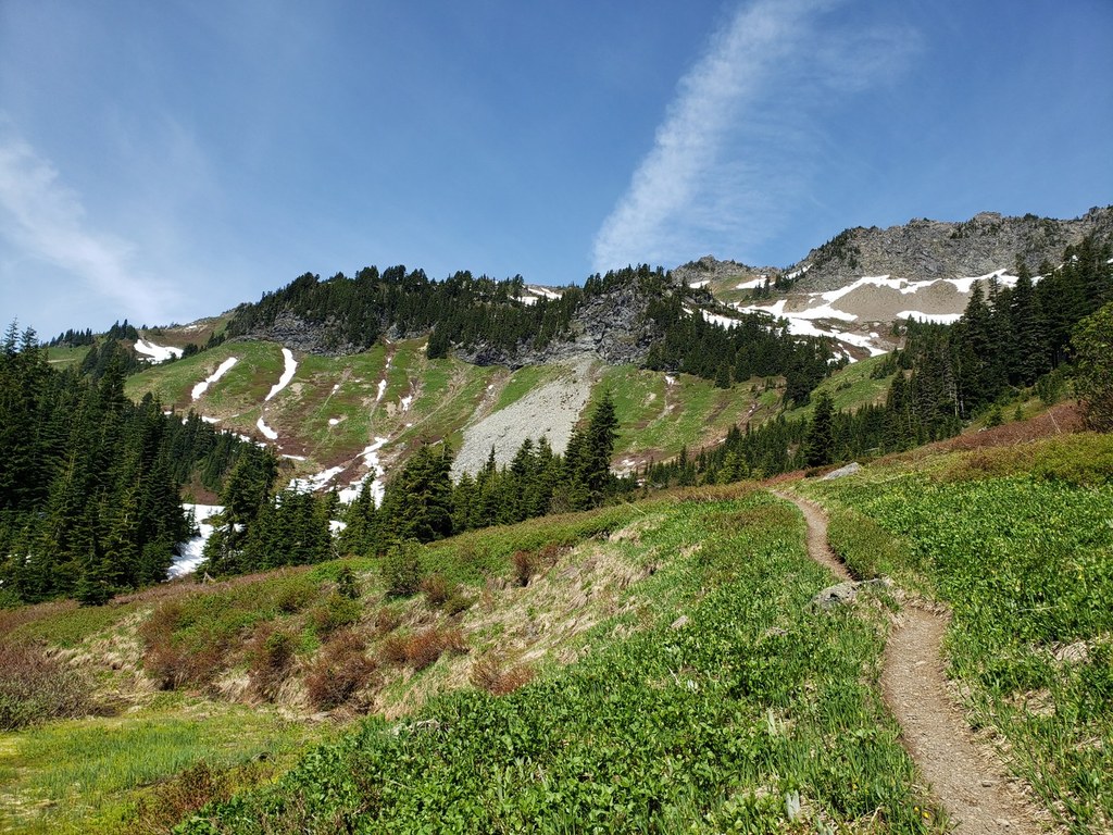
After 3 miles, the trail finally eases up and opens into sprawling meadows. This is your first chance to glance back for a spectacular and unobstructed view of Mount Baker. As you meander through the meadow, you will not find any golden larches, but — if you come in the right season — you can enjoy vibrant fall colors highlighted by an abundance of huckleberry bushes that blanket the meadow and the ridge above in hues of green, red, purple and gold. Come in summer, and the meadows will present a veritable bouquet of alpine flowers in all directions. The trail crosses a stream that might be your last chance to filter water before the summit.
Resume your upward climb over the final 1.2 miles of the climb as the trail winds directly through a sizable huckleberry patch, potentially offering some late-season treats. The last 200 feet of trail are more of a scramble up loose rock. Take advantage of the cable to hold on in this last section. From the old Church Mountain Lookout site, you can enjoy a fantastic 360-degree view of Mount Baker, Mount Shuksan, Kidney Lakes, Tomyhoi, Larrabee, the Border Peaks, Goat Mountain, Excelsior Pass and Skyline Ridge along the horizon.
Pro Tip: Consider bringing a pair of leather gloves if you plan to handle the cable near the top of the mountain.
Church Mountain

-
 Length
- 8.5 miles, roundtrip
-
 Elevation Gain
- 3,750 feet
-
 Highest Point
- 6,100 feet
The rewards for this strenuous hike are vast alpine meadows and a wide panorama of North Cascades peaks.
Continue reading
Hiking Church Mountain

WTA worked here in 2022, 2021, 2019, 2015 and 2014!
Map & Directions
 Trailhead
Before You Go
Parking Pass/Entry Fee
Northwest Forest PassWTA Pro Tip: Save a copy of our directions before you leave! App-based driving directions aren't always accurate and data connections may be unreliable as you drive to the trailhead.
Getting There
Drive the Mount Baker Highway east for 34 miles from Bellingham to the town of Glacier. Pass the Public Service Center, and keep driving east for another 5.4 miles. Turn left onto Forest Road 3040, and follow this road for 2.7 miles to its end, and the trailhead. Half a mile before the trailhead, you will cross a seasonal stream that may be challenging for small cars during periods of high flow.


