

Hike to the highest point on Whidbey Island for excellent views near and far. On your journey upward, walk the beach, cross under one of the most scenic bridges in the state, and check out the twisted trunks of the Pacific Madrone trees on the way.
Start your hike at the far west end of Cranberry Lake. Walk to the amphitheater and locate the trail on the far side. This is the North Beach trail. Follow the wide, well-built trail for almost a mile as it climbs above North Beach toward the bridge. Once you reach the bridge, the trail crosses under it, giving you a chance to admire the engineering. Started in August of 1934 and completed in July of 1935, the bridge and much of the park was built by the Civilian Conservation Corps in the height of the Great Depression.
Once you cross under the bridge, the trail forks, keep left, you want to follow the Perimeter Trail. The trail forks again. Keep left again, following the Perimeter Trail still. A third fork in the trail is where you should head right.
As you hike, you will see some small trails heading a short way down toward the water, they lead to some views of Mount Baker through the trees.
Following the Perimeter Trail takes you around the side of Goose Rock and above the shores of Cornet Bay. The trail drops down close to the beach before heading up again. There is a side trail to the left, but that is not your trail, take the one to the right that heads uphill. Hike along an open, grassy area on a rocky hillside, in spring look for the pink flowers of wild currant. Look out at Cornet Bay and on a sunny day, Mount Baker in the distance. All along this section notice the contorted branches and peeling red bark of the native madrone trees. These will have clusters of flowers in the spring, and red-orange berries in the fall. Some of these trees are quite old, with huge trunks and grey bark at the base.
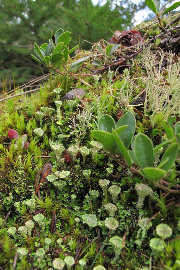
The trail drops down to a well signed intersection. Here you meet the Summit Trail. Take this one; it’s time to head to the top! The trail climbs steeply, then switchbacks through the woods. Climb out of the trees and hit the first of what is called ‘the Balds’. Bald refers to an area scraped to the bedrock by receding glaciers at the end of the last ice age. A good look at the rock and you can see the striations. It has taken thousands of years to build up enough topsoil on top of the rock to grow the plants in this meadow. Get down on your knees and look carefully, see how many different kinds of mosses, stonecrops and other plants you can find! Please don’t destroy them by careless walking.
Follow the path, and head up and under the power lines. Here will be some great views of the Cascade peaks along the Mountain Loop Highway. From here, you can follow a trail over to the high point and the top of Goose Rock at 484 feet. From the top you can see the Olympics, across the water to the San Juan Islands, and just below you, Cranberry Lake. Check out the view of the Naval Air Station and watch the jets on maneuvers.
When you are ready to head back, you have several routes to choose from. Take the Summit trail back to the start of the Perimeter trail and the bridge, or go back the way you came up, and hit the Discovery trail, cross Highway 20 by going under a pedestrian tunnel, and meet the North Beach trail on the other side of the bridge. From the North Beach trail, drop down to the beach and walk along the beach. There are picnic tables scattered about where beach meets woods. If the tide is out, you may be able to walk all the way back to the parking lot by way of the beach. If it is in, you will reach a dead end at the west point headland, backtrack and catch the trail again.
WTA Pro Tip: This is a very popular park and the trails are well used. For maximum enjoyment, get here early! The park hours are: 6:30 a.m. - dusk April through September, 8:00 a.m. - dusk October through March.

 Trailhead


