

Eagle Creek trail is a rare find; a moderately-graded, view-heavy trail that hikers can explore for miles and miles, turning around whenever it suits them. Because of that, it's also a highly popular area. Despite two trailheads and even some roadside parking, the trailhead here can get quite full. Carpool if you can, or have a second option if you get here and there is no parking available.
Before you get started, be sure you have your Northwest Forest Pass to park in the lot. There is a kiosk with a QR code and cell service, so if you don't have cash or a check you can buy it online right at the trailhead. Then you can get moving!
Your route parallels Eagle Creek for most of the trail, but this is as close as you'll be to the water for a while, so enjoy the rushing water up close before you get a birds-eye view.
The best part about this is that the creek seemingly drops away from the trail, rather than the trail climbing away from the creek, as usually happens on hikes, so you don't have to work quite as hard for the incredible views you're about to get. You'll hike on a delightfully-moderate trail, watching the creek drop away from you and enjoying more and more glorious views of the valley.
But it's worth looking down occasionally, too. The trail is wide but rocky and in places slippery because of waterfalls or seeps coming down the hillside to your left and crossing the trail. And of course there are also short sections with very steep drop offs. Here, there is cable set into the walls of the canyon for you to hang onto if you need a little extra help along the exposed sections. It's also worth mentioning here that dogs must be on leash on this trail. According to the Forest Service, each year unleashed dogs fall or chase other unleashed dogs off the trail into the ravine. Keep everyone safe by keeping your dog on leash.
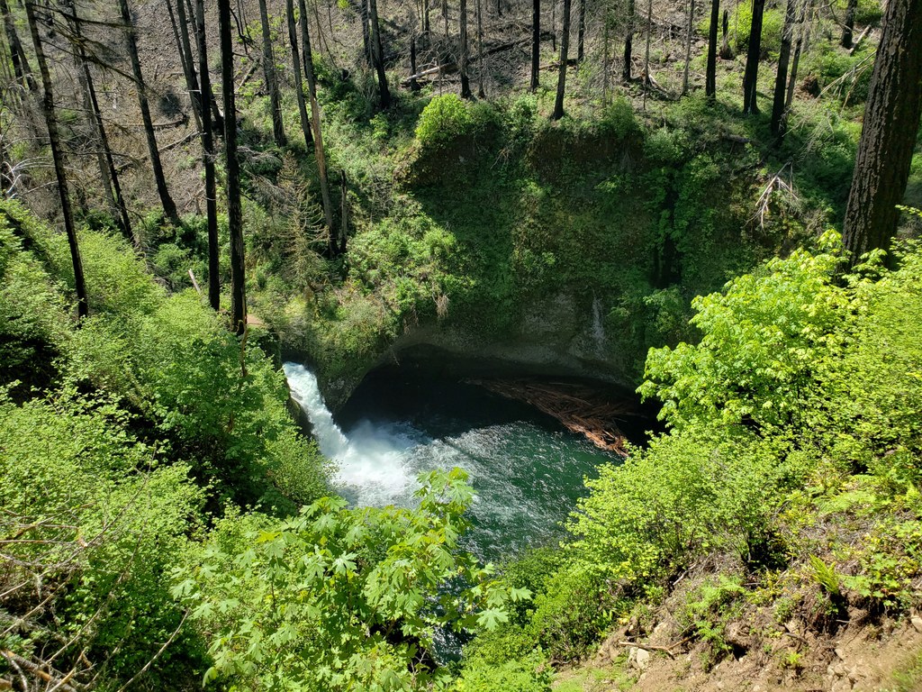
After 1.7 miles, the trail rounds a curve. This is also the turn off for Lower Punchbowl Falls, a 0.4-mile detour with 170 feet of elevation gain down to the base of a large waterfall. While this is a great destination to cool off on a hot day, please know that cliff diving here is prohibited — it's too dangerous.
Continuing on the main Eagle Creek trail, you'll soon come to an overlook for Punchbowl Falls, the feeder for the Lower Punchbowl. There's a nice photo op here before you continue on, passing a small bridge over Tish Creek, and then a more impressive bridge over Fern Creek, 2.58 miles in.
Around mile 3, gorgeous Loowit Falls hoves into view, just after a spectacular view upriver. Just a bit further on is High Bridge, a common turnaround point. With a small shady area of boulders (perfect for a snack spot), High Bridge also features an incredible view of a ravine where Eagle Creek pours through a relatively tiny slot canyon. High Bridge is at 3.3 miles, making a roundtrip here a little over 6 miles.
If you decide to continue, it's only 0.7 miles to Four One-Half Mile bridge. The trail here changes character, returning to run closer to the creek and alongside and under some incredible rocky outcroppings. Four One-Half Mile bridge also features a creekside sitting spot in the shade if you want a rest.
Another mile along, arrive at an intersection. Here the Ruckel Ridge Trail takes off uphill, though since the Eagle Creek fire in 2017 this trail has been closed. Just before this intersection is Wy'East camp, the first official campsite on Eagle Creek Trail. And just a bit beyond the intersection with Ruckel Ridge is Blue Grouse Camp, at 5.2 miles from the trailhead.
From Blue Grouse campsite, iIt's just another half mile to Tunnel Falls, a good turnaround point for many people doing Eagle Creek as a day hike. This popular destination features a high waterfall that hikers can walk behind before heading back to the main trailhead.
Continuing your hike
Eagle Creek trail continues all the way to Wahtum Lake, another 7.2 miles and 3719 feet of elevation gain. Beyond Tunnel Falls is Twister Falls, and then the trail begins climbing more in earnest. Pass 7 1/2 mile camp and a handful of other campsites interspersed with other waterfalls. 3.7 miles from Tunnel Falls is a junction with the Indian Springs trail. The trail continues to climb steadily to Wahtum Lake. While there are campsites here, keep in mind this is one of the last campsites for Pacfiic Crest Trail hikers, and the lake is also accessible by road, so you'll likely be sharing the area with thru-hikers and families, especially in the summer.
 Trailhead


