

Sun-drenched ridgelines, blooming trillium, and sparkling alpine waters define this fitting tribute to one of Washington’s greatest trail advocates. An ode to lifelong nature photographer and conservationist Ira Spring, this highly popular trail traverses steep pitches and open meadows en route to Mason Lake, a popular weekend camping destination in its own right.
From the parking lot, the trail meanders through forest and gently climbs long switchbacks until reaching Mason Creek at 0.8 mile. The water crossing used to be somewhat difficult during times of heavy runoff in the spring.
Luckily, thanks to the efforts of volunteer crews and the generosity of the Spring Trust for Trails, a sturdy footbridge has been installed across the creek, and hikers can safely cross it in all seasons.
At 1.6 miles, veer left at an obvious but unmarked junction and take a deep breath -- the real climbing starts here. Ascending several steep pitches, the trail zigzags above the tree line into an alpine meadow bursting with seasonal wildflowers and mountain vistas. Stay left at the junction with the Bandera Mountain Trail at 2.9 miles and continue climbing north toward the high point of the hike, a rocky crest at 4,320 feet. Here, expansive views to the south and west reveal prime photo opportunities and glimpses of Mount Rainier on clear days. Look out for a plaque embedded on one boulder facing southward just off trail dedicated to Ira Spring, the trail’s eponym, who wrote many a guidebook and who was WTA's primary supporter in its infancy.
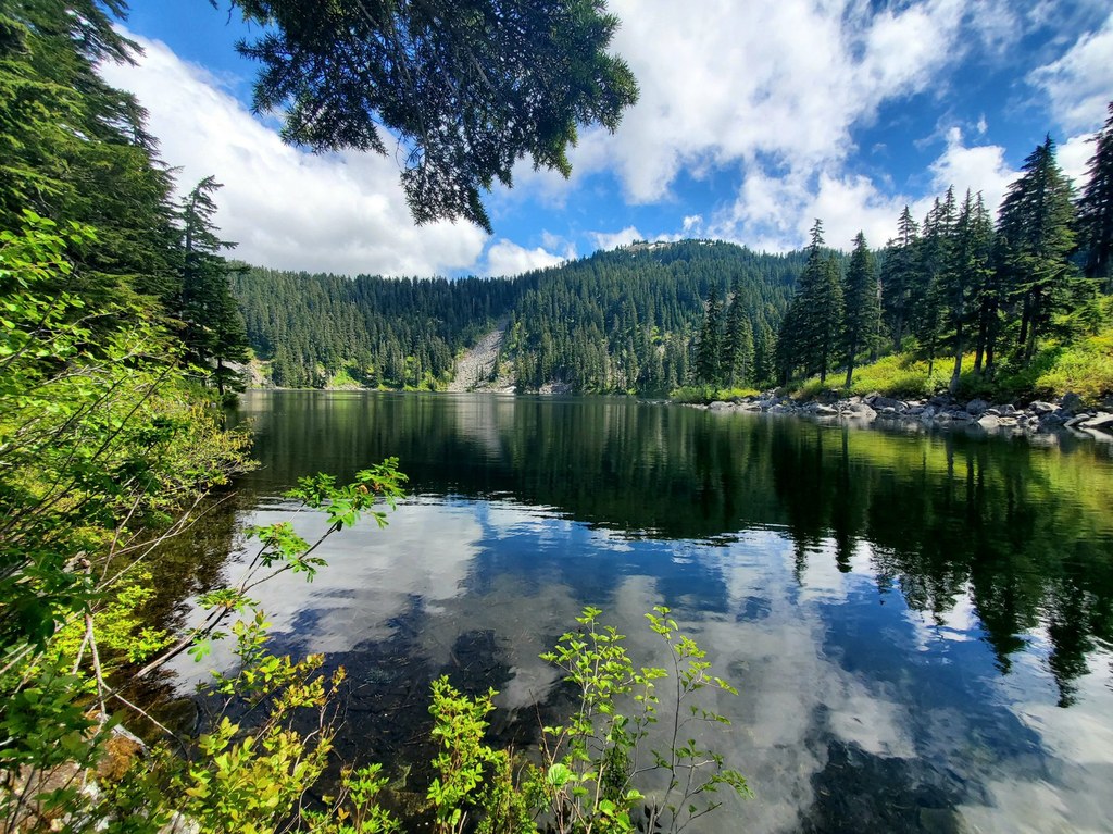
Drop over the north side of the ridge into the Mason Lake Basin, quickly descending about 200 feet to the shores of Mason Lake — a small but deep alpine pool populated with rainbow trout.
The main trail continues along the west and north banks of the lake to several designated camping areas, complete with a backcountry privy. Find an unclaimed boulder on the shore and soak in sunlight while enjoying views of Bandera Mountain and its tree-lined slopes reflecting off the cool waters.
Extend your hike
Option 1: From the junction with the Bandera Mountain Trail, head to the summit of Little Bandera Mountain -- a short but aggressive 0.6-mile jaunt to elevated lake views and sweeping northwest vistas. But don’t underestimate the effort required; from the turnoff, this narrow path soars 700 feet up the ridge spine in just over half of a mile.
Option 2: From Mason Lake, follow the main trail along the north bank to the junction with Mount Defiance Trail. Turn left and follow this trail for 1.3 miles until reaching a spur trail to the summit at 5,200 feet. Views abound at the crest, but the 5,584-foot summit is a steep climb and scramble along the rough 0.2-mile spur trail.

 Trailhead


