

The old trail up Mailbox Peak was the stuff of legend. It inspired potential Rainier climbers, challenged adventurous day hikers, and occasionally Mother Nature used the trail to bite back. The number of injuries and rescues on the old trail, as well as terrible erosion caused by the masses of daily visitors, prompted the Department of Natural Resources to create a new trail to the top. While still relatively steep, this new route, built in part by WTA volunteers, offers a safer way for folks to attain the summit of this formidable peak.
Your trip begins along the Middle Fork Road. The hike is wildly popular--on a typical weekend, the trailhead can have upward of 50 cars at any given hour. The new trail also came with a new upper parking lot, but even so, don't expect to get a spot in the parking lot unless you arrive very early.
- Trail smarts

- What to Pack: Day Hike Packing List
Hang your Discover Pass in your car and head out, walking for a short jaunt along a paved DNR road. Approach a gate and slip around it. About one hundred yards past the gate, an inviting opening indicates the location of the new trail. Set out for the summit here, along a trail that switchbacks along the northwest face of Mailbox Peak.
Bridges and creek crossings await you in the lower section of the hike, and then the switchbacks start. At roughly 850 feet of elevation gain per mile, your thighs will feel the burn once you start climbing, and it won't let up until you're standing triumphantly next to the Mailbox. Distract yourself by taking a look at the construction of the trail. A multitude of WTA volunteer crews worked to create rock fords and turnpikes (elevated sections of trail) that keep your feet dry as you cross many creeks.
The switchbacks continue for about 4 miles, before rejoining the old trail at elevation 3860 feet for your final push to the summit. This last push consists of 960 feet of elevation gain in half a mile--hopefully the approach warmed you up for the final assault! If your energy flags, remember what views await you at the summit.
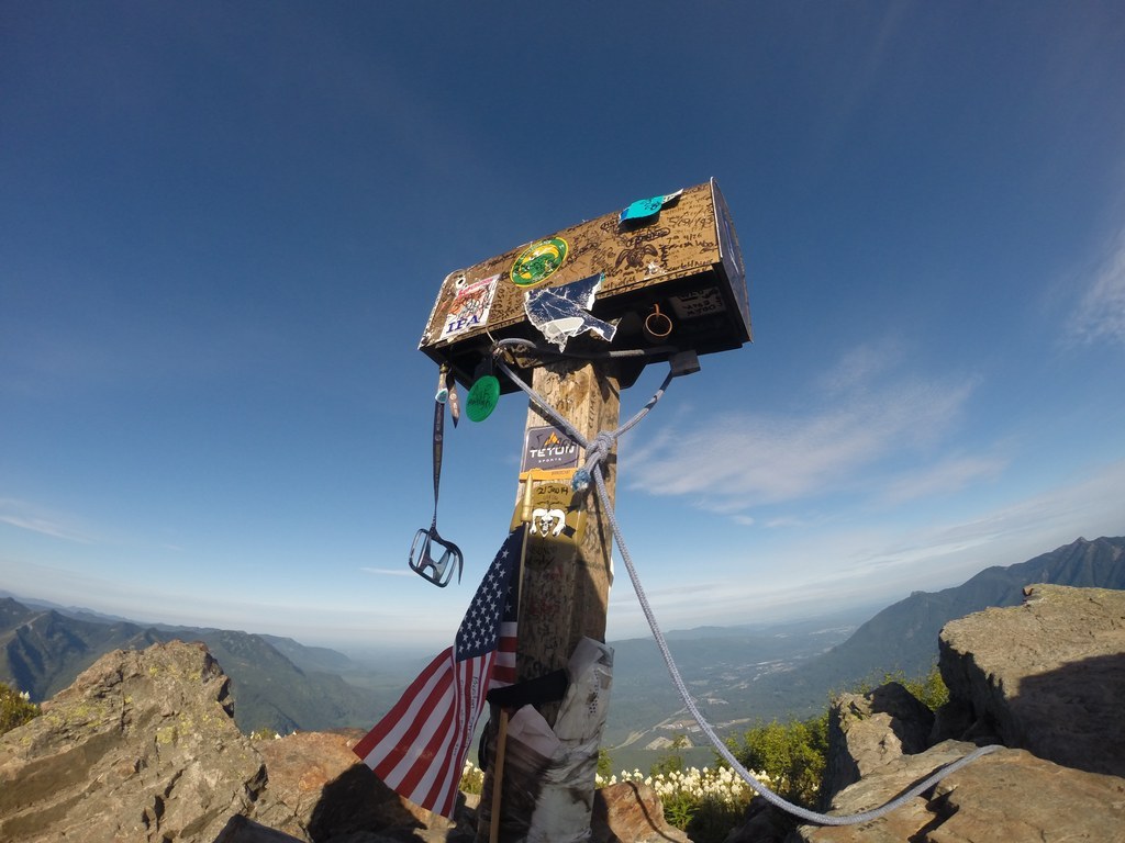
The peak's position at the end of a long ridgeline means you'll have an even better vantage point for panoramas than you might on other summits like Granite or Bandera. Rainier is in your face, and to the northwest, the Middle Fork Valley stretches before you like a lush green carpet. If nothing else, think about what might be in the mailbox itself besides the summit register. Folks have found beer, toys, even a fire hydrant at the top! What might you find? Let us know in the trip reports.

 Trailhead


