
This is a fantastic trip -- amble along a river before making a steep climb to breathtaking ridge walks and astounding views of the craggy Cascades.
Your route begins by crossing a bridge and descending along the White River. Be sure to refill water bottles here. Though you may not yet need the water, you will later in the hike.
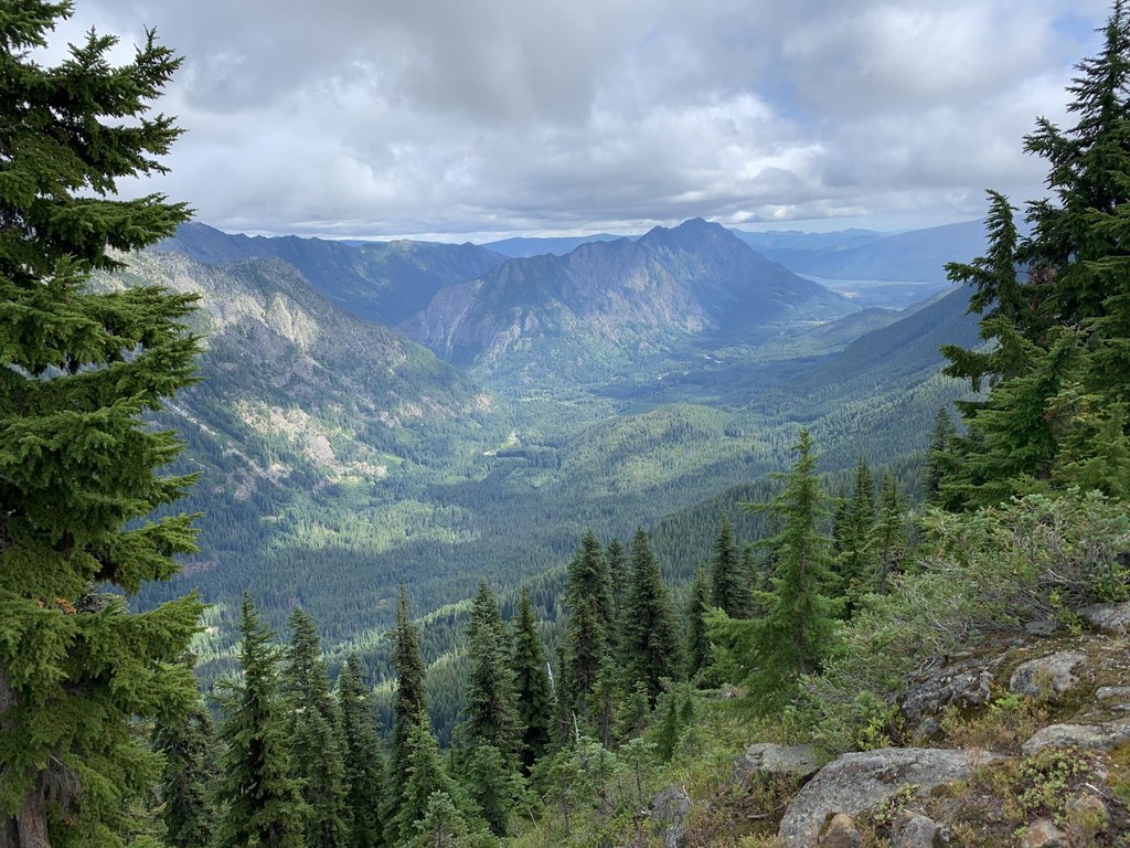
Once your supply has been replenished, begin a relentless climb to the ridge top -- this is a trail to a former fire lookout after all. 3000 feet of gain come in three miles of smooth trail. But your reward is miles of ridge walking with views among the best in the Cascades. The views keep you entertained while the ups and downs along the ridgeline keep your legs working.
The trail contours below the ridge, goes along the top, and crosses over to the other side several times. Several spots are “scrambly” but there is trail all the way. Still, hikers should be comfortable with hiking on scree before attempting this hike.
As you approach the summit, evaluate the summit. Is there still snow lingering there? Do you feel comfortable on the stone steps and exposed rocks? If not, simply end your hike here. The views are incredible, and the elevation gained is not to be sneezed at.
If you're comfortable with a summit push, carry on to the top, where close up views of Clark Mountain are to the north. Poet Ridge is to the south. Views open to Mount Daniel and Mount Stuart far to the south. Crowning it all is Glacier Peak, and it's right in your face.
The summit views are 360 degrees and surpass those along the ridge. When nature calls you to tear yourself away from the views, look for the stone privy or ig”loo”. The top was blasted flat for the old fire lookout. Now it provides a flat spot to enjoy the views.
After all that work some time on top is highly recommended before returning to your car.
WTA Pro Tip: There's a small campground just before the trailhead that provides a great basecamp for your Mount David trip.
Mount David

-
 Length
- 14.0 miles, roundtrip
-
 Elevation Gain
- 5,800 feet
-
 Highest Point
- 7,420 feet
This is a fantastic trip -- amble along a river before making a steep climb to breathtaking ridge walks and astounding views of the craggy Cascades.
Continue reading
Hiking Mount David
Mount David
Map & Directions
 Trailhead
Before You Go
Parking Pass/Entry Fee
Northwest Forest PassWTA Pro Tip: Save a copy of our directions before you leave! App-based driving directions aren't always accurate and data connections may be unreliable as you drive to the trailhead.


