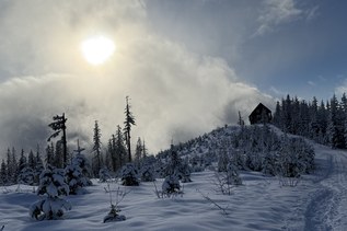
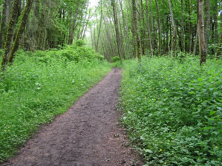
Shangri LaRecent Trip Reports
Hiked here recently?
Submit a trip report!
There are
23
trip reports for this hike.
See all trip reports for this hike.
Coal Creek Trail, Cave Hole, Cougar Pass, Tibbett's Marsh, West Tibbett's Creek Trail (#COUGAR-E10) , Shangri La
— Mar 06, 2012
— whitebark
Day hike
Expand report text
Hide report text
Read full report
Today I did a long one-way hike up the Coal Creek Trail, over the top of Cougar Mountain, and down t...
Today I did a long one-way hike up the Coal Creek Trail, over the top of Cougar Mountain, and down to Issaquah Transit Center. This was a bus-assisted hike - I parked at Eastgate Park & Ride and took the Metro 240 bus to the start of the lower Coal Creek Trail on 119th Ave SE. More info on the route of this hike can be found here:
https://sites.google.com/[…]/cougar-mountain-grand-traverse The Lower Coal Creek Trail has been greatly improved since I hiked it last. The City of Bellevue has their own distinct style of trail maintenance, which involves extensive use of curb logs to support the downhill side of the tread, and liberal use of bark dust on the tread. Bellevue also likes to build wide tread that they can drive motorized carts on. They have a certain blithe disregard for trail grade - some of their trails are remarkably steep. Most trail construction guides recommend removing as much organic matter from the trail tread as possible, while Bellevue loves to dump more on! Well, whatever...there was little mud on the Lower Coal Creek Trail and it was a pleasure to hike on. No blowdowns either - in fact there was little problem with blowdown anywhere on this hike. The upper end of the Lower Coal Creek Trail has been relocated to the intersection of Coal Creek Parkway and Forest Drive. There is a stoplight here which makes the crossing of the parkway easier - no more scary, run-for-your-life jaywalking through 50 mile per hour traffic. I continued hiking on the main Coal Creek Trail upstream of Coal Creek Parkway. This is a beautiful stretch of trail that closely follows the rushing waters of Coal Creek. The trail here has also been upgraded and is in lovely shape, until it approaches the creek crossing. The Bellevue beauty bark treatment ends abruptly here, and the trail becomes muddy and steep until it climbs to the old railroad grade that once went toward the Newcastle mines. Beauty bark and good maintenance resumes here, and the hiking is easy all the way to Red Town Trailhead. From Redtown Trailhead, I followed the Cave Hole trail/road uphill. This trail was in good shape of course, but above the turnoff to Coal Creek Falls there were some drain dips that needed repair. A thin layer of snow covered the trees and open ground here, as well as other high parts of Cougar Mountain, but not much was sticking to the trails. I took the Bypass Trail (in good shape) to Fred's RR Trail. Followed that north a short distance to the Clay Pit Road. From there, I hiked the Klondike Swamp Trail (in good shape) to Cougar Pass Trail. Followed that trail (horrible clay mud, needs a tread treatment of some sort like gravel) to Tibbetts Marsh Trail. Followed the TMT (very muddy, needs work) to Tibbetts Creek Trail (muddy), then followed that path down to Bear Ridge Trail. Went left on the BRT to Shangri-La Trail. Followed the SLT down to the Talus development. I walked the streets of Talus to James Bush Road, then followed that quiet lane down to SR 900. A short hike north the highway brought me to the Issaquah Park and Ride, where I caught a Sound Transit 554 bus that quickly took me back to Eastgate, where my car was stashed. All in all, a nice 9 mile day of hiking on a crisp early March day. Day hike
Features:
Wildflowers blooming
Issues:
Mudholes
Expand report text
Hide report text
Read full report
with photos
This was a muddy walk on a great day, warm but not hot. It took about an hour to do the loop via th...
This was a muddy walk on a great day, warm but not hot. It took about an hour to do the loop via the Tibbett's Marsh to the West Tibbett's Creek Trail and then return via the Bear Ridge and Shangri La Trails to the AA Peak Trail head.
It was a moderate workout with not too many on the trails, I was surprised by this as the parking lot was full. Maybe a trail crew or crews out? The trails are all muddy with the Tibbett's Marsh trail being the worst, but not by much. Lots of flowers still in bloom, phlox, bleeding heart and others lined the trails and helped take you mind and eyes away from the mud holes and slick trail conditions. Day hike
Issues:
Blowdowns
Expand report text
Hide report text
Read full report
with photos
This is the second time I have tried this hike after first seeing it on the King County Map of Couga...
This is the second time I have tried this hike after first seeing it on the King County Map of Cougar Mountain. The hike is a challenge to route finding skills as much of the hike lies outside the park boundaries. Since my last trip to this area, the park has put up signs and done trail work on the Red Cedars and Military Ridge Trails, however, once outside the Park directions to other trails in the loop become non-existent or sketchy.
Having said all this, it was worth exploration of the area. The "Precipice" from Big Tree Trail is impressive and this trail is how I finally solved the puzzle of the route. My first attempt was to take Military Ridge down, this trail appears to end in a park - playground in the Talus development and I could not find the Precipice Bottom trail - it turns out to be there but hidden by a construction berm. So back up to the Big Tree Trail and down it, about 0.6 miles down this trail I came to a small sign noting Talus 0.5 miles Rough Trail. I took a chance that this was the correct trail and started on what proved to be the Precipice Bottom Trail (no sign noting it as such). The Precipice Bottom Trail is very rough in places, with short steep pitches, a section that is angled on hard pan (clay) which would likely be very nasty in wet weather. The trail ends just after the third drainage/creek crossing on a small bridge and back at the park - playground area. These trails are not hiked frequently and are in the noise zone of I-90 but offer solace and challenge. My guess is that I covered about 6 miles and 1200 feet of elevation gain/loss in the trek. Many thanks to King County for the additional trail work and signage. These trails need some upgrading, but are not overly difficult once you find the route and the weather is not too wet. Day hike
Issues:
Mudholes
Expand report text
Hide report text
Read full report
with photos
A hike in the clouds was what this day was for the most part. Our group from the Issaquah Alps Trai...
A hike in the clouds was what this day was for the most part. Our group from the Issaquah Alps Trails Club started in the sun at AA Peak heading down the Shangri La Trail to the Surprise Creek Trail, looping down to the Talus Community area and then up about 400 feet to the Bear Ridge Trail.
The Bear Ridge and parts of the Surprise Creek Trail are quite muddy from recent rains and snow melt. The Surprise Creek Trail is also a bit rough once past the Precipice Top junction. The new Talus Bridge Creek Trail is a short 1/4 mile walk off the Bear Ridge Trail and connects with the new Talus Community. The bridge over the West Fork of Tibbetts Creek is quite impressive and is made of a plastic/fiber glass composite material. Scott Seamans who organized most of the work on this trail was present, still working on sections just north of the bridge and gave us all a guided tour of the trail discussing its construction and the assistance of Issaquah community in obtaining the land and putting in the bridge. The hike was fairly easy with about 3.5 to 4.0 miles of walking, 400 feet elevation gain and about 1400 feet of elevation loss (a bit hard on my knees, but good conditioning for the upcoming summer hiking).
Bear Ridge, Shangri La
— Dec 07, 2008
— whitebark
Day hike
Expand report text
Hide report text
Read full report
Originally my plan was to help out the Issaquah Alps club build the connector trail from Talus to th...
Originally my plan was to help out the Issaquah Alps club build the connector trail from Talus to the Bear Ridge trail. But the trail was nearly done when I arrived at the work site, so I felt a hike was in order instead. Rambled up the Bear Ridge Trail to the Shangri-La trail, then followed that path down to Talus. Both trails are in fine shape, and the fern-draped Fantastic Erratic (a huge granite boulder) is as impressive as ever.
That nearly-finished Bear Ridge connector trail is now hikeable from end to end. It's a fine piece of work, passing through the usual lovely forest and crossing a couple of nice creeks before popping out into a spanking new Talus neighborhood. |
|
Document Actions
- Email this page
- Print this
- Share


