Trails for everyone, forever

Home Go Hiking Hiking Guide Swan Lake

Alert: On Oct. 1 the federal government began a partial shutdown that will impact National Parks, National Wildlife Refuges and U.S. Forest Service lands in Washington. Here's the latest information we have for hikers and campers


Swan Lake

Eastern Washington > Okanogan Highlands/Kettle River Range
48.5154, -118.8357 Map & Directions
Length
2.5 miles, roundtrip
Elevation Gain
350 feet
Highest Point
3,730 feet
Calculated Difficulty About Calculated Difficulty
Easy
Placid Swan Lake on a beautiful summer day. Photo by Mary Hartman. Full-size image
  • Established campsites
  • Lakes
  • Wildflowers/Meadows
  • Wildlife

Parking Pass/Entry Fee

None
Saved to My Backpack

Whether you’re camping nearby or just out for a day, the trail around peaceful Swan Lake makes a beautiful outing. Loons and beavers make this place home. Continue reading

Rating
3.20 out of 5

(5 votes) Log in to rate

Hiking Swan Lake

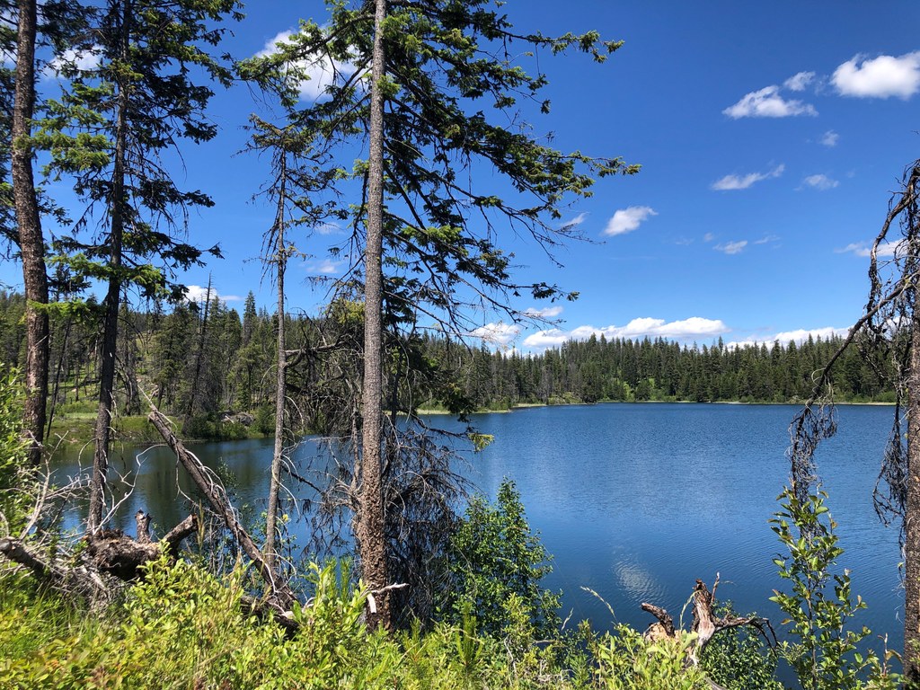
Walk down to the lakeshore path from the day use parking lot and turn right. This trail leads through the group campsite and past the CCC kitchen shelter. The trail continues around the northern and western shorelines. The North Star wildfire in 2015 made its mark on this area, but many of the trees survived and there is new growth. Wild roses and other flowers scent the air.

After about 0.7 mile there’s an unmarked junction. The left fork appears to be the mapped trail, but due to fallen trees and brush, it’s a little hard to navigate. The right fork is a clearer path; it goes uphill and around a few bends before descending to the lakeshore and passing over a couple of footbridges. Look for evidence of beavers in the swampy areas.

If you’re lucky you’ll see loons diving in the placid waters and hear their eerie calls. Near the south end of the lake, you’ll pass a marked junction with the Swan Butte Trail (this spur adds 0.5 mile each way). However, fallen trees may make access difficult.

The Swan Lake Trail ends at Scatter Creek Road. Turn left and walk the camp road back to the day use area.

WTA Pro Tip: Drinking water is available in the Swan Lake Campground. Bring your swimming togs for a dip in the lake after your hike.

Toilet Information

  • Toilet at trailhead
  • Accessible toilet

More information about toilets

Hike Description Written by
Mary Hartman, WTA Correspondent

Swan Lake

Map & Directions

Trailhead
Co-ordinates: 48.5154, -118.8357 Open in Google Maps

Before You Go

See weather forecast

Parking Pass/Entry Fee

None

WTA Pro Tip: Save a copy of our directions before you leave! App-based driving directions aren't always accurate and data connections may be unreliable as you drive to the trailhead.

Getting There

From Republic, take Washington Highway 21 south 7 miles to Forest Road 53 (Scatter Creek). Turn right and follow Scatter Creek for 7 miles to Swan Lake Campground. The south trailhead is on the left side of the road, just before the lake and campground. The north trailhead is in the day use area near the group campsites. There are vault toilets in the Swan Lake Camground.

More Hike Details

Trailhead

Eastern Washington > Okanogan Highlands/Kettle River Range

Swan Lake (#14)

Colville National Forest, Republic Ranger District

Guidebooks & Maps

Day Hiking Eastern Washington (Landers and Romano - Mountaineers Books)

USGS Swan Lake

DNR Republic

You can improve or add to this guidebook entry!

Swan Lake

7 Trip Reports

Hiked here recently?

Submit a trip report!
 
Trip Reports