

An easy stroll along a burbly creek, the Umtanum Creek Falls Trail has something for everyone in the family to enjoy. The way is shaded by Douglas-fir and ponderosa pine. Kids should look closely for wildflowers like yellow desert-parsley, bluebells, wax currant and bitterbrush. Encourage them to listen to the different bird songs, using binoculars to spot bluebirds, woodpeckers and more.
The trail is confusing at about 0.3 mile in. The trail goes straight up the rocks along logs. Don't go right and cross the creek. Many hikers have made this mistake.
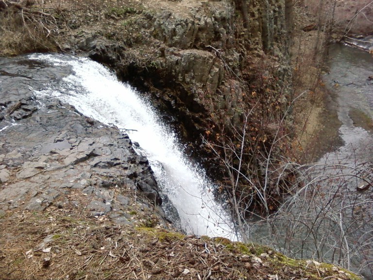
Identify the sweet fragrance of sagebrush, while keeping an eye out for bighorn sheep on nearby canyon walls. The trail opens up to reveal Umtanum Creek Falls, a pretty little waterfall that cascades into a pool surrounded on three sides by basalt walls. Hikers can take a rough trail to the bottom of the falls, or stay at the top and enjoy the view.
 Trailhead


