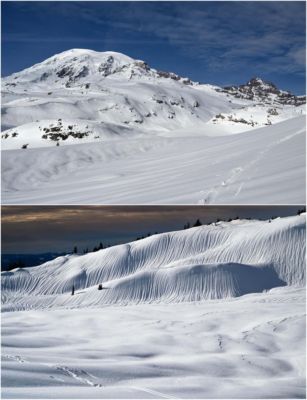
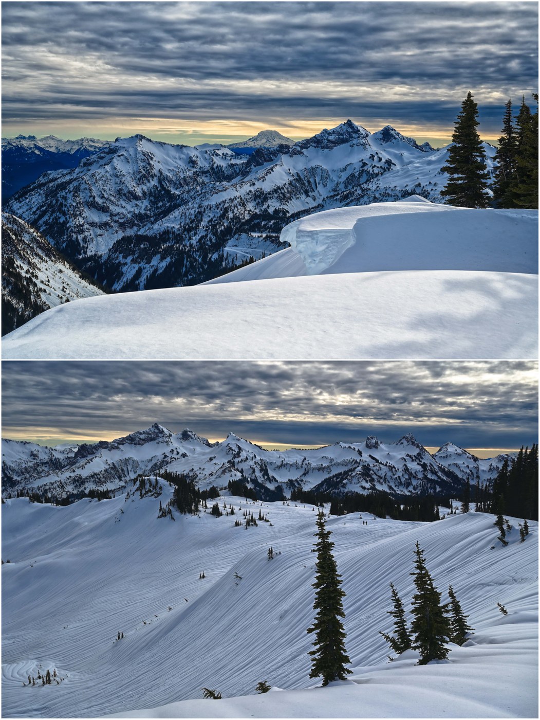
Bottom Line: Mixed of sun and cloud, temperature inversion, spectacular snow runnels, avalanche debris and large crowns; stunning views in all directions
Stats
- Distance: 6 miles RT
- Duration: 4-1/4 hours
- Vertical: 1350 ft
- Road: We overnighted at National Park Inn (trip report); the road up to Paradise was clear, with some ice at lower elevations due to the temperature inversion
- Weather: mix of sun and cloud, ~45F, no wind, variable snow conditions with elevation, from posthole-able, to hardpack with 2" of low-density snow on top, to deep medium density snow
- Takeaway: Absolutely gorgeous day and incredible views; the snow runnels in particular were mesmerizing, and the cloudy skies to the south added drama to the Tatoosh range; Skyline trail over to Mazama Ridge was probably a poor choice, especially given that we traversed high at a junction with the Golden Gate trail; the slope was steep as we broke trail, with avalanche debris and large cracks
Lined up at the road closure outside of National Park Inn, which opened at 9am sharp, right no schedule. You can grab a breakfast to go (the only way they serve it) at the Inn if there is time.
The Paradise parking lot filled incredibly fast - whoa! Toilets were open, but not a lot else. Rangers were standing by the main trail up to answer questions from the mix of snowshoers and backcountry skiers. The sun was shining - happy people :)
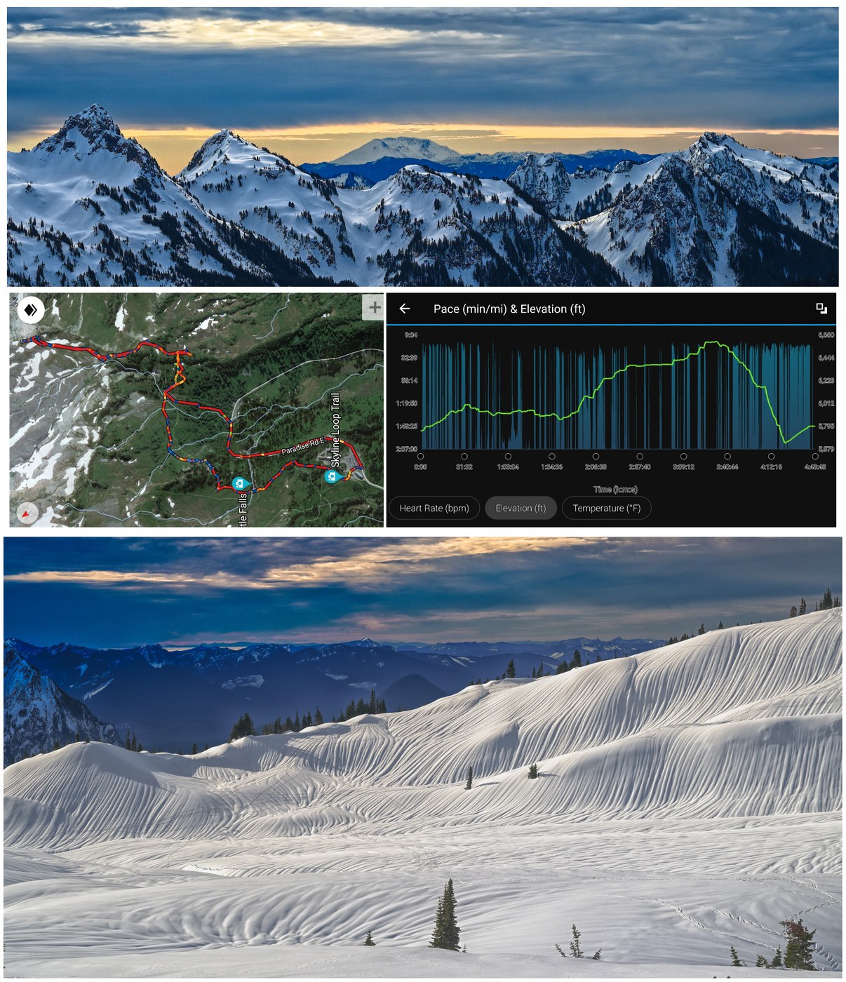
Our goal was to head up Mazama Ridge. There are two ways to approach - via the Paradise Road and 4th Crossing, of up behind the Paradise Lodge and east via Skyline once you gain some elevation. Avalanche danger was LOW so we opted for the upper route (otherwise we would have taken 4th Crossing per the WTA trail description). On the return, we took the road as time was running short (the downhill gate closes at 4pm), forming at least a bit of a mini-loop (see map below).
One ascends, and eventually reaches (using Gaia for tracking) the intersection between the Golden Gate and Skyline trails. We had planned Skyline to cross over to the switchbacks up Mazama Ridge, but in retrospect Golden Gate might have been better. The crossover was steep with avalanche debris. We broke trail, and even post-holed with our snowshoes. I broke one of my straps in an effort to free it. With this route there is an obvious creek crossing as well. Descending into the gully it seemed safe, and certainly the snowpack had more evidence of a hard overnight freeze here.
The "switchbacks" up Mazama were pretty obvious at this point, although the trail in truth was more straight up, leaning into your snowshoes to maintain traction. We have rugged snowshoes with deep teeth - we did notice folks with lighter-weight snowshoes designed more for groomed trails that were having considerable difficulty on the steeper areas.
Once you crest Mazama Ridge, you can turn north towards upper Skyline Trail and Paradise Glacier Trail, or south down towards Reflection lakes and the loop back around to Paradise. We had planned the latter but decided on the former given the beautiful (and safe) conditions. We climbed to the Skyline/Paradise Glacier junction and headed right on the glacier trail. We ascended up to an obvious high point in about a mile, with other tracks peetering out as we wet. Going higher would have required us to descend (but not towards Paradise) so we made that our stopping point.
On the return, back at the point we crested Mazama Ridge, we elected to not head downhill towards Reflection Lake and the long loop back to Paradise, but instead head back down the switchbacks we ascended, and then take Paradise Road back to the parking. Six miles was plenty of distance in snowshoes for the day :)
This hike was amazing. The landscape was painted in snow runnels, which were absolutely mesmerizing. From some vantage points, at a distance, they looked like the patterns a barista might back in your latte foam :) There was some avalanche debris on lower elevation trails, as well as huge anow cracks revealing deep blue caverns (very beautiful). While the avalanche danger had come down progressing over the proceeding days, there was of course considerable evidence of the heavy rainstorm that hit over the previous week. Higher up, very large crowns were visible and warranted a large berth. No wildlife to speak of except for the usual friendly gray jays that will take every opportunity to steal your lunch,


Comments