Trip Report
Martin Lakes, Angel Staircase, Eagle Lakes, Boiling Lake & Cooney Lake — Friday, Sep. 23, 2011
 North Cascades > Methow/Sawtooth

Golden Lakes loop trail, described in 100 Classic Hikes in Washington (pg. 74-77)
5-day, 4-night backpacking trip to see the Golden Lakes of Eagle, Upper Eagle, Boiling, Cooney, and Martin Lakes in the Okanogan forest lands just East of Lake Chelan. Most descriptions of this backpack hike accomplish the loop in 3 days with camps at Upper Eagle & Cooney. We had the entire week off and the weather looked promising so we decided on taking our time and break the hike into smaller bites and more “relaxing” time at the lakes and camps.
From Seattle it takes 4.5 to 5 hours to get to the trail head. We went via Hwy 2 (Steven’s Pass) to Wenatchee to 97N to Pateros and then 17 miles N on Hwy 153. From 153 it is still about 11 miles back on forest service roads to the trail head. There is camp sites and a pit toilet at the trail head, so it is possible to arrive later and sleep at the trail head and head out early the next day. We left Seattle at 7am and got to the trail head at 11:30am. On the return home we went N on 153 to Hwy 20 and then W over the North Cascades Hwy to Burlington and then S on I-5 to Seattle and it took us right at 4.75 hours. So either way seems about equal. Too far for day hikes, but for a few days in the wilderness it is worth the drive.
As of our hike (Sept 19-23) the Larches around the lake are NOT golden yet. A few are just starting to turn color. So it will be a couple weeks at least before the color is really impressive (one on the main reasons for this hike). Bugs are present in the lower meadows and near water streams. Up higher (Eagle Lakes, Cooney Lakes) we didn’t have any problem with bugs. Both our camps in the valley near Boiling lake and at Martin Lakes had lots of flies and mosquitoes, but bug spray worked fine.
Temperatures varied throughout the week. Monday was the end of a short cold spell and the temps both Monday and Tuesday night were in the mid-30’s at night. Thursday and Friday saw temps at low 40’s and even low 50’s for nights. Daytime temps mid-50’s early week and mid-70’s by end of week.
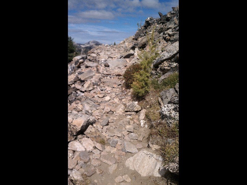
Trail condition was good for the type of use allowed. Motorcycles, Mountain Bikes, Horses, and Hikers are allowed on most of the trails in this area. It is not a wilderness protected area (sad to say) and so the restrictions that keep a wilderness area preserved for future generations don’t exist here. The trail is covered in 2-3” of dust because of the motorcycles that use the trails. Switchbacks are “banked” and almost all are loose with 3-5 inches of loose dirt, again due to the motorcycle usage. Steep inclines can be tore up with loose rock and gravel due to the motorcycle usage. And we did encounter one 3’ x 2’ foot spill of gasoline on the trail leaving fumes and visible pollution. We also observed that while the trails to the lakes (all side trails off the main one) were signed “no motorcycles” they ALL had recent motorcycle tracks and the same kind of trail erosion. Even on the Angel’s Staircase, the steep switchback climb to 8000’ motorcycle tracks and spin outs in the switchbacks were ever present. No place is off limits in the mind and attitude of some riders. What takes a hiker days to explore, and be "toured in a matter of hours by motorcycle, all without breaking a sweat. But at what cost to the wilderness itself? Just expressing an opinion after visiting this gorgeous area.
We saw no one on Monday’s hike from the Trail head to Upper Eagle Lake. A little over 7 miles and we gained 2756’ in gross elevation for the first leg. Lake is nestled in a circle of 8000’ peaks of which Bigelow Peak is the star. The turn off of the main trail to Upper Eagle is unmarked, though someone had flagged it. You come to a small tarn first, and then need to go another ½ mile or so the lake itself. We found what was signed “horse camp” with a really nice camp spot including stone tables, log benches, stone seats, fire pit with grills. Since no one else was here we decided we take advantage of all the upgrades. A really crude and dilapidated (and full) wooden toilet was located a short distance up a trail from the horse camp. Worked, but not exactly pleasant and needing services desperately.
Tuesday we packed up and headed back down the ½ or so to the main trail and continued on toward 7600’ Horsehead Pass. We saw a couple of nice campsites on the way toward the pass, so one could skip Upper Eagle if they wanted and camp along the main trail. One is right off the main trail where the outlet stream of Upper Eagle comes down. Another campsite is near the junction off the main trail where a trail goes down to Eagle Lake a few hundred feet below. We pressed on to 7600’ and made the top of Horsehead Pass where we stopped for a snack / rest break. On the top of Horsehead pass you look directly down to Boiling Lake and the tree-filled valley below. Best pictures of boiling are from the trail, high above the lake where its bubbling springs produce interesting “circles” in the mud (kind of like crop circles). Follow the trail down and it will eventually take you right to Boiling Lake at the outlet stream side. There are 2 large campsites here at Boiling where one could camp, drawing water either from the Lake or the outlet. We stopped here for a while and enjoyed the meadows and quiet before heading on further on the main trail where in about 1 mile we crossed a flowing stream and found 2 large campsites (it’s marked “camp” on Green trail map) and set up camp on near the creek. Another camp was already set up on the other side of the trail, so with our arrival both sites were full. It would be possible to set up her in the meadows or near the 2 sites. A “toilet box” is provided a short hike up from the campsites. This backwoods toilet was much more “together” and less filled than the one at Upper Eagle. Bugs were a problem here and for the first time we put on bug spray. In the afternoon our solitude (the other campsite people were gone on a day hike), we were greeted by 3 motorcycles cruising the area. Total annoyance time was about 15 minutes, but still quite a shock when you are 12 miles from civilization enjoying a quiet sit in a meadow listening to the stream.
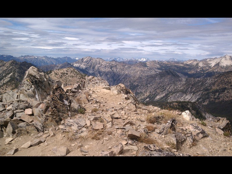
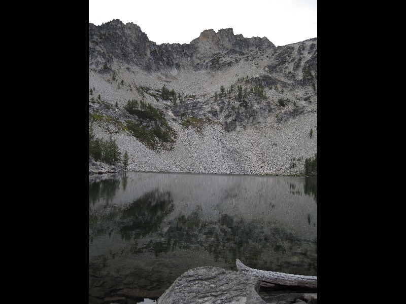
Wednesday we packed up and headed up the valley to what is called Angel’s Staircase and the high point of our hike, a pass over a ridge topping out at 8051’. Trail signage is somewhat vague and sometimes not even present with spurs, side-trails, hunter made horse trails, and older abandoned trails (before motorcycle use). From our campsite of Tuesday night there were 3 different ways to go, and some confusing signs. The trail we needed was the most “left” trail and was right beside our campspot and immediate crosses the stream we camped alongside of. After about a mile the trail split in a Y and again no signage. We chose the left-hand fork as it was the most developed and maintained with wooden bridges and side boards and drainage put in. It climbed to 7000’ before it ended in a large open meadow with a Hunter’s horse camp where hunters come to find deer in the open meadows. It was NOT the main trail after all. Our 2 choices were to either head back the way we came (about ¾ mile down), or according to our Delorme GPS the trail was ¼ mile below us and it seemed easy to simply angle down through the meadow and pick up the GPS trail. All went well until we arrived at the GPS trail only to find that the Forest Service had abandoned the trail and so now it was no more than a faint deer path through the trees and meadows. Oh well, we at least had a GPS and we were on “the trail”. We finally (about ½ mile later) connected with the “real trail” which had been rerouted for motorcycle use. Another ½ mile and we found the junction to the “Angel’s Staircase” marked “no motor vehicles allowed”. We followed the motorcycle tracks right up the ‘Staircase’ and in a long 1.4 miles reached the top of the pass at 8051’. It was a long steep climb with heavy packs, but the views of the jagged peaks around us were the best of even I’ve experienced. Eventually you gain enough elevation to literally look down at all the area around. Fantastic views and the highlight of the trip. After taking in the views, catching our breath, and eating some more snacks, we traversed the .4 miles over to the saddle that looks down on Cooney Lake on one side, and the Merchant’s basin on the other side. Off toward the Merchant basin, Sunrise Lake shine like a jewel in a basin surrounded by 8000 peaks. Our choice was either Cooney or Sunrise. Going to Sunrise meant we’d add another 7 miles to our planned itinerary, and going to Cooney meant descending 800’ down an unmaintained steep loose gravel trail .8 miles to the lake. We decided to descend to Cooney and spend the night there. The trail down is steep, loose, and motorcycles have torn up the switchbacks making for some “exciting” hiking. Cooney is a pretty lake and the campsites are located on the far side, around past the outlet, and sit up on a rock bench above the lake. We set up in a nice one overlooking the lake. That evening and all through the night the wind blew with 15-20 mph gusts coming down off the 8000’ ridge above us. Our tent was filled with wind-blown dust and grit by morning as the sites were all sandy dirt (no pine duff or brush on the sites). Needless to say, we were ready to pack up and head out early the next morning. No bugs, but probably due to the wind.
Thursday we headed back to the main loop trail and headed past 3 crude horse camps and came to another unmarked junction. Right or Left? Well, to go to Martin Lakes, go LEFT out of Cooney. To go to the Merchant’s Basin (back toward Sunrise Lake) stay straight. We took the straight for a ways and the GPS showed us going toward the Basin instead of Martin Lake. So we backtracked and headed left (and up) for Martin Lakes. The hike was through forest filled with dead and downed trees. Tread was nice and the path easy. A signed junction 2.2 miles from the Cooney Lake junction pointed to “Martin Lakes.” Of course a “No Motorcycles” sign was posted, and we once again followed the motorcycle tracks up to Martin Lake at .6 miles up. Only found 3 campsites at Martin and we decided to set up back from the lake a bit off one of the sites so as not to get blown away as the winds had not died down since leaving Cooney Lake. Pitching out tent was a two-person job in the wind and we had to put out the guy-lines for the first time to keep it secure. Martin Lake and Cooney Lake were both windy and chilly, with sun breaks at time. The upper lake at Martin was just a tarn-sized pool at this time and no sites to camp, so we stayed at the main lake and enjoyed the late afternoon and evening reading, relaxing, and taking in the views when the wind stilled a bit and sun came out from behind the clouds.
On Friday we packed up and headed back down to the main trail (.6 miles) and then hiked out to the trailhead some 6.5 miles away. Almost all downhill and just a few little uphill sections. Hiking out we encountered a party of 2 mountain bikers headed for Cooney, a motorcycle “backpacker” with pack and pad on his back, and a single “day-biker” headed for the Angel’s Staircase, though she didn’t have any mileage or navigation devices and had already experienced some “unmarked junctions” in here first 1.7 miles in. So we chatted about how to find the right trails and how far to get to Cooney and what to expect at the steep switchback gravel/dirt/rock trail up 800’.
All in all we clocked 28.3 miles with full-packs; ascended 6,938’ in elevation, and descended a total of 7050’ in elevation. All told we were on the trail hiking for 23 hours, 19 minutes including rest stops. The rest of the time was spent enjoying the wilderness.
I would recommend this hike, but only when the larches are fully turned to golden and the Fall color is present. The rest of the time the dust and motorcycles would cause me to seek a quieter wilderness experience. It's amazing how much a single rumbling, fuming, trail eroding motorcycle can take away one's wilderness experience. The beauty of this land is so great, it a real travesty that it is being destroyed for the sake of "a fun ride in the dirt." Most are courteous and you can hear them coming a mile away (literally), so you don't get surprised. It just that knobby tires with engine muscle churning up inclines and around sharp switchbacks tear up the trail no matter what. Mountain bikes don't produce the same kind of deterioration as the motorcycles and they do not destroy the quiet of the meadows either. As a hiker seeking solitude and back country quiet, motorized vehicles are just incompatible with a true wilderness experience. Perhaps someday this area of 8000' peaks and rugged peaks of wonder will receive the protection they deserve.
Photos on Flickr: http://www.flickr.com/photos/33346716@N03/sets/72157627621129941/


Comments
Posted by:
jasonracey on Sep 29, 2011 10:11 AM
Posted by:
Cruiznbye on Sep 29, 2011 10:11 AM
You are part of the problem, not the solution.
Financeguy
Posted by:
Financeguy on Sep 29, 2011 01:49 PM