

The hike to Martin Lakes starts at the Crater Creek Trailhead, at 4760 feet of elevation. You'll be traveling initially along the Eagle Lakes trail. The mostly forested trail has an up-valley view at 0.3 miles before descending to cross Crater Creek. At the junction with the Crater Creek Trail, stay on the Eagle Lakes Trail as it heads away from Crater Creek. This multi-use trail offers easy travel as it climbs at a 300 feet per mile gradient.
At 2.2 miles from the trailhead (5600 feet of elevation), turn onto the Martin Creek Trail to descend 360 feet to the Eagle Creek ford/rock-hop junction. The remnants of the old bridge are in the trees to the SE of the ford.
From the ford, the trail climbs, initially with switchbacks, then a long traverse through the forest, staying below a long rockslide at 4.7 miles (5700 feet of elevation). It continues climbing with short, then long switchbacks, nearing Martin Creek at 4.9 miles (5800 feet of elevation), before reaching the Martin Lakes Trail at 6.5 miles (6480 feet of elevation).
Take the Martin Lakes Trail (motorcycles prohibited) as it climbs, steeply at times, up to the lower Martin Lake at 7.0 miles (6740 feet). The trail continues past the lower lake and makes its way to the upper lake, 7.3 miles from the trailhead (6840 feet).
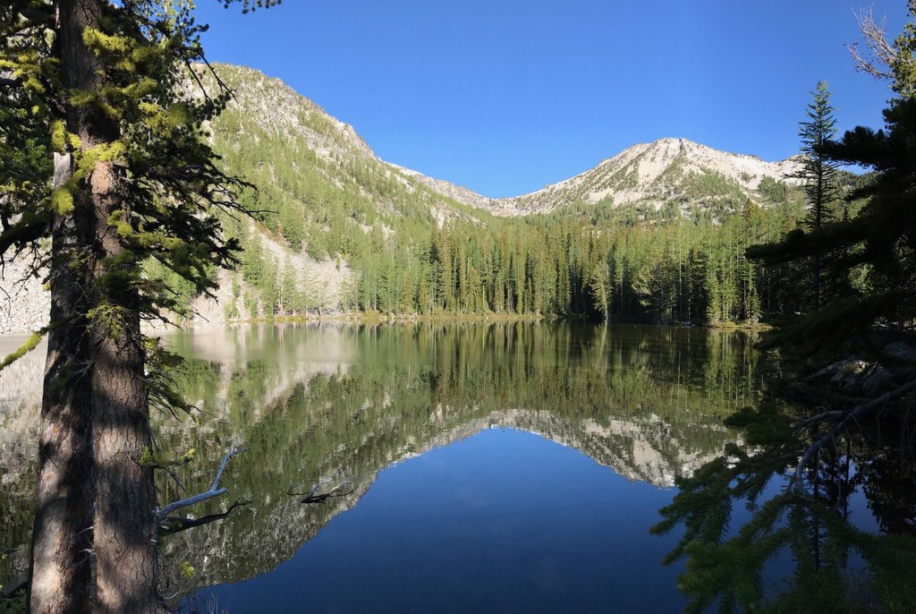
The shallow lakes have good fishing, but are also somewhat buggy in the early summer. The lakes have many campsites, the largest is the horse camp on the northeastern shore of the lower lake. Other large ones are on the low ridge to the east of the lake, as is the local toilet.
Smaller camps are at and along the route to the upper Martin Lake.
The best view of Martin Peak is from the northern tarn, reached via an informal trail along the northern inlet of the upper Martin Lake. The other tarn is reached via more difficult cross-country travel along the western inlet stream to the upper lake.
 Trailhead


