Trails for everyone, forever

Home Go Hiking Hiking Guide Chinook Pass to Crystal Mountain via the Pacific Crest Trail

Chinook Pass to Crystal Mountain via the Pacific Crest Trail

Mount Rainier Area > Chinook Pass - Hwy 410
46.8720, -121.5159 Map & Directions
Length
8.9 miles, one-way
Elevation Gain
1,400 feet
Highest Point
6,400 feet
Calculated Difficulty About Calculated Difficulty
Moderate/Hard
Hikers heading from Chinook Pass to Crystal Mountain. Photo by jbrink. Full-size image
Saved to My Backpack

Done as a one-way car shuttle hike, this route takes you past several lakes and streams, through meadows of wild flowers, patches of huckleberries, views of mountains and occasional wildlife such as marmots, black bears, pikas and mountain goats. And on a warm day you can take a cooling dip in Sheep Lake on your journey. Continue reading

  • Ridges/passes
  • Wildlife
  • Lakes
  • Wildflowers/Meadows
  • Mountain views
  • Established campsites
  • Waterfalls
  • Fall foliage

Parking Pass/Entry Fee

Northwest Forest Pass
Rating
5.00 out of 5

Hiking Chinook Pass to Crystal Mountain via the Pacific Crest Trail

Done as a one-way car shuttle hike, this route takes you past several lakes and streams, through meadows of wild flowers, patches of huckleberries, views of mountains and occasional wildlife such as marmots, black bears, pikas and  mountain goats. And on a warm day you can take a cooling dip in Sheep Lake on your journey.

The trailhead for this hike is the same as for Sheep Lake, which begins at Chinook Pass. Begin at a parking lot on the east side of Highway 410 where there are restrooms and an informational kiosk. If the parking lot is full there is one across the highway to the south and one at the Tipsoo Lake trailhead which will add about a quarter mile to your trip.

From Chinook Pass, the trail takes you along and above Highway 410 on a mostly exposed slope before turning north for a short way through a forest of cedar, hemlock and Douglas fir to Sheep Lake's south shore. Round the lake's southeast side and cross a footbridge over a small inlet.

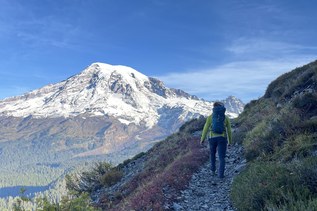
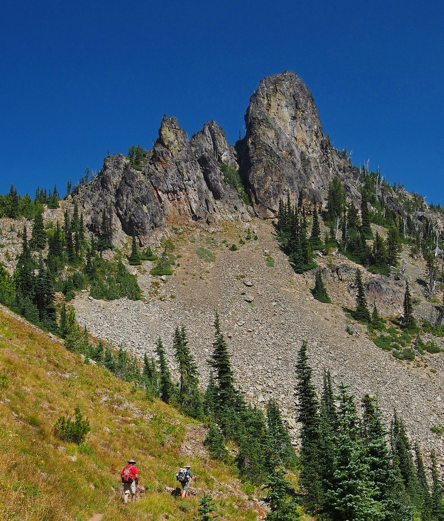
You will begin to gain a bit of elevation through meadows of lupine, magenta paintbrush, elephant head, tiger lily and columbine. As the trail steepens, Mount Adams, Goat Rocks and Mount St. Helens come into view as well as Sheep Lake far below. Closer in, the ridge's jagged spine includes the prominent squared off monolith of Cupolo Rock, a popular rock climber wall.

At 3.5 miles is Sourdough Gap, the entry to the ridge traverse above the Morse Creek Basin. From the Gap the trail descends about a hundred yards to a signed junction for the Pacific Crest Trail (PCT). You can enjoy a short side view to a great view of Crystal Lake and Mount Rainier by continuing past the junction for about a hundred feet and venturing down a boot path that crosses over a narrow ridge and drop down on a trail above Crystal Lake with Mount Rainier towering behind it. Now backtrack to the junction and follow the PCT northeast along the ridge with Placer Lake in sight below you.

After a little over 6 miles, you will reach the Bear Gap junction. From there take the Silver Creek Trail 1192 for a two mile descent that passes over over Silver Creek on a footbridge and a small falls next to an abandoned mine opening. The last section of trail takes you through the  open fields of Bullion Basin to the Crystal Mountain parking lot.

Hike Description Written by
John Brink, WTA Correspondent

Chinook Pass to Crystal Mountain via the Pacific Crest Trail

Map & Directions

Trailhead
Co-ordinates: 46.8720, -121.5159 Open in Google Maps

Before You Go

See weather forecast

Parking Pass/Entry Fee

Northwest Forest Pass

WTA Pro Tip: Save a copy of our directions before you leave! App-based driving directions aren't always accurate and data connections may be unreliable as you drive to the trailhead.

Getting There

This hike is a one way trip and requires a car shuttle leaving a vehicle at Crystal Mountain Ski resort and one at the starting point, Chinook Pass.

To get to Crystal Mountain, drive east from Enumclaw 34 miles on Highway 410 and turn left on the Crystal Mountain Road for 5 miles to the ski resort parking lot. For the trailhead, go back to Highway 410 and turn left going south and then east to Chinook Pass to the parking lot on the northwest side of the highway. Parking is also available across the road to the southwest.

More Hike Details

Trailhead

Mount Rainier Area > Chinook Pass - Hwy 410

Okanogan-Wenatchee National Forest, Naches Ranger District

Guidebooks & Maps

Day and Section Hikes

Pacific Crest Trail: Washington

by Adrienne Schaefer; Day Hiking: Snoqualmie Region

by Alan Bauer

Green Trails: No. 2695 (Mount Rainier Wonderland)

Green Trails Mount Rainier East No. 270 and Green Trails Bumping Lake No. 271

You can improve or add to this guidebook entry!

Chinook Pass to Crystal Mountain via the Pacific Crest Trail

21 Trip Reports

Hiked here recently?

Submit a trip report!
 
Trip Reports