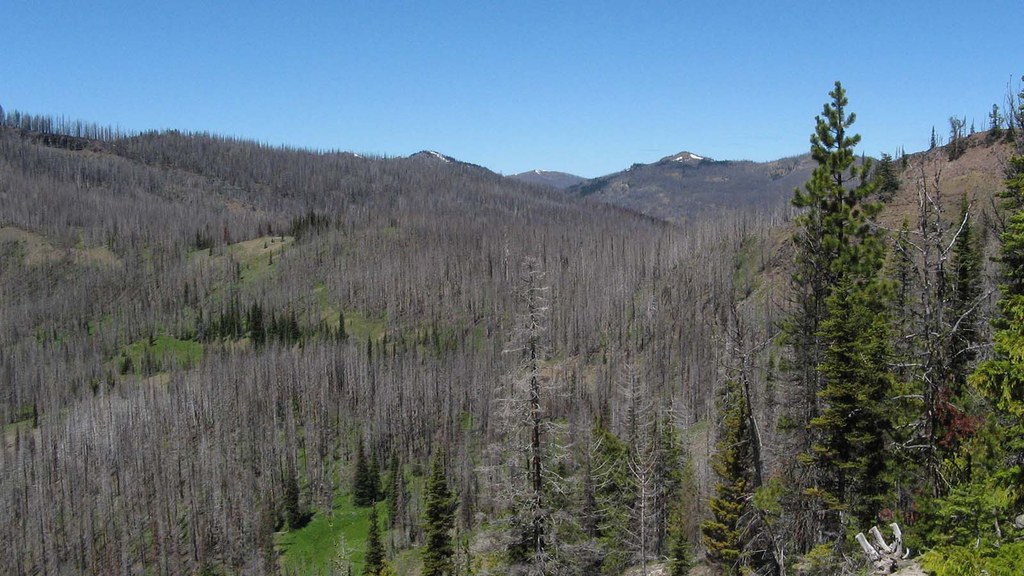

The first 4 miles of this trail provide a good early summer workout as the snow melts early here. The 28 switchbacks provide a somewhat shallow climb above Miner Creek through the blackened forest with a slightly flowered understory. The 2017 Norse Peak Fire burned most of this trail, and prior to that, a Miner Creek flood washed out the lower part of the trail and created a small canyon. So hikers can see firsthand the effects and recovery of fire and flood.
To get started, the trailhead parking and sign are on the east side of the small campground, while the flood-rerouted trail starts on the Pleasant Valley Loop trail (unsigned) on the west end of the campground, halfway around the loop drive (elevation 3400 feet). After crossing the stout bridge over Miner Creek, turn right on the unsigned trail (flagged in places) to gradually climb through the forest along the washout, meeting the old trail about 0.4 mile up the hill (elevation 3610 feet).
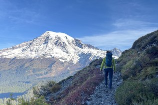
Turn left on the old trail and really start the climb through the blackened trunks with sections of early summer flowers adding color to the brown and black. Those blackened trunks and a few surviving trees will provide most of the minimal shade along the trail. After 1.7 miles, reach a viewpoint (elevation 4740 feet) on the end of the ridge, with rock perches and flowers. This is about the halfway point in the climb, and it is worth a taking a moment to look out over the American River valley and the peaks of American Ridge.
The last 1.9 mile climb to the high point continues with two more lazy switchbacks leading into a less burned forest (more shade) and views off the steep-sided ridge crest over Survey Creek. Mount Rainier peeking over the ridges to the west provides a distraction from the relentless climb. In early season, elk and deer may be in this area. Later in the year, they move on toward the Crow Creek valley.
The high point is 4.1 miles from the trailhead (elevation 5850). A side route to the west passes a rustic campsite to an overlook of Survey Creek and views into the severely burnt Crow Creek valley. This makes a good turnaround point for day hikes.
Note: Other camps, with water, are by meadows a bit farther along the trail, and at Sheepherder Lake.
From the high point, the trail descends for 0.2 mile to sloping meadows and crosses Survey Creek (elevation 5605). After a short climb, it starts a 0.4 mile shallow descent through a few meadows, with water and passes a tarn. The meadows provide summer gazing for the elk, which abound here.
After leaving the meadows (elevation 5680 feet), the trail enters a severely burned area and descends for 0.8 mile to a signed junction (elevation 5090 feet). The Crow Lake Trail continues down to Crow Creek with options to descend to grassy Crow Creek Lake or climb to Big Crow Basin.
The 0.3 mile side trail descends to Sheepherder Lake (elevation 4960 feet). The small lake has a somewhat grassy shore and a couple of campsites in the burnt forest. In summer, be ready to deal with a hoard of mosquitos near the lake.
For those wanting a much cooler trip, the trailhead is also the Crow Lake Way Sno-Park from late fall through early spring. Those venturing up from the Pleasant Valley Loop Trail should be well versed in backcountry navigation and equipped for the winter conditions.

 Trailhead