

During the winter months, the Crystal Mountain ski resort is a destination for winter sports, but during summer, when the snow melts out, it is also a great place to go hiking.
This page describes the options for doing a loop hike around the ski slopes, which is the ridge west of Crystal Mountain Boulevard. For WTA’s guide to trails on the ridge east of Crystal Mountain Boulevard, check out the Pickhandle Gap Loop.
In general, the loop options at Crystal Mountain start at the base of the slopes, climb to the Crystal summit, then return via the Crystal Mountain Trail. There are a few different ways to get to the summit. From the main parking area, you can either buy a ticket and ride on the Mount Rainier Gondola, which drops you off on the summit, or you can hike up via Kelley’s Gap Road and the Green Valley Trail. If you opt for the Gondola, consider the direction of your loop — taking the gondola up at the beginning will save you some climbing, but a ride down at the end will save your knees from descending a steep trail.
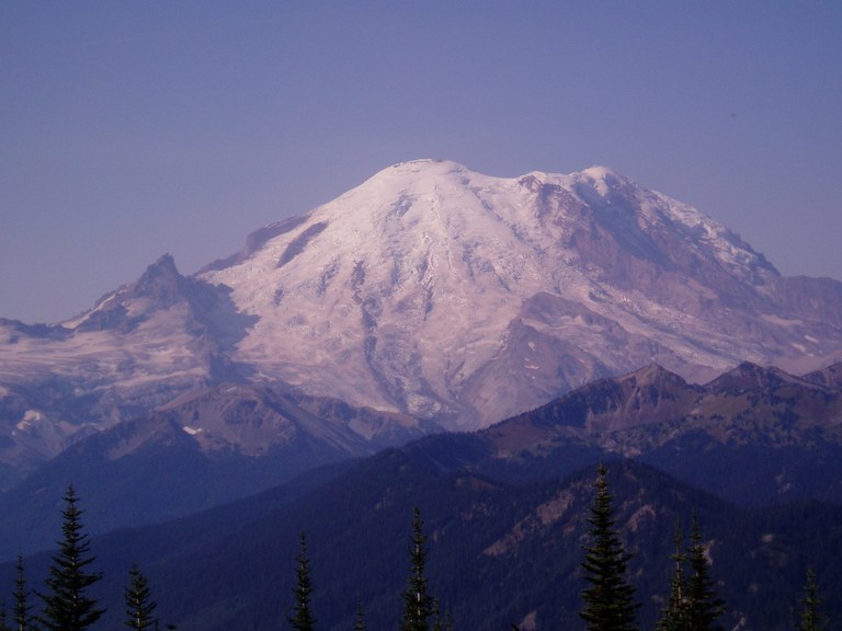
Once on the ridge, take in views of Mount Rainier, Crystal Peak, and many others, both near and far. A rarity on a hike, there is also a restaurant here; if nothing else, it’s a good place to fill your water.
Head south along the ridge on the Crystal Mountain Trail, which starts to trend downwards for a total of about 2.5 miles. After descending, you will arrive at a junction. You can either go up to Bear Gap or left to Henskin Lake and The Silver Creek Trail. Stay left, pass the lake and meet up with the Silver Creek Trail. Walk this until it ends at the Gold Hill Access Road. From here, it’s a short connection on the Bullion Basin Trail back to the parking area.
As an alternative approach to the summit, you can also start at the Northway Trail. This is a longer route along the ridge to the summit. The Northway trailhead is down the road from the main parking lot, so it is not a true loop. To connect back to your car, you have to travel two miles along Crystal Mountain Boulevard. This is a good option for a bike or car shuttle.
Regardless of the loop you choose, a map is crucial to navigate all the turns and junctions you’ll come across along the way.
 Trailhead


