

The trail begins at an Owyhigh Lakes trailhead sign along State Route 123. (This is the other end of the Owyhigh Lakes trail, which begins inside the White River entrance to Mount Rainier National Park.) From the road, drop moderately steeply, losing 300 feet over 0.4 mile. As you near the bottom of the valley at 3000 feet of elevation, you’ll pass a 62-foot cascade on your right, Deer Creek Falls.
At the bottom, go right, on a path that is shared by the Eastside Trail and the Owyhigh Lakes Trail. Cross the clear waters of Deer Creek and Chinook Creek on a pair of bridges, then a tenth of a mile later, at 0.5 mile, go right at the signed junction, on the Eastside Trail.
The trail climbs steadily at a moderate grade, with Chinook Creek audible to your right, but seldom visible. At 0.8 mile is Lower Chinook Creek Falls, featuring an 82 foot drop. However, it is difficult to see because of heavily forested slopes.
Continue upward, through outstanding old-growth forest. It can be quite peaceful here, and it’s not unusual to have the trail to yourself. At 3.3 miles and 4600 feet of elevation, you emerge from the forest at Highway 123. Cross the road then walk downhill about 20 yards to where the trail resumes on the opposite side.
From here on, the trail is only partially in forest. It is still pleasant, not uncomfortably exposed on a warm day. At 4.1 miles, you walk past a highway switchback. This is the first switchback east of Cayuse Pass, where Highway 410 climbs up the rock face on roadway that was blasted out of a cliff by the Civilian Conservation Corps (CCC) in the 1930s. The tight switchbacks and the artfully constructed stone retaining walls are still quite impressive.
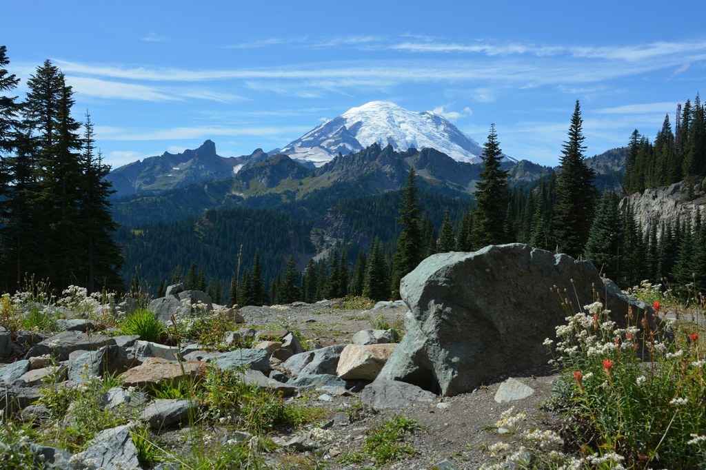
Finally, at 4.7 miles, the trail exits the forest where it connects with the Naches Loop Trail, just across Highway 410 from the south end of Tipsoo Lake. Wander around a nearby pond, or cross the road to walk to the east side of Tipsoo Lake, a favorite location of photographers, for views looking over the lake to Mount Rainier in the west.
Or you can head to the northwest corner of Tipsoo Lake, where the main parking area has picnic tables, garbage cans, and restrooms if you need any of these amenities. If you choose to walk along 410 to get there, it is best to go around to the west side of the retaining wall, where a crude trail keeps you off of the asphalt. The picnic area or the east side of Tipsoo Lake make for a one-way hike of 5.0 miles.
 Trailhead


