

This trail saw infrequent maintenance from the Forest Service, but with the construction of a new bridge in the summer of 2025, the Forest Service has begun maintenance of the trail once again. At its full length, trail #756 once connected to the Pacific Crest Trail. Today, it offers a variety of outings depending on the skills and desires of the hiker.
At its simplest, the East Creek trail is a quick little leg stretcher for those driving along Highway 20 through the North Cascades. From the parking lot, a well-groomed route drops quickly through mature, cool forest to the rushing Granite Creek (East Creek will come later). The location of the former river crossing is obvious but it is impossible to cross here. There is ample space to have kids run around, eat lunch, or just listen to the crashing water.
For those who want more, you need to cross the river. From the old bridge location, continue upstream until you reach a talus field (about 150 yards). A faint trail winds along the bottom of the talus for another 50 yards before dropping into the brush and side channels, which must be crossed. You are aiming for a modified log crossing which has a rope handline (as of September 2021). This crossing is good in the author’s opinion, though extreme caution needs to be exercised as a fall into Granite Creek would not end well. Use your judgement. From the far end of the log there is a faint user trail heading uphill. In less than 100 yards you will intersect the original trail, turn right.
The trail is in remarkably good condition as it gains 1,100 feet, climbing above East Creek. Leveling out after a mile or so, the trail enters mature forest in the bottom of a large valley. After another mile East Creek is reached, this has easy crossing later in the season. Although brushy at times, the trail continues in generally good condition for 2 more miles. After a few small creek crossings a junction with the Boulder Pass Trail is reached. Boulder Pass is a great destination with remote camping and stupendous wildflowers. Please be respectful of private property while passing through this area.
Just past the Boulder Pass turn-off, the Gold Hill Mine is reached. This is a great turnaround point for many. There are numerous mining relics littering the area. Please be respectful and leave what you find here.
From the mining site, the nature of the trail turns decidedly more rough. Parts of the trail have become much easier to follow, and some sections remain difficult. Initially, the old trail drops from the mine site on good tread. Diagonally, the trail trends up the valley but down towards East Creek. Several hundred feet are lost before crossing the creek. The crossing is not well defined, but the trail is easy to pick up on the hillside on the other side. Follow this flagged route for a while, crossing back to the north side of the creek at approximately 5.8 miles from the trailhead. Flagging is present, though the trail may not be obvious.
For the next quarter mile or more, the trail suffers from significant windfall. Flagging is present and actually follows the original trail (despite mapping sources showing the trail remaining on the south side of the creek). There are a lot of downed trees on this trail from start to finish, but this section is the worst. Persevere and you will come out the other end, further up valley, and the tread will return.
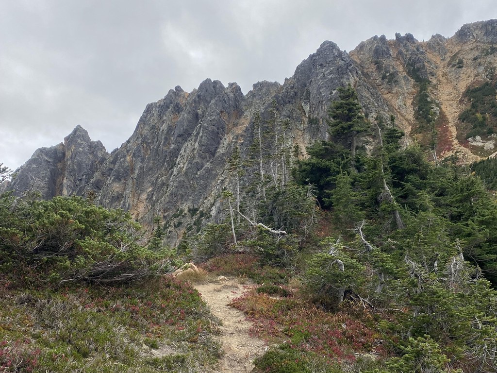
All along this trail, there is ample water, even in late season. While hiking up the valley past the windfall, year-round water is found at 5,000 feet. At 5,200 feet, the trail starts climbing and switch-backing again in earnest. The tread is old and narrow, but generally in great shape. Small meadows full of flowers start appearing and the larch-strewn basin, ringed by rock cliffs, looms above. Twenty-two switchbacks and 1,400 feet of gain bring you to the airy Mebee Pass. The Methow Pinnacles shoot ruggedly up to your right, Golden Horn and Holloway dominate your view straight ahead.
Mebee Pass is not a place to camp. Literally, the pass is only feet wide with scarcely room for a bivy bag in the middle of the trail. The wind howls through this notch. Decent trail winds down the other side into the West Fork of the Methow and the famed Pacific Crest Trail. The author has not taken this length of trail #756, so cannot speak for its condition.
WTA Pro Tip: There is a water source at 6,100 feet just west/below the pass.

 Trailhead


