Trails for everyone, forever

Home Go Hiking Hiking Guide Edgar Rock

Edgar Rock

Mount Rainier Area > Chinook Pass - Hwy 410
46.9198, -121.0560 Map & Directions
Length
3.4 miles, roundtrip
Elevation Gain
1,300 feet
Highest Point
3,675 feet
Calculated Difficulty About Calculated Difficulty
Moderate
Midway viewpoint on Edgar Rock Trail. Photo by Outdoor1. Full-size image
  • Dogs allowed on leash
  • Good for kids
  • Old growth
  • Ridges/passes
  • Summits
  • Wildflowers/Meadows
  • Wildlife

Parking Pass/Entry Fee

None
Saved to My Backpack

Rock spires across the Naches River from Highway 410 catch the eye of travelers from the roadway. For a closer look, consider a hike to the top of Edgar Rock by way of the Lost Creek Trail. This route proves popular early in the season as well as late in the year. The hike is not very long and features good views at the top. Continue reading

Rating
3.42 out of 5

(12 votes) Log in to rate

Hiking Edgar Rock

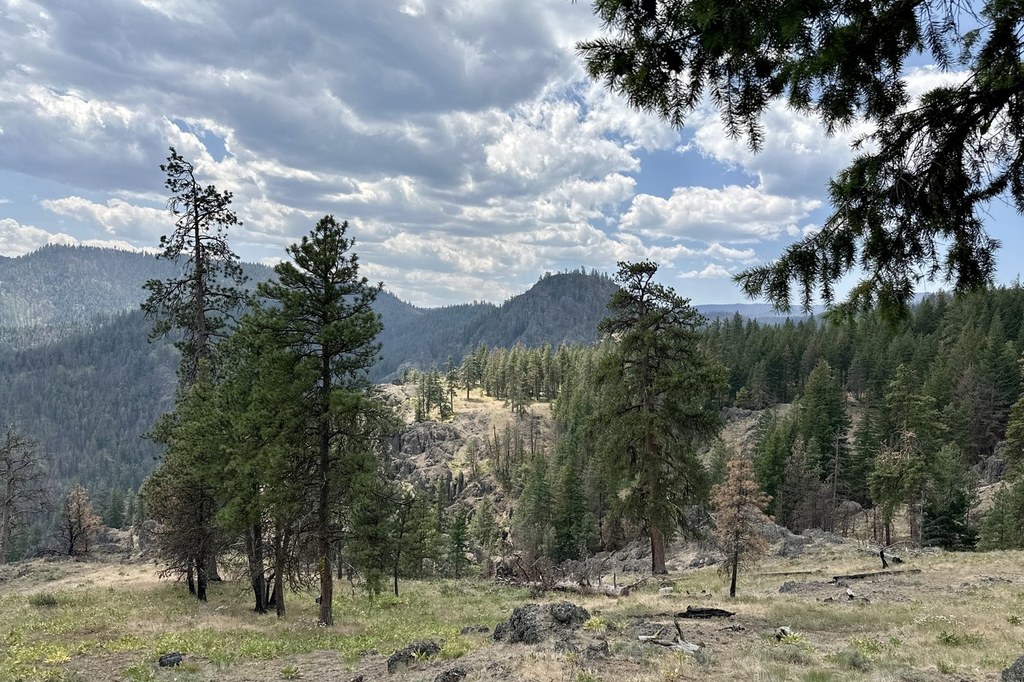
Edgar Rock has served as a prominent landmark over the years. From the highway view it appears suitable terrain for mountain climbers only. But a trail winds up from the back side, avoiding the precipitous rock formations.

This is a great place for an early season hike as the snow recedes towards the higher elevations of the Cascades. Start out beside Lost Creek, then a scant 100 yards from the trailhead, go right and begin ascending a series of switchbacks toward Edgar Rock. Hike at first through open, eastern Washington forests of Ponderosa pines scenting the air. Then wildflowers begin to take over; you'll see a variety of colors with yellow dominating the landscape as you switchback skyward.

Despite suffering fire damage in the 2021 Schneider Springs fire, this is still a very pleasant hike. The grade feels very consistent, averaging about 15%.

Climbing ever higher, there is an unsigned junction just short of the top where the trail switches to Edgar Rock trail (up to now, it's been the Lost Creek Trail). At 1.7 miles from the trailhead, the rocky summit is attained with views up and down the Naches Valley. There is also a small natural rock arch just off the summit. Enjoy the views in all directions before heading back down the way you came.

Edgar Rock is the usual destination, but if you are enjoying wandering through the open terrain, the Lost Creek Trail continues another 1-2 miles beyond the spur trail to Edgar Rock.

WTA Pro Tip: There is no water on this hike, so be sure to bring enough water with you. Also, this hike can be beastly hot in mid-summer. Consider visiting in the shoulder season, or hiking early.

Toilet Information

  • No toilet at trailhead

More information about toilets

WTA worked here in 2024, 2022, 2018 and 2016!

Edgar Rock

Map & Directions

Trailhead
Co-ordinates: 46.9198, -121.0560 Open in Google Maps

Before You Go

See weather forecast

Parking Pass/Entry Fee

None

WTA Pro Tip: Save a copy of our directions before you leave! App-based driving directions aren't always accurate and data connections may be unreliable as you drive to the trailhead.

Getting There

From Cayuse Pass (the junction of State Routes 410 and 123; closed winters), travel  east on SR410 32.5 miles. When you reach the hamlet of Cliffdell, you have about 2.5 to go to your turnoff. Start watching for the green mileposts. At 0.2 mile past milepost 98, turn right on Old River Road, following a sign toward “Lost Creek Village”.

From Naches, travel west on Highway 12 for 4.4 miles. Continue straight onto Highway 410 west for 18.1 miles. At 0.8 mile beyond milepost 99, turn left onto Old River Road, following a sign toward “Lost Creek Village”.

After turning onto Old River Road, bypass Jefferson Road. Stay right on Old River Road, traveling 1 mile. Go left, again following a sign to Lost Creek Village. Drive another 0.7 mile of narrow road, to where is a low spot in the road, a wide shoulder on the left, and a visible trail on the right. A green sign reading “964” marks the trailhead. Park on the shoulder here (room for two vehicles) or the nearest shoulder parking you can find. If you see a large sign for Lost Creek Village, you are a quarter mile past the trailhead.

More Hike Details

Trailhead

Mount Rainier Area > Chinook Pass - Hwy 410

Lost Creek (#964), Edgar Rock (#964A)

Okanogan-Wenatchee National Forest, Naches Ranger District

Guidebooks & Maps

Trailblazer Guide to 75 Hikes in Central Washington by Ron Graham (1995)

Green Trails No. 272 Old Scab Mtn

Buy the Green Old Scab Mtn No. 272 map

You can improve or add to this guidebook entry!

Edgar Rock

50 Trip Reports

Hiked here recently?

Submit a trip report!
 
Loading trip reports...
Trip Reports