
Climb steeply out of the Elwha River Valley to impressive views of the Bailey Range and wide-open meadows on this trail that accesses Hurricane Hill the back way.
Start at the Madison Falls trailhead, the last accessible trailhead before the road washout closure. The first 2 miles of the trail is relatively flat and wide, save for the section of trail you'll hike to get around the washout. After that, you'll start your climb.
The tread is narrow and quite steep -- you're climbing about a thousand feet per mile, after all, but luckily, it stays in relatively good condition for its entire length when it is snow-free.
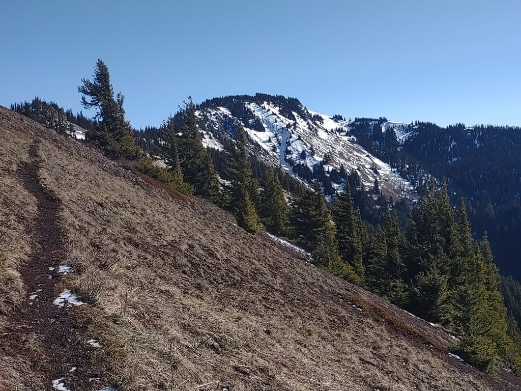
Switchbacking tightly through close forest for two miles, the trail opens up into expansive meadows where wildflowers and peek-a-boo views of the Bailey Range off to your right encourage you to climb higher.
Mounting up the final shoulder of Hurricane Hill, you may see some people meandering in the meadows. The Elwha to Hurricane Hill trail links up with the Hurricane Hill Nature Trail in this wide meadow.
Your final push is up a couple of long switchbacks to the hill's summit, where views spread below you in every direction. To the north lies the city of Port Angeles and the Strait of Juan de Fuca, with a view all the way to Vancouver Island. South, the Bailey Range's snowy peaks line the horizon. To the west are the forested hills and folds of the Elwha River Valley, and east is Klahhane Ridge and Mount Angeles.
WTA Pro Tip: Bring trekking poles for this hike. Whether you're heading up or downhill, the grade of the Elwha to Hurricane Hill trail is steep enough that trekking poles are a must. Your knees will thank you.
Elwha To Hurricane Hill

-
 Length
- 18.5 miles, roundtrip
-
 Elevation Gain
- 7,100 feet
-
 Highest Point
- 5,650 feet
Climb steeply out of the Elwha River Valley to impressive views of the Bailey Range and wide-open meadows on this trail that accesses Hurricane Hill the back way.
Continue reading
Hiking Elwha To Hurricane Hill

WTA worked here in 2021!
Map & Directions
 Trailhead
Before You Go
Road closed: The Olympic Hot Springs Road is inaccessible to vehicles due to a washout. Data for this route reflect a hike starting at the Madison Falls trailhead which is the last accessible trailhead before the washout.
Parking Pass/Entry Fee
National Park PassWTA Pro Tip: Save a copy of our directions before you leave! App-based driving directions aren't always accurate and data connections may be unreliable as you drive to the trailhead.
Getting There
Headed west on Highway 101 from Port Angeles, drive 8.5 miles and turn left onto Olympic Hot Springs Road (just before the bridge over the Elwha River). Continue down Olympic Hot Springs Road, until you reach the park entrance gate. Buy a pass, (or flash one if you already have one) and park at the Madison Falls trailhead.
Note: This is currently — and will indefinitely be — as far as a vehicle can go on Olympic Hot Springs Road due to flood damage.


