Trails for everyone, forever

Home Go Hiking Hiking Guide Greenbrier Trail
WTA is a nonprofit that needs you

We're just as excited as you to get the summer hiking season started. We're psyched our website, app and work for trails help you get outside.

But we're a nonprofit that runs on donations from regular people. If everyone who visited this site this holiday weekend donated $9/month, it would fully fund our work for the next 2 years. Time spent outdoors is priceless, but every donation large or small helps us support those experiences for everyone. Thank you and happy hiking!


Please take 2 minS to chip in $9

link

Greenbrier Trail

Puget Sound and Islands > Seattle-Tacoma Area
47.7646, -122.1477 Map & Directions
Length
1.9 miles, roundtrip
Elevation Gain
105 feet
Highest Point
236 feet
Calculated Difficulty About Calculated Difficulty
Easy
The turnpiked section of trail at Greenbrier wends through quiet woods. Photo by Micki K. Full-size image
  • Dogs allowed on leash
  • Good for kids

Parking Pass/Entry Fee

None
Saved to My Backpack

Come visit this WTA-built trail, a nearly 2-mile hike through palustrine forest and wetlands, mostly flat with some rolling hills. Great for walkers, kids, and dogs. Continue reading

Rating
3.00 out of 5

(2 votes) Log in to rate

Hiking Greenbrier Trail

Try this less than 2-mile hike, built by WTA crews, through palustrine (inland, non-tidal) wetland. It's a great outing for kids and dogs, as well as walking folks of all abilities, due to its soft surface and gently rolling hills.

The trail wends through an area where logging was once practiced; a number of artifacts have been incorporated into the trail, including an old steam donkey (steam-powered winch used to haul logs from where trees were felled to a central processing area). There is a huge old Western Red Cedar with a girth of six people extending arms around.

In the spring, the wetlands are full of Pacific Dogwood and Skunk cabbage in bloom. In autumn, the area is rich in the yellow and gold of bigleaf maples, vine maples, alder, and cottonwood. All year-round there are a variety of birds to be seen and heard – woodpeckers, flickers, chickadees, Stellar Jays, owls, etc.

The Greenbrier Trail within the Woodinville City limits is bordered by the Greenbrier residential community to the west and Woodinville-Duvall Road to the east. The parcel is designated as a native growth protection area and contains palustrine forest or emergent wetlands.

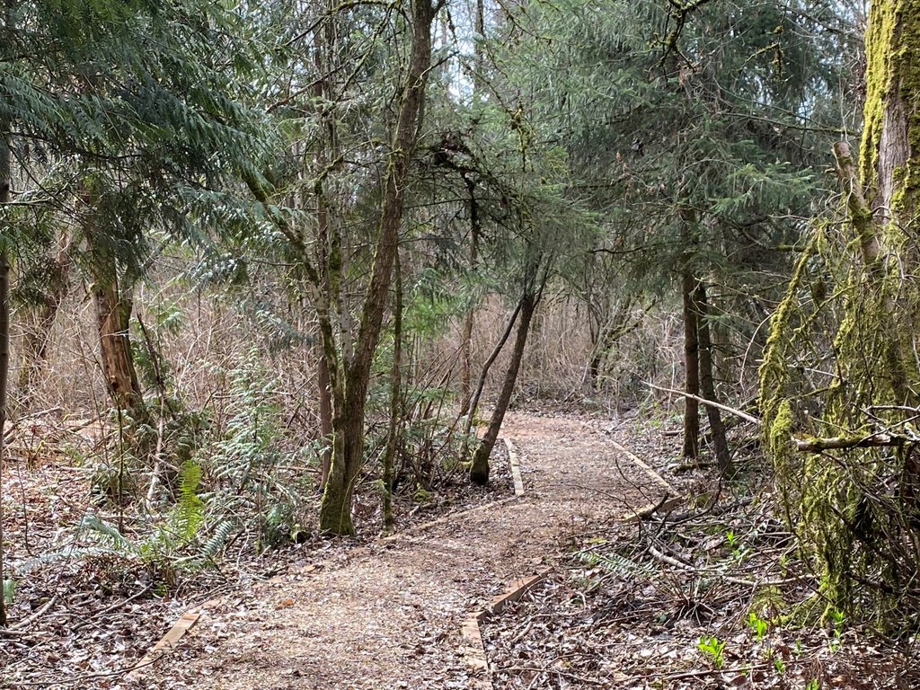
The forest wetland floor is saturated, mucky soil – trails through this area are raised turnpike, filled with mulch as well as several puncheon bridges. Trails in the upland forest are mineral soil with some gravel base. The forested sections of the trail are rich with Douglas fir, Western red cedar, and sword ferns. The shrub/scrub wetland area is covered by dense shrubbery such as vine maple, dogwood, or salmonberry, (as well as invasive holly and Japanese Knotweed).


Toilet Information

  • No toilet at trailhead

More information about toilets

Wheelchair Accessibility

Wheelchair access would be difficult due to mulch-filled turnpike areas that can become soggy and chairs will sink into. Where there are not turnpikes, the trail has some areas of root growth across, or is steep in elevation. The far end of the trail has old, raised wood puncheon (not installed by WTA) which would pose an obstruction to a wheel chair.

Hike Description Written by
Micki Kedzierski, WTA Correspondent

Greenbrier Trail

Map & Directions

Trailhead
Co-ordinates: 47.7646, -122.1477 Open in Google Maps

Before You Go

See weather forecast

Parking Pass/Entry Fee

None

WTA Pro Tip: Save a copy of our directions before you leave! App-based driving directions aren't always accurate and data connections may be unreliable as you drive to the trailhead.

Getting There

From Seattle

Take I-90 or WA-520 to I-405 North toward Everett. Take Exit 23 for WA-522 toward Bothell/Woodinville. In one mile, keep right at the fork and merge onto WA-522 East. Go about 1.7 miles and take the NE 195th Street exit toward Duvall. Turn right onto NE 195th Street. This becomes NE North Woodinville Way. In about 0.4 miles, turn left at the light onto 144th Avenue NE and park on 144th Avenue NE at the Intersection with NE North Woodinville Way, across from the “Shake N-Go”. After parking, walk across NE North Woodinville Way at the light. The Greenbrier Trailhead is on the left about 100 feet down 144th Avenue NE.

From Everett and North

Take I-5 South to Exit 182 for I-405 South toward Bellevue/Renton. In about 7 miles, take Exit 23A for WA-522 East toward US-2/Woodinville. Continue about 0.3 miles, keeping left at the fork to continue onto WA-522 East. Go about 1.7 miles and take the NE 195th Street exit toward Duvall. Turn right onto NE 195th Street. This becomes NE North Woodinville Way. In about 0.4 miles, turn left at the light onto 144th Avenue NE and park on 144th Avenue NE at the Intersection with NE North Woodinville Way, across from the “Shake N-Go”. After parking, walk across NE North Woodinville Way at the light. The Greenbrier Trailhead is on the left about 100 feet down 144th Avenue NE.

More Hike Details

Trailhead

Puget Sound and Islands > Seattle-Tacoma Area

City of Woodinville

You can improve or add to this guidebook entry!

Greenbrier Trail

3 Trip Reports

Hiked here recently?

Submit a trip report!
 
Trip Reports