

The trailhead for Griff Creek is behind the Elwha River washout, meaning hikers must do a short road walk to access this steep but quiet trail.
Since the Olympic Hot Springs road washed out and was closed in 2018, hikers must do a 2 mile road walk from the Madison Falls trailhead to get to the former trailhead for Griff Creek. But once this low-key warmup is over, Griff Creek trail treats you to about 1000 feet per mile of elevation gain. Whew.
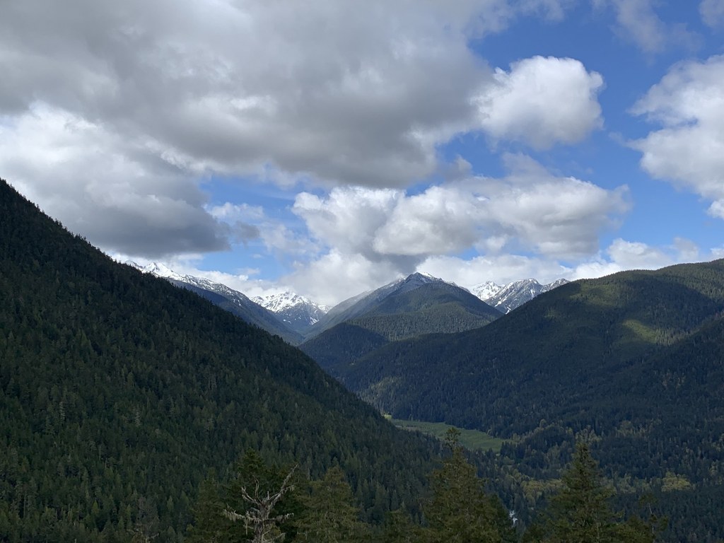
Luckily, for the first mile of trail, you hike under a canopy of both deciduous and evergreen trees, and the trail is lined with ferns and mosses, even wildflowers in the right season! About a mile and a half from the former trailhead, hikers arrive at a large rock where you might find a peek of Griff Peak -- but just around the corner is a better viewpoint where you can see views up the Elwha River valley toward former Lake Mills and the Olympic Mountains in the distance including Mounts Carrie and Fairchild.
You've only got another half mile to the next viewpoint, but it's steep. Once you've arrived, you'll enjoy the same views as below but more expansive. Consider stopping here for lunch or a snack or just making it the end of your hike. The official end of the trail is another 0.8 miles from where you are, with similar views that you've see from the other two viewpoints, and reporters have noted that the last section of the trail is considerably more challenging than the first parts.
But, from the very top, you get views of the backside of Hurricane Hill, Griff Peak and one of the Unicorns!

 Trailhead


