

From the lower trailhead, start off hiking on a wide path through tall trees and mosses, accompanied by twittering, flitting songbirds. Most of the elevation gain is in the first mile, until you come to a junction with another trail. This one comes in from the campground at the end of the road you drove in on. This route adds about 0.2 mile to your hike, a good option for anyone wanting the views of the falls with less of the elevation gain.
After the junction, the trail flattens out and traverses through more forest, passing small creeks and cascades that provide excellent photography opportunities. At about a mile and a half, hikers will hear Hardy and Rodney Falls, but two bridge crossings over smaller cascades come first. Take time to see how high up these little waterfalls go — you will be surprised and impressed.
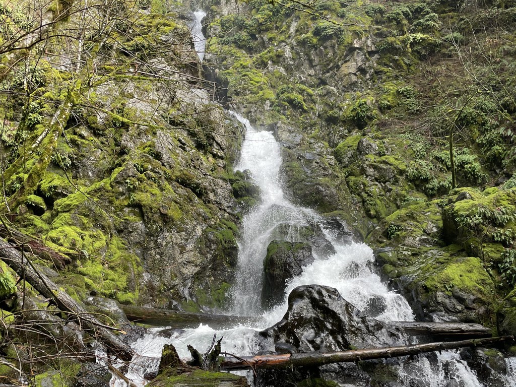
Rounding the corner, you'll encounter a junction heading down to an overlook of Hardy Falls. There are two viewing platforms, both offering gorgeous views of the mighty falls. Be careful on the trail on the way down — when it is wet, the mud can be slippery. These are likely picnic areas, if you don't mind sitting down on the platform, though there is one small bench available as well.
After soaking in the view of Hardy Falls, head back up to the original trail. Cross a bridge built by DNR work crews, and continue just a few yards up the trail to Rodney Falls. Here, the trail splits. Head down and to the right to continue across a wide bridge at the base of thundering Rodney Falls. This is the Hamilton Mountain trail, which heads up to a loop around the summit crown of the mountain.
If you don't have the time, energy or desire to continue, the trail up and to the left brings you to the Pool of the Winds in just a few hundred feet. This spur trail ends on the rock just adjacent to the first tier of Rodney Falls, where hikers can bask in the spray from the falls and peer into the splash pool, all behind the safety of a handrail.
In particularly high water, it may be impossible to get all the way to the Pool of Winds viewpoint, but this is a great diversion for hikers of all ages and provides an excellent reward and rest stop before turning around and heading back down the trail.
WTA Pro Tip: A CCC-built shelter is available on a first-come, first-served basis with four outlets, overhead light, two wood stoves and three picnic tables; perfect for a birthday party or reunion!

 Trailhead


