
In an area known for rhododendrons and stunning mountain views, find a relatively easy hike to a high ridgeline that used to house a fire lookout tower.
Hike through second-growth forest of Douglas-fir, wandering in and out of trees along the edge of an old logging show, now filled with rhododendrons (Washington's state flower) and bear grass. Half a mile in, cross Forest Road 2421, and look to your right, up the road about 100 feet for the continuation of the trail. From there, begin to climb steeply up the hillside before reaching Jefferson Ridge.
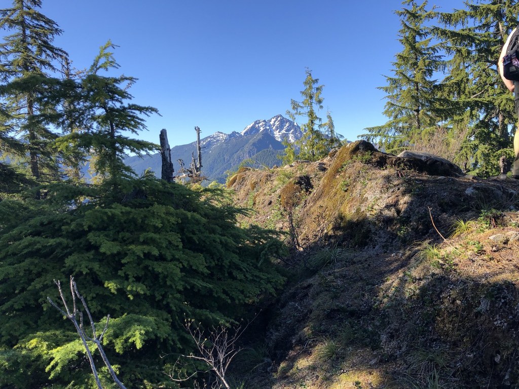
From here, you have views into the Hamma Hamma River drainage, lush with trees and the Hamma Hamma sparkling below. Continue along the ridgeline before reaching the site of the historic Johnson Ridge fire lookout. From here, you'll enjoy views of Mounts Washington and Pershing, Cruiser, Skokomish, and Mount Stone.
The Brothers and Lena are also visible, and between the two, Mount Deception and Mount Mystery are just visible.
WTA Pro Tip: Pick up a free map of this area from the Quilcene Ranger Station.
Jefferson Ridge

-
 Length
- 4.8 miles, roundtrip
-
 Elevation Gain
- 1,832 feet
-
 Highest Point
- 3,832 feet
7.30.25: This trail is closed until further notice due to the Hamma Fire.
In an area known for rhododendrons and stunning mountain views, find a relatively easy hike to a high ridgeline that used to house a fire lookout tower.
Continue reading
Hiking Jefferson Ridge
Map & Directions
 Trailhead
Before You Go
7.30.25: This trail is closed until further notice due to the Hamma Fire.
Parking Pass/Entry Fee
NoneWTA Pro Tip: Save a copy of our directions before you leave! App-based driving directions aren't always accurate and data connections may be unreliable as you drive to the trailhead.
Getting There
14 miles north of Hoodsport, on the west side of the Hood Canal. Turn onto Forest Service Road 25 (Hamma Hamma Road). Proceed 6.5 miles onto this road and take a left across a bridge to Forest Service Road 2480. Drive 0.2 miles and turn right on Forest Service Road 2421. Drive 3.1 miles to a fairly obscure trailhead sign on the right side.
Park on the side of the wide road here.


