Trails for everyone, forever

Home Go Hiking Hiking Guide Kalaloch - Browns Point
link

Kalaloch - Browns Point

Olympic Peninsula > Pacific Coast
47.6129, -124.3762 Map & Directions
Length
4.0 miles, roundtrip
Elevation Gain
25 feet
Highest Point
25 feet
Calculated Difficulty About Calculated Difficulty
Easy
  • Dogs allowed on leash
  • Good for kids
  • Coast

Parking Pass/Entry Fee

None

Wild and mercurial, the Olympic Coast has a special appeal in the spring and fall. Grassy bluffs, cliffside caves and tidal pools are all to be found along this four-mile beach hike near the Kalaloch Campground. So shrug on your rain gear and enjoy the bird watching, sense of solitude and stunning seascapes. Continue reading

Rating
4.00 out of 5

(10 votes) Log in to rate

Hiking Kalaloch - Browns Point

One of the best ways to get immediately up close and personal with the dramatic west coast of the Olympic Peninsula is by visiting Kalaloch. The beaches here: 1,2, 3, and 4 all offer a front row seat to the pounding surf and wild waves of the Pacific Ocean. Plus, it only takes a few steps from your car to enjoy most of them.

The main Kalaloch access point is from the campground just north of Kalaloch Lodge on Highway 101. Turn left into the day use parking area and find a spot. From your car, head to the driftwood fence lining the sidewalk, and descend a short asphalt path to a set of large stairs that descend to the beach.

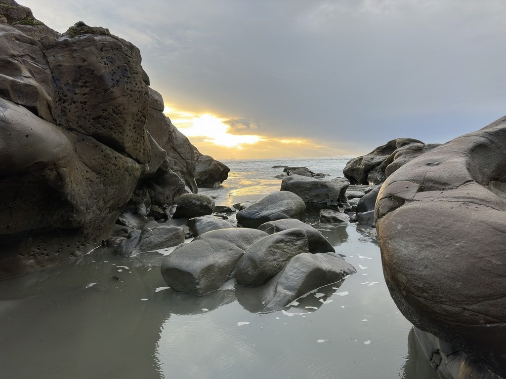
The stairs are large and crumbly, filled with beach gravel and slumping in places. But it’s just a hop and skip down them to get onto the pebbled beach. At high tide, this beach isn’t for the faint of heart (or really anyone at all), since the sea comes right up to the staircase, but at low tide, you’ve got plenty of coastline to wander. Just keep an eye on the tide.

Any crowds that may be at Kalaloch disperse along the shoreline. Many visitors here embark to Browns Point, a location just a bit north of Beach 4 that passes bluffs high overhead, giving a feeling of isolation to the area. Explore as far north as you can get, but avoid rounding the headlands to the north since the tide can catch you here.

Once you’ve had your fill of the beach, head back the way you came. If there’s time, it’s worth checking out the 0.8 mile Kalaloch Nature Trail. Improved annually by WTA volunteers, it’s a charming walk through the massive old growth forest, where skunk cabbages glow at the base of trees hundreds of years old.

WTA Pro Tip: You can also visit Beaches 1, 2, 3 and 4, nearby, or head three miles north on Highway 101 to another WTA-maintained loaction, the Big Cedar Tree trail. 

WTA worked here in 2020, 2019, 2018 and 2017!

Hike Description Written by
Anna Roth, WTA Staff

Kalaloch - Browns Point

Map & Directions

Trailhead
Co-ordinates: 47.6129, -124.3762 Open in Google Maps

Before You Go

See weather forecast

Parking Pass/Entry Fee

None

WTA Pro Tip: Save a copy of our directions before you leave! App-based driving directions aren't always accurate and data connections may be unreliable as you drive to the trailhead.

Getting There

From Hoquiam follow US 101 north for 70 miles to Kalaloch. From Forks travel, 34 miles south on US 101. The parking area for Kalaloch Beach is just north of Kalaloch Lodge.

More Hike Details

Trailhead

Olympic Peninsula > Pacific Coast

Olympic National Park

Guidebooks & Maps

Day Hiking: Olympic Peninsula (Romano - Mountaineers Books)

Day Hiking: Olympic Peninsula ed. 2 (Romano - Mountaineers Books)

Green Trails La Push No. 163S

Custom Correct South Olympic Coast

You can improve or add to this guidebook entry

Kalaloch - Browns Point

62 Trip Reports

Hiked here recently?

Submit a trip report!
 
Trip Reports