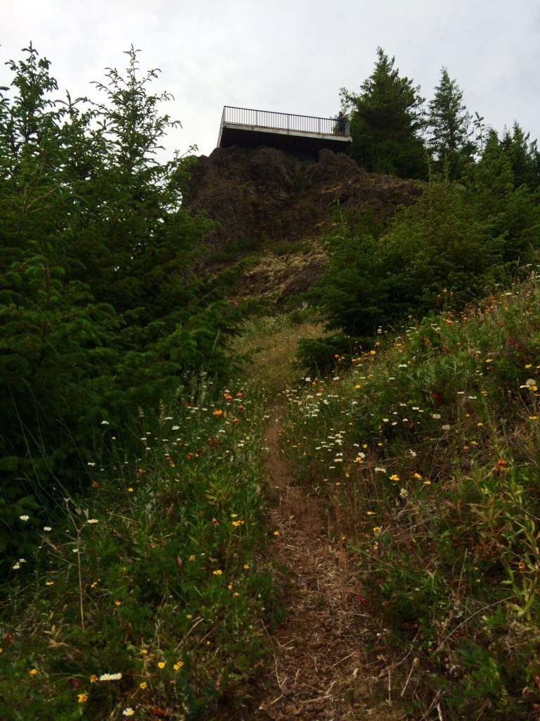

Once the site of a historic lookout, this craggy, ridgetop perch serves up excellent views of Lake Crescent, Mount Olympus and the Sol Duc River Valley.
Start by following an abandoned section of Highway 101 that parallels the Sol Duc River. Several access points allow close-up views of the river. In fall, the many vine maples lining the path put on a colorful show. At 0.2 mile, take the signed trail toward Kloshe Nanitch. Cross a bridge at 0.5 mile, and start the ascent of Snider Ridge by way of switchbacks.
Continue through dense second-growth Douglas-fir and an understory of greenery, including salal, ferns, mosses and liverworts. The trail crosses several drainages while steadily climbing 1,700 feet in about 2 miles. Briefly, the grade eases and travels through a stand of hemlocks before climbing a series of tight switchbacks to a small ledge.
At 3 miles, the trail passes beneath cliffs and arrives at a junction; the right fork continues along Snider Ridge for 3 miles where it connects with the Mount Muller Loop. Follow the left fork, through a meadow beneath the site of the historic lookout. Arrive at the viewpoint after a final steep climb.
Kloshe Nanitch—Chinook jargon for “take care” or “look out”—served as the site of a fire watch for many years. Originally built in 1917, the lookout was abandoned and destroyed in 1963. A replica of the historic building was built in 1996, only to be removed once again in October 2012. On clear days, views extend beyond the surrounding peaks, all the way to the Pacific Ocean and James Island.
Kloshe Nanitch

-
 Length
- 6.4 miles, roundtrip
-
 Elevation Gain
- 2,200 feet
-
 Highest Point
- 3,160 feet
Hike to a former fire lookout site on the Olympic Peninsula. Fires are now patrolled by aircraft here, but the beautiful, rugged surroundings can still be reviewed by hikers from the lookout with a name that draws on a Chinook phrase that translates to "take care".
Continue reading
Parking Pass/Entry Fee
Northwest Forest PassHiking Kloshe Nanitch

WTA worked here in 2022 and 2016!
Map & Directions
 Trailhead
Before You Go
Parking Pass/Entry Fee
Northwest Forest PassWTA Pro Tip: Save a copy of our directions before you leave! App-based driving directions aren't always accurate and data connections may be unreliable as you drive to the trailhead.
Getting There
From Port Angeles follow US 101 west for 37 miles to the Klohowya Campground. Proceed west, turning right on West Snider Road. In about half a mile come to the Forest Service work center and continue straight on the paved road. In another half mile the road ends at the trailhead (unsigned as of 2006).


