Trails for everyone, forever

Home Go Hiking Hiking Guide Lake Wilderness Park

Alert: On Oct. 1 the federal government began a partial shutdown that will impact National Parks, National Wildlife Refuges and U.S. Forest Service lands in Washington. Here's the latest information we have for hikers and campers


Lake Wilderness Park

Puget Sound and Islands > Seattle-Tacoma Area
47.3792, -122.0414 Map & Directions
Length
3.5 miles of trails
Elevation Gain
50 feet
Highest Point
580 feet
The flat trails at Lake Wilderness Park are largely wheelchair-friendly. Photo by trip reporter Mary&Mollie. Full-size image
  • Dogs allowed on leash
  • Fall foliage
  • Good for kids
  • Wildlife

Parking Pass/Entry Fee

None
Saved to My Backpack

A great quick neighborhood escape, or stay longer and there is something for everyone. A cultivated arboretum with additional trails in a small forest, with playground, disc golf course, a lake with swimming, fishing, boat rentals, and more. Continue reading

Rating
2.00 out of 5

Hiking Lake Wilderness Park

Lake Wilderness Arboretum is an approximately 42-acre tract with about half the space as a cultivated arboretum, and the other half as a "wild" nature preserve. There are about 3.5 miles of trails in total. The Green to Cedar River Trail divides the two sections of the arboretum. Adjacent to the arboretum is Lake Wilderness Park, which includes many amenities, including a playground, disc golf course, picnic areas and tennis/pickleball courts. Open seasonally, the lake also has a swimming area with canoe and kayak rentals. The lake is also stocked with fish. 

The cultivated arboretum has a large number of paths crisscrossing it, but near the parking lots is an information booth with signs and brochure maps. A lack of significant underbrush helps make navigation reasonable. Among the paths to explore include a 0.5-mile outer loop, a children's story walk and a path known as the Tribal Life Trail. Like most arboretums, there are placards identifying the trees and plants throughout, and on the Tribal Life Trail, the placards identify how various native plants were used by local Native American tribes as food, medicine, clothing and other parts of life. 

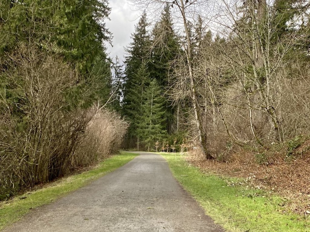
Along the north edge of the cultivated section, there are 3 accesses to the Green to Cedar River Trail. That trail is an old railroad grade and maybe 10 feet higher than the surrounding ground. The arboretum property continues beyond the trail as a nature preserve, and trails can be accessed from several locations. There are a number of well-traveled trails crisscrossing here as well. However, there are no signs, and large amounts of underbrush means that it is easy to get turned around with what trails go where. None are especially long, but if you are trying to finish your hike on a timeline, using a mapping app on your phone would be helpful. On the other hand, if you are looking to get a taste of being out in the woods without going far from home, this can satisfy your need for a quick nature fix.

Toilet Information

  • Toilet at trailhead
  • Accessible toilet

More information about toilets

Wheelchair Accessibility

Parking

A couple of accessible spots, including van-accessible in the parking lot for the arboretum. A few more near the lodge, and other lots around the park. Parking lots are paved.

Restroom

ADA-style porta-potty located near the arboretum information booth.

Trail Surface

The trails through the cultivated part of the arboretum are mostly hard-packed gravel and dirt. They are predominantly flat with no cross-slope and should be accessible to nearly all wheelchair users.

Access to the Green to Cedar River Trail is more difficult. All of the accesses are much steeper than ADA standards, and most manual chair users will require assistance. The middle access is the most gentle slope, but has stairs. There is a path next to the stairs but it has some cross slope and is a little narrow. The western-most access is a straight shot, but slightly steeper than the middle access. The eastern-most access is angled and has a significant cross-slope, and is not recommended for wheelchair users.

The trails on the far side are for the most part inaccessible for wheelchair users. Three of the 4 accesses to the trails have wooden stairs. The one remaining access, marked on some maps as “service road”, along the eastern edge does not have stairs, but is steep and has a significant cross slope. The trails themselves are dirt, narrow, have significant numbers of large roots crossing them and are likely muddy in the winter months.

Hike Description Written by
Z. K., WTA Correspondent

Lake Wilderness Park

Map & Directions

Trailhead
Co-ordinates: 47.3792, -122.0414 Open in Google Maps

Before You Go

See weather forecast

Parking Pass/Entry Fee

None

WTA Pro Tip: Save a copy of our directions before you leave! App-based driving directions aren't always accurate and data connections may be unreliable as you drive to the trailhead.

Getting There

From Renton, take the Renton-Maple Valley Highway (WA-169). Alternatively, from WA-18 take the SE 231st St exit towards Maple Valley / WA-169 South. Turn right on Witte Rd. After 0.8 miles, go 3/4 of the way around the roundabout, and proceed east on SE 244th St. At 0.3 miles, SE 244th St takes a hard right. Proceed straight to enter the park, and park in lots on either side of the road. 

More Hike Details

Trailhead

Puget Sound and Islands > Seattle-Tacoma Area

City of Maple Valley

Guidebooks & Maps

https://www.lakewildernessarboretum.org/wp-content/uploads/2023/09/Arboretum_ParksRecMap_July2023.png

https://www.tentrails.com/wp-content/uploads/2019/03/2013_lwaf_visitorsmap.jpg

You can improve or add to this guidebook entry!

Lake Wilderness Park

9 Trip Reports

Hiked here recently?

Submit a trip report!
 
Trip Reports