
Begin your short hike just past a side road that comes off Capitol Peak Road to the left. An unmarked trail crosses the main road just after the side road. Go down the trail on the left of the road, heading downhill, to get to Mount Molly; the right side, heading uphill, goes to Capitol Peak.
Follow this trail along the road for a short time in fairly open territory. Sword ferns and scrubby brush covers the ground nearby, and tall conifers rise up a little distance from the trail. After a short distance, the trail crosses the road again and heads into deeper forest. As the light is partially blocked out by surrounding trees, the trail transforms into a ruddy colored clay chute. Dense sword ferns line the trail, and views of the surrounding hills can be seen through the trees.
Continue up at a slow but steady uphill grade until you reach another road. Cross the road to find the trail coming to a three way intersection. Take either the middle or right-hand trail--they connect a little further down.
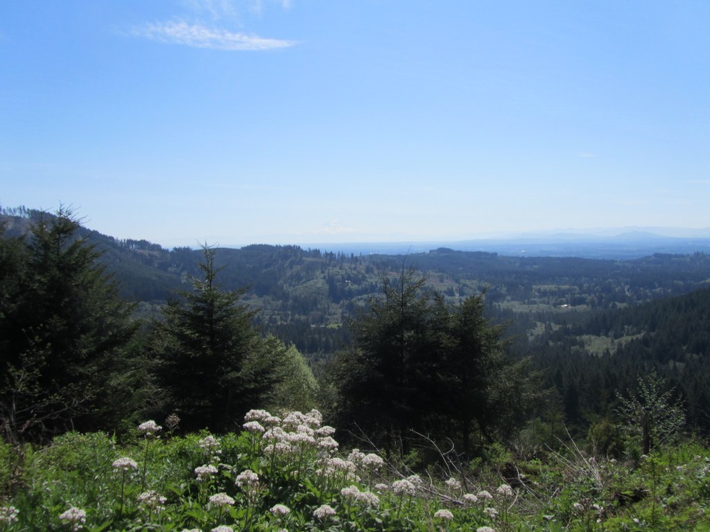
On a clear day Mount Rainier looms huge above the path, and young conifers frame the view. Don't get so carried away with the view that you miss the turnoff to the peak, though. The trail to the top is just a tiny turnoff to the left which is easy to miss coming from this direction. The trail takes a sharp turn in the opposite direction of the main trail, and it's very steep.
From here, switchback upward just a little farther to reach the top of this miniature mountain and get views of surrounding hills, the Cascades, and Mount Rainier. If you're lucky, you may see a soaring bald eagle or ruby-crowned kinglets and spotted towhees in the brush. If you do miss the turnoff, you'll continue down the other side of the mountain along the Waddle Creek Basin trail, so if you're heading downhill for any considerable length of time, you'll know to turn back and find the trail to the peak.
WTA Pro Tip: Stop to admire the views facing Mount Rainier before you continue on to the top of the mountain and around to the other side to follow the loop trail back to the main trail. There's no lookout spot, so the best views are along the trail when you're almost, but not quite, to the top.
Capitol State Forest - Mount Molly

-
 Length
- 3.0 miles, roundtrip
-
 Elevation Gain
- 908 feet
-
 Highest Point
- 1,950 feet
Explore one of the many trails in Capitol State Forest as an out-and-back, or combined with another trail in the area.
Continue reading
Hiking Capitol State Forest - Mount Molly
Capitol State Forest - Mount Molly
Map & Directions
 Trailhead
Before You Go
Parking Pass/Entry Fee
Discover PassWTA Pro Tip: Save a copy of our directions before you leave! App-based driving directions aren't always accurate and data connections may be unreliable as you drive to the trailhead.
Getting There
To reach the trailhead, drive Highway 12 west to Porter Creek Road, which goes right through the small town of Porter. Red's Hop N'Market which also serves as the post office is located near the right turn onto Porter Creek Road. The trailhead is across the road from Porter Creek Campground which is about 4.5 miles from Highway 12.


