
To start this hike, first register at the visitor's center then backtrack down the road a bit to a hairpin turn in the road where there is a pull off spot to park on the left side of the road.
Do not start this snowshoe trip at the beginning of the actual road where it is too steep and dangerous to get down to the road bed. Instead start from the parking area described above and cross the road, then hike a few hundred feet up the road.
Keep in mind that it might be tricky to get up the embankment from the road. Once on the embankment, go straight down the steep hill a few hundred feet to the Obstruction Point Road. Again, use caution here, the hill can be quite steep.
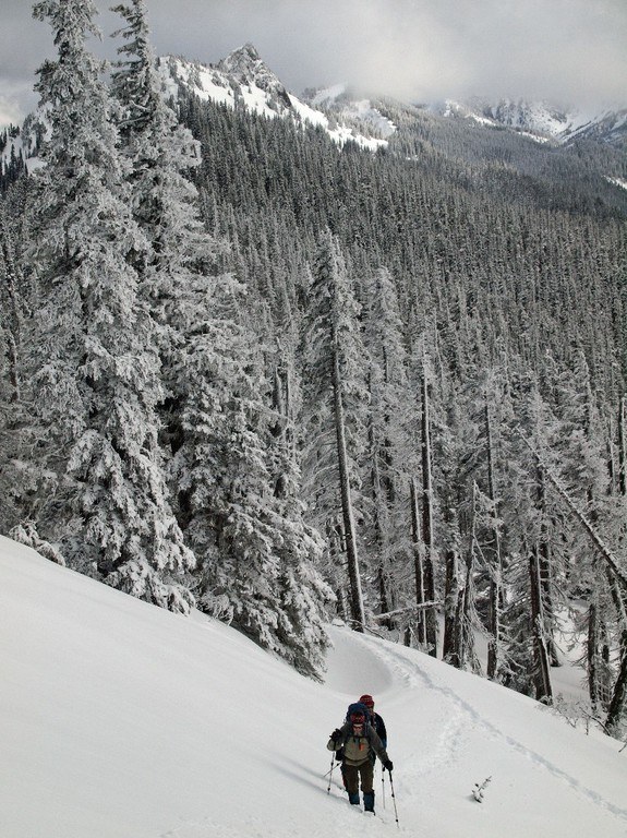
The hike along the road is mostly flat with a little ups and downs, until you come upon Steeple Rock, where avalanche risk is not unheard of. Check with the visitor's center before you start the hike to ensure that it's safe to hike the road.
The road to Steeple Rock is uphill, narrow and very windy.
WTA Pro Tip: During high traffic periods like holiday breaks or New Years, call ahead and ask about wait times. Parking is limited due to snow coverage (not all lots remain open) and there can be 1-3 hour wait at times.
Obstruction Point Road Snowshoe

-
 Length
- 3.4 miles, roundtrip
-
 Elevation Gain
- 100 feet
-
 Highest Point
- 5,100 feet
Skip the crowds of skiers and snowshoers at Hurricane Ridge and try a challenging hike on Obstruction Point Road.
Continue reading
Parking Pass/Entry Fee
National Park PassHiking Obstruction Point Road Snowshoe
Obstruction Point Road Snowshoe
Map & Directions
 Trailhead
Before You Go
Parking Pass/Entry Fee
National Park PassWTA Pro Tip: Save a copy of our directions before you leave! App-based driving directions aren't always accurate and data connections may be unreliable as you drive to the trailhead.


