Trails for everyone, forever

Home Go Hiking Hiking Guide Pacific Crest Trail (PCT) Section L - Rainy Pass to Manning Park

Alert: On Oct. 1 the federal government began a partial shutdown that will impact National Parks, National Wildlife Refuges and U.S. Forest Service lands in Washington. Here's the latest information we have for hikers and campers


Pacific Crest Trail (PCT) Section L - Rainy Pass to Manning Park

North Cascades > North Cascades Highway - Hwy 20
48.5181, -120.7331 Map & Directions
Length
60.2 miles, one-way
Elevation Gain
15,300 feet
Highest Point
7,100 feet
Calculated Difficulty About Calculated Difficulty
Hard
The Pacific Crest Trail between Granite and Cutthroat Passes. Photo by C P. Full-size image
  • Fall foliage
  • Mountain views
  • Ridges/passes
Saved to My Backpack

This last leg of the Pacific Crest Trail (or first depending on whether you're north- or southbound) offers breathtaking views as it passes along the eastern edge of the North Cascades and into the Pasayten Wilderness. Note that as of 2025, hikers are no longer allowed to cross the border into Canada. Continue reading

Rating
3.50 out of 5

(6 votes) Log in to rate

Hiking Pacific Crest Trail (PCT) Section L - Rainy Pass to Manning Park

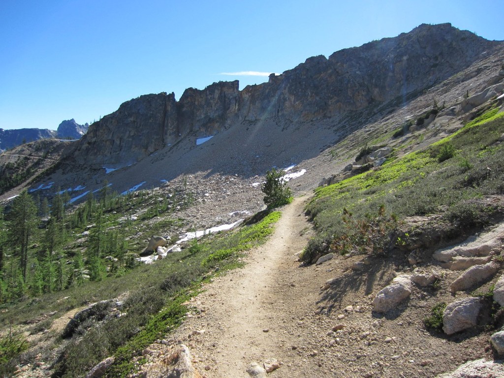
After passing through the North Cascades National Park, the PCT heads east for this final section that runs along the eastern edge of the Cascades and through the Pasayten Wilderness. 

From beginning to end, the route offers a wide array of scenery, from the jagged peaks of the Cascades to valleys, ridges, meadows and woods in the expansive and rugged, rolling terrain of the Pasayten Wilderness. Early fall is the best time to be here, when the fall foliage puts on a brilliant display of reds, golds, yellows and green throughout this 60-mile stretch.

Though it starts in Rainy Pass, this section is actually protected from much of the rain and snow that Mount Baker and the rest of the North Cascades to the west are so well known for. For this reason, late-season hikers should be prepared to pack in water, though water sources are available at Harts Pass. From late October through mid-summer, however, hikers should still expect and prepare for snowy and icy conditions, and winter hikers must watch out for avalanche conditions along the often exposed route.

Hikers should also keep in mind that there are no resupply options available along this section, and the only vehicle access is at Harts Pass, where Road 5400 crosses the trail. Just about 30 miles from here, you will reach the northern terminus of the Pacific Crest Trail — congratulations!

From here, you will need to turn around, as there is no way to cross the border in either direction. As of 2010, it is no longer legal to cross the border heading southbound into the US from Canada on the PCT. As of 2025, it is also no longer legal to cross the border heading northbound into Canada from the US on the PCT. 

WTA worked here in 2021!

Hike Description Written by
Multiple authors contributed to this report, WTA Community

Pacific Crest Trail (PCT) Section L - Rainy Pass to Manning Park

Map & Directions

Trailhead
Co-ordinates: 48.5181, -120.7331 Open in Google Maps

Before You Go

See weather forecast

WTA Pro Tip: Save a copy of our directions before you leave! App-based driving directions aren't always accurate and data connections may be unreliable as you drive to the trailhead.

Getting There

Drive east on the North Cascades Highway (Highway 20) for 51 miles to Rainy Pass. Make a left (across the road from Maple Pass) and drive less than half a mile to an unpaved parking lot for the Pacific Crest Trail. Restrooms are available here.

More Hike Details

Trailhead

North Cascades > North Cascades Highway - Hwy 20

Pacific Crest Trail Section L - Rainy Pass to Manning Park (#2000)

Okanogan-Wenatchee National Forest, Methow Valley Ranger District

Guidebooks & Maps

Pacific Crest Trail Oregon & Washington (Jeffrey Schaffer and Andy Selters) - Wilderness Press

Pacific Crest National Scenic Trail

Cascade Series - Northern Washington

www.pctmap.net/iphone/wa_section_l_map.pdf

You can improve or add to this guidebook entry!

Pacific Crest Trail (PCT) Section L - Rainy Pass to Manning Park

84 Trip Reports

Hiked here recently?

Submit a trip report!
 
Trip Reports