

The Placid Lake Trail is a connector to the Pacific Crest Trail, but you don’t need to go that far to find many wilderness delights.
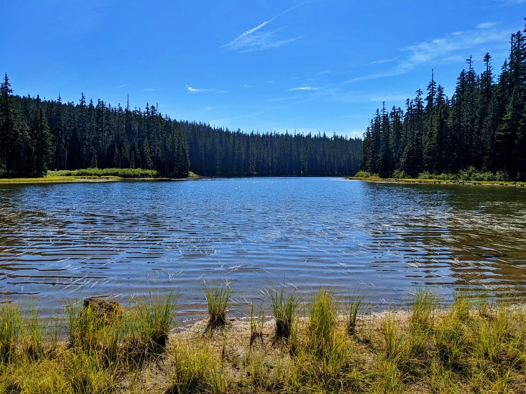
Starting from the signed trailhead, which has an information board and wilderness permit box, the trail crosses a footbridge and enters the Indian Heaven Wilderness. The rolling trail climbs up and down over a ridge and descends to the north shore of Placid Lake in 0.8 mile at 4,042 feet elevation. The main trail turns left but a short spur leads straight ahead through a meadow to the lakeshore.
The maintained trail ends at the lake and a large campsite, but paths lead around the lake to other campsites and fishing access. Placid Lake is a family-friendly destination for kids and seniors. The sandy beach, shallow water, brook and cutthroat trout, colorful wildflowers, and huckleberries offer many ways to spend a day in the wilderness with only 1.6 miles hiking round trip.
If you are ready to move on, return to the main trail and gradually ascend through open forest of silver fir, mountain hemlock, Engelmann spruce and a scattering of western white pine trees. The understory is thick with huckleberry bushes, white rhododendrons, beargrass, vanilla leaf and red mountain heather. In 0.7 mile, reach the junction with the Chenamus Lake Trail at 4,165 feet.
To visit Chenamus Lake, turn right and follow the trail to arrive at the lake’s western shore in 0.5 mile at 4,245 feet elevation. Chenamus Lake is only 4 acres and doesn’t have any fish. Several campsites around the lake are reached by paths along the shore. If Chenamus Lake is your destination, your hike will be 4.1 miles round trip with 485 feet elevation gain.
If you want to hike onward, return to the main trail and continue ascending through forest, climbing a couple of wide switchbacks as you ascend the west slope of Bird Mountain and then traversing across the headwaters for Placid Lake. As you gain elevation, hike through open glades and past a small lake. Shortly before reaching the junction with the Pacific Crest Trail in 2.3 miles, you will enter a long meadow that invites exploration. This could be a good turnaround point.
WTA Pro Tip: Visit after mid-August when the mosquitoes have begun to subside. This a popular deer and elk archery hunting area in September so you may find the trailhead parking area occupied by hunter camps. Overflow parking is in pullouts along the access road.
 Trailhead


