Trails for everyone, forever

Home Go Hiking Hiking Guide Preston-Snoqualmie Trail

Alert: On Oct. 1 the federal government began a partial shutdown that will impact National Parks, National Wildlife Refuges and U.S. Forest Service lands in Washington. Here's the latest information we have for hikers and campers


Preston-Snoqualmie Trail

Snoqualmie Region > North Bend Area
47.5507, -121.8876 Map & Directions
Length
6.5 miles, one-way
Elevation Gain
500 feet
Calculated Difficulty About Calculated Difficulty
Moderate
Photo by trip reporter explorerdogs. Full-size image
  • Dogs allowed on leash
  • Old growth
  • Rivers
  • Wildlife

Parking Pass/Entry Fee

None
Saved to My Backpack

Preston – Snoqualmie is a 6.5 mile one-way, paved, rail-to-trail path that trail meanders through a densely wooded environ and intermittently offers unique perspectives of the Snoqualmie River Valley, leading to a zoomed-out viewpoint of Snoqualmie Falls. Continue reading

Rating
3.00 out of 5

Hiking Preston-Snoqualmie Trail

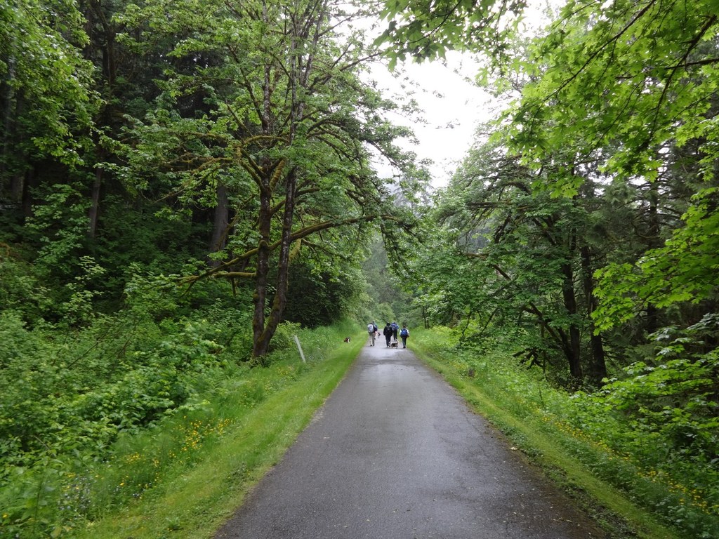
The Preston – Snoqualmie trail is a 6.5 mile each way, paved, mostly flat, rail-to-trail path connecting the cities of Preston and Snoqualmie. Open to hikers, bikers and equestrians, the trail meanders through a densely wooded path, and intermittently offers unique perspectives of the Snoqualmie River Valley. Ultimately, it leads to a quiet, zoomed-out viewpoint of Snoqualmie Falls against the backdrop of Mount Si.

Interestingly, this trail can be hiked in two parts. Starting at the Preston trailhead with rich flora and lush evergreens and cedar, you reach the ravine at Raging River at around 2.1 miles. There used to be a 100-foot trestle bridge here, spanning the river, built in the early 1900’s, it was damaged in a rail accident and no longer exists. A section of this trail is adjacent to the Raging River Natural Area providing wildlife corridors for cougar, elk, bear, deer and a sanctuary for birds.

Up to this point it is easy terrain and the trestle overlook gives glimpses of the roaring river, making a nice turn around point. A bench here marks the dead-end. 

On return, veer onto the paved path to the left (0.1 miles from your turnaround point at the trestle overlook). This path winds down and joins with the Preston – Fall City Road to resume the second part of the trail. After crossing the road on a crosswalk, turn right and follow the shoulder of the road for 400 ft to the first cross street, SE 68th Street. Turn left here and immediately cross a bridge over the Raging River. In about 1000 ft the street will dead end, and there is an obvious paved trail back up to Preston - Fall City Road. Again follow the road on the shoulder for about 0.25 miles until you are funneled on a short steep gravel path snaking its way up the hill towards Lake Alice Trailhead. At the top the wide paved path resumes, and continues another 1 mile to the Lake Alice Trailhead, about 3.6 miles from the start. On the sections along Preston - Fall City Road, there are concrete “Jersey Barrier” dividers to separate you from the traffic.

At this trailhead, cross the road and continue 1.5 miles back on a levelled path to the Snoqualmie Falls viewpoint. Parking and portable toilets are situated at Lake Alice trailhead and at the falls overlook, but the falls themselves are still distant; you'll want to go on Preston-Snoqualmie for the journey.

Toilet Information

  • Toilet at trailhead
  • Accessible toilet
  • Toilet has running water

More information about toilets

Wheelchair Accessibility

Trailheads, Parking, and Restrooms

Lake Alice Trailhead:

  • Paved parking lot with a rough surface, and 1 poorly-marked accessible parking spot. The spot should be van accessible if you back in.
  • No permanent restrooms. 1 non-ADA port-a-potty.

SE 87th Place Trailhead:

  • Paved parking lot on the side of the road. 1 marked accessible spot, access aisle on driver's side, but backing in is possible.
  • No permanent restrooms. 1 non-ADA port-a-potty.

Preston Park:

  • Total marked 6 accessible spots, in two locations in the large parking lot. All had access aisles, but none seemed to be wide enough to meet ADA standards for van accessibility.
  • Flush toilets are available in the park restrooms, located on the other side of the picnic shelter from the parking lot. Large ADA stalls in both men’s and women’s restrooms. Toilets are metal “jailhouse” style.

Trail Accessibility

The majority of the trail is 8 ft wide asphalt in good condition. Expect minor cracks and the rare root bump. Minimal to no cross-slope. As it is a rails-to-trails trail, the majority of it is flat or has a very slight grade. There are two exceptions to the slight grade. 

Just before the trail crosses Preston-Fall City Rd., coming from Preston, it drops ~100 ft in less than 0.2 miles, with some sections much steeper than an ADA ramp. Powerchairs likely can still handle it — however, it would be quite a workout for manual chair users. 

About 0.5 miles from the Lake Alice trailhead headed northeast, the trail goes down and back up a bit of a ravine. It’s a couple of hundred yards wide. Somewhat steeper than an ADA ramp, but likely independently manageable for a lot of manual chair users. There is clear visibility of it ahead, so you can see what you are in for before you commit.
Additionally, at the Snoqualmie Falls viewpoint, the viewpoint itself, as well as a couple of benches are 20 to 30 ft off of the paved trail, on hard-packed gravel. However, there is a 2-3” lip from the gravel back up to the paved trail. The port-a-potty here was a non-ADA type.

Trail Inaccessibility

There is a significant barrier to nearly all wheelchair users between the SE 87th Pl trailhead and the Lake Alice trailhead. Approximately 2.6 miles from SE 87th Pl, and 1 mile from Lake Alice Rd, the trail becomes gravel, narrow and a series of 8 steep switchbacks. Compounding the issue is at the top, there are 4 timbers placed across the trail as steps. They are spaced out, so one might be able to curb hop them, but 3 of them are 8-10” high, and the 4th is 4-6” high. It might be navigable in an off-road style handcycle, but the tight turns on the switchback might cause issues.

[Accessibility notes provided by Z. K.]

Hike Description Written by
Rupa Saumil, WTA Correspondent

Preston-Snoqualmie Trail

Map & Directions

Trailhead
Co-ordinates: 47.5507, -121.8876 Open in Google Maps

Before You Go

Preston-Snoqualmie Trail Bridge #2 (about 0.75 miles west of the Lake Alice Trailhead) has sustained serious damage that necessitated a full closure of the structure. No detour is available and a timeline for repairs is not yet established. The trail is still open in both directions.

See weather forecast

Parking Pass/Entry Fee

None

WTA Pro Tip: Save a copy of our directions before you leave! App-based driving directions aren't always accurate and data connections may be unreliable as you drive to the trailhead.

Getting There

From Interstate 90 (heading east or west), take Exit 22, turn north, and at the "T," turn right on Preston-Fall City Road. For the western (Preston) trailhead, turn left in .3 mile on Southeast 87th Place. Parking and restrooms are also available at the adjoining Preston Park.

To reach the Lake Alice trailhead, continue 3.5 miles on Preston-Fall City Road and turn right on Southeast 47th Street, which curves right into Lake Alice Road at the cemetery. The trailhead is on the right in 0.8 mile.

More Hike Details

Trailhead

Snoqualmie Region > North Bend Area

King County Parks

Guidebooks & Maps

60 Hikes Within 60 Miles: Seattle: Including Bellevue Everett and Tacoma by Andrew Weber and Bryce Stevens

You can improve or add to this guidebook entry!

Preston-Snoqualmie Trail

31 Trip Reports

Hiked here recently?

Submit a trip report!
 
Trip Reports