Trails for everyone, forever

Home Go Hiking Hiking Guide Pyramid Peak

Alert: On Oct. 1 the federal government began a partial shutdown that will impact National Parks, National Wildlife Refuges and U.S. Forest Service lands in Washington. Here's the latest information we have for hikers and campers


Pyramid Peak

Mount Rainier Area > Chinook Pass - Hwy 410
47.1065, -121.4032 Map & Directions
Length
1.4 miles, roundtrip
Elevation Gain
735 feet
Highest Point
5,715 feet
Calculated Difficulty About Calculated Difficulty
Easy/Moderate
Greenwater River Valley and Mount Rainier. Photo by Rolan Shomber. Full-size image
  • Dogs allowed on leash
  • Fall foliage
  • Mountain views
  • Summits
  • Wildflowers/Meadows

Parking Pass/Entry Fee

None
Saved to My Backpack

A short and steep hike in the woods leads to the top of Pyramid Peak, where the hiker is rewarded with an expansive southerly view of the Greenwater River Valley. From this former lookout’s rocky perch, Mount Rainier dominates the skyline to the southwest. Continue reading

Rating
3.50 out of 5

(2 votes) Log in to rate

Hiking Pyramid Peak

The steep hike to the top of Pyramid Peak begins with a nearly level 80-yard walk on the Pacific Crest Trail to its signed junction with the Pyramid Peak Trail. After this easy warmup in the forest, the work begins with a steep switchback climb on the minimally used trail that rarely receives formal maintenance. The light use means a better chance to see wildlife or signs of wildlife (deer, elk and more).
 
Most of the first 0.3 miles of the trail is on forest duff due to the light use, which makes for a soft trail. The dense forest canopy means little understory and lots of shade (nice on a sunny day!). Due to the minimal maintenance, there are logs to step over or around.
 
The second 0.3 mile is in open forest with lots of blueberry bushes crowding over the trail. In mid-summer, this area is a lupine garden.  Later in the summer, the berries are ripe for picking. The views in this section are still mostly blocked by the forest, with a few peek-a-boo views to the south.
 
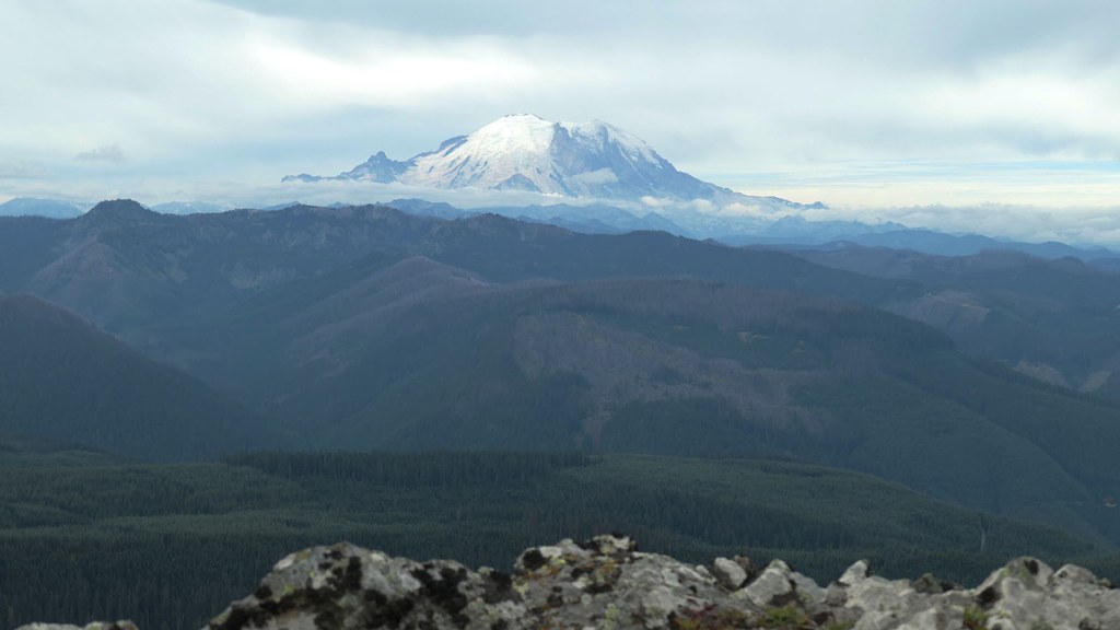
The last 0.1 mile is in the open as it skirts the rocky southern edge of the peak, provides the first look at the expansive southern view, and reaches the rocky perch at the summit. What was once an impressive view to the north is now blocked by decades of tree growth.
 
Pyramid Peak was the site of two USFS lookouts from the 1930s to the early 1960s. The latest was intentionally burned down by the USFS in 1968, leaving broken glass, nails, and anchors — just watch your seat as you enjoy the view.
 
Some maps show a trail coming from Windy Gap and up the north side of Pyramid Peak. This section of trail — formerly the Cascade Crest Trail — is long abandoned and now is a brush bash.
This hike is best done midweek when the stillness of the backcountry is not overwhelmed with the sounds of gunfire, motorcycles, and ORV’s. If doing this hike during the Modern Firearms Deer Hunting Season (about 3rd week in October), be sure to have bright clothing, preferably orange or pink, and expect to meet at least one of the hundreds of hunters in the Greenwater River drainage.
 
Note: This initial description of the hike uses the shortest hiking route to the junction of the PCT and the Pyramid Peak Trail. Three other ways to get to this trail junction, which involve more hiking but less stressful driving.
  1. Pyramid Pass: Hike north on the jeep road for 30 yards and then left on the PCT for 0.4 miles.
  2. Windy Gap: Hike west southwest then south 0.1 mile on the access trail, then 0.8 mile south on the PCT.
  3. Horse Camp: Hike 0.8 miles on the access trail, then 2.3 miles north on the PCT.
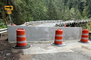
Toilet Information

  • No toilet at trailhead

More information about toilets

Hike Description Written by
Rolan Shomber, WTA Correspondent

Pyramid Peak

Map & Directions

Trailhead
Co-ordinates: 47.1065, -121.4032 Open in Google Maps

Before You Go

See weather forecast

Parking Pass/Entry Fee

None

WTA Pro Tip: Save a copy of our directions before you leave! App-based driving directions aren't always accurate and data connections may be unreliable as you drive to the trailhead.

Getting There

to trailhead

From Enumclaw, take SR 410 eastbound for 20 miles to Forest Road 70 (located between milepost 44 and milepost 45). Turn left onto FR 70 and follow it for 15.2 miles. Turn left onto FR 7080 and follow it for 1.6 miles to Pyramid Pass (unmarked PCT crossing). Turn left on an unnamed jeep road (narrow with pullouts) and follow it for 0.4 miles. Turn left onto the trailhead access road (narrow and steep) and follow it for 80 yards to the trailhead.

Note that an AWD or 4WD vehicle with good clearance is recommended for the rough FR 7080 and the jeep roads.  Allow at least 20 minutes to go the 2 miles on these rough roads.

There is parking for 5 vehicles at the trailhead and no amenities. The PCT exits the parking area to the northwest. The trail sign has been shot to pieces as of 2023.

Alternate trailhead: Windy Gap

From SR 410, follow FR 70 for 8.1 miles. Turn left on FR 7030 and follow it for 3.9 miles. Turn right onto FR 7036 and follow it for 2.5 miles. Turn right onto FR 7038 and follow it for 1.1 miles. Turn right onto FR 195 and follow it for 0.7 miles to a sharp left bend at Windy Gap with a pullout for parking (no amenities).

Alternate trailhead: Horse Camp

From SR 410, follow FR 70 to a junction at 15.7 miles. Take the right branch and follow it for 1 mile to the horse camp. This last mile of road is very rough and rutted with many side roads. Stay on the main road to reach the trailhead (toilet at trailhead).

More Hike Details

Trailhead

Mount Rainier Area > Chinook Pass - Hwy 410

Pyramid Peak (#1160), Pacific Crest Trail (#2000)

Mt. Baker-Snoqualmie National Forest, Snoqualmie Ranger District

Guidebooks & Maps

Day Hiking: Snoqualmie Pass ed. II (Nelson and Bauer - Mountaineers Books)

Green Trails Lester No. 239

Buy the Green Trails Lester No. 239 map

You can improve or add to this guidebook entry!

Pyramid Peak

22 Trip Reports

Hiked here recently?

Submit a trip report!
 
Trip Reports