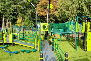

Clallam County’s 196-acre Salt Creek Recreation Area offers a little bit of something for everyone—playgrounds and play fields, wildlife viewing, remnants from WWII-era Camp Hayden, year-round camping and panoramic views of the Strait of Juan de Fuca from the multi-use Striped Peak trail.
Hikers, bikers, and horseback riders can all access the Striped Peak Loop Trail just past the park’s entrance booth. Trailhead parking is on the right and clearly signed. Of course, visitors can hike this either direction, but this description goes clockwise.
From the trailhead, start out among fir and maple trees, traveling along the well-constructed gravel Access Trail. As the path heads into the forest, it wanders through towering cedar, fir and hemlock, arriving at a junction at 0.35 miles. To your left is the Strait Slope trail, so named for the slope overlooking the Strait of Juan de Fuca.
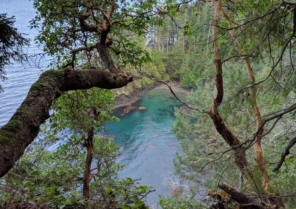
About 0.9 miles from the trailhead, peer 200 feet below to a remote and isolated cove. The junction for this side trail (named, appropriately, Cove Trail) is clearly posted. The hike down is steep, but excellent stepping-stairs have been built along the way, so footing is not as difficult as the grade would suggest. At high tide, the rocky beach is accessible only by wading, so it is best to go when the tide is at least half way out.
Horseback riders are requested to stay off the Cove Trail to the water due to its steepness and the steps that are not built to stock standards.
Back at the Strait Slope trail, continue on for a total of 1.8 miles from the junction to where the trail takes a horseshoe bend and soon becomes the Bunker Ridge trail. Here, you will want to stop and marvel at the view of the Strait of Juan de Fuca. Visitors used to have to walk the logging roads on Striped Peak back to the trailhead from here. Now, thanks to 3.5 years of work from WTA crews, visitors can rely on a beautifully-built trail to carry them back to the trailhead.
Bunker Ridge trail runs along the ridge, and when there is a break in the trees, fabulous views of Canada are available. The trail does two switchbacks before meeting an active logging road. Cross and connect with the trail diagonally across the road (to your left), which is clearly marked. It continues through a clearcut for approximately a half-mile, with a bench on the water side to rest and enjoy another view of the Straits and Vancouver Island.
Soon you will re-enter the forest and swoop your way for a quarter-mile until the route turns left onto what feels like an old spur road. That's what it is, though it's now officially a trail. It's not long here before you see your trail veer to the right and start climbing uphill through the forest.
After the fourth switchback, start watching for a spur trail on your left (marked with a sign). That will be the side route to Striped Peak, which features a simply glorious birds-eye view of Crescent Bay, Salt Spring Island and Vancouver Island!
This lollipop-shaped spur trail does cross a logging road. After you lounge at the top, resting and gawking at the jaw-dropping view, just head back down the spur trail and pick up where you left off, turning back left on the main trail to continue the direction you were going. Soon you'll pop out onto a road but the trail skirts alongside. Bring a headlamp if you want to explore the huge underground WWII bunker here.
Follow the trail past the bunker and enjoy the long winding, downhill descent. You'll snake around a tight S-curve and find yourself with yet another triply lovely view spot adorned with benches. After a little over a mile you will come back to the junction you passed when you first started. Turn left and you only have to retrace 0.35 miles to arrive back at the campground.
Usage note
This trail is open to hikers, mountain bikers and horse riders. Remember your right-of-way on trail so everyone can enjoy their day outside!

 Trailhead