

The Upper South Fork Skokomish River to Sundown Pass can be considered a tale of two trails. The first half stays low in lush valley bottom on brushy but obvious tread, while the second half makes up for lost time, ascending steeply through subalpine forest between wet meadows on faint and broken tread. The scenery improves with every step near the top, and reaching Lake Sundown is a welcome reward after all the toil.
Begin by marching along the old bed of decommissioned FS 2362 under scraggly alders for the first half mile before entering verdant forest indicative of the Olympics. The tread is dirt with duff and some rocks, but is generally pleasant. Come to a ledge where the river can be heard but not seen, then pass beneath Elephant Stump, before arriving at Rule Creek on a nice bridge at 1.2 miles.
Here the trail turns toward the South Fork Skokomish and crosses it on a conveniently fallen cedar. On the other side the way resumes a narrower but still obvious tread that is usually littered with debris in early summer. Thrown logs lie about and showcase the handiwork of skilled backcountry trail crews. Very large firs appear, both upright and prostrate, the latter giving back their nutrients to the forest floor.
At 2.4 miles the trail comes again to the bank of the Skokomish in a garden of thimbleberry. There is no bridge this time, so fording is required to reach the opposite side. A campsite sits on both sides, but beware the rotting maple limbs burdened with moss above. The trail now continues northwesterly near the river, which disappears from the streambed for a time, rendering the valley eerily quiet here.
The way enters a small clearing where the trail itself seems to disappear. Follow straight through and at the far end the trail appears again next to a cut log. Head right and uphill, arcing around a knoll before passing through a brushy corridor with some devils club growing right in the trail. At 4.0 miles the way crosses Startup Creek either by fallen log, if present, or by rock hopping the gurgling channel.
The trail now leaves the valley for good, climbing by a couple steep switchbacks before rounding the mountain on a steady incline. At 5.1 miles is the park boundary sign. Gone is the wide and obvious Forest Service trail. The way is now rough and tumble, gaining steeply on narrow and eroding tread through silver fir and yellow cedar. Orange markers can be seen, but some are off course, marking a previous location.
Soon the trail comes out of the woods and into a bright meadow where Riley Camp sits on the northern verge. Head straight through the meadow and find the trail at the far tip. After climbing through more forest the way comes again to a marshy meadow where the trail can be found heading to the right this time. Now the way climbs in earnest for Sundown Pass, bypassing lovely meadows on the left, on a brutally steep pitch.
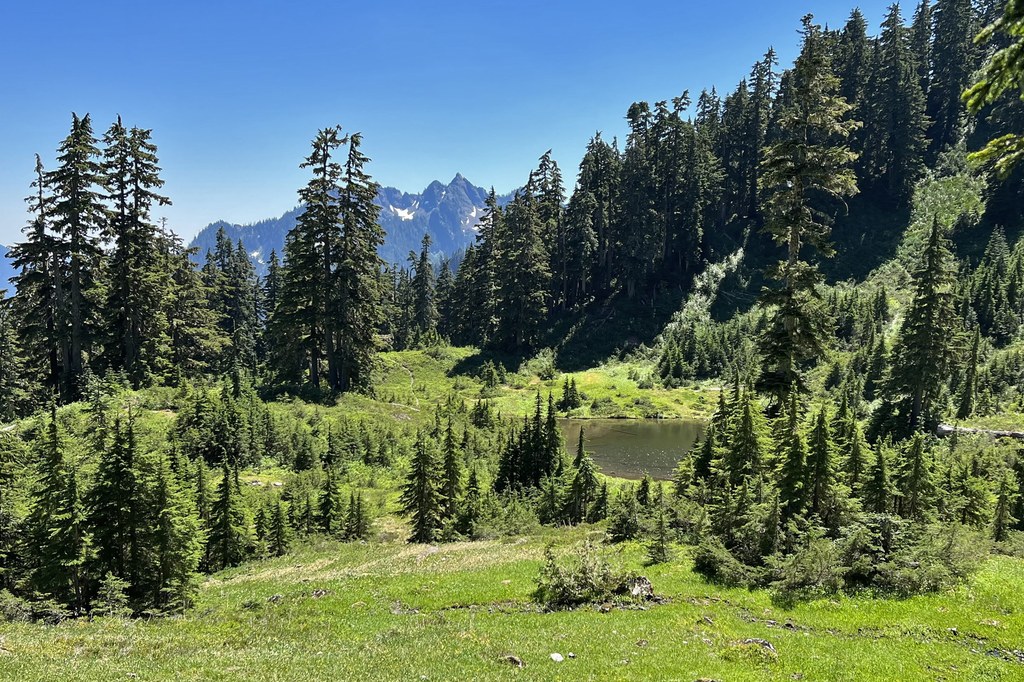
Suddenly the path reaches a small basin holding two tarns frequented by elk and bear. The way resumes the final, grueling push to Sundown Pass at 7.2 miles. A broken signpost marks the 4125 foot pass, with trees mostly obscuring the view. Descend nearly 400 feet to meet the Graves Creek Trail at 7.6 miles in a semi-open meadow. Return by the same route, or walk just 0.3 more miles to Lake Sundown with its twin campsites over sparkling, clear water.

 Trailhead


