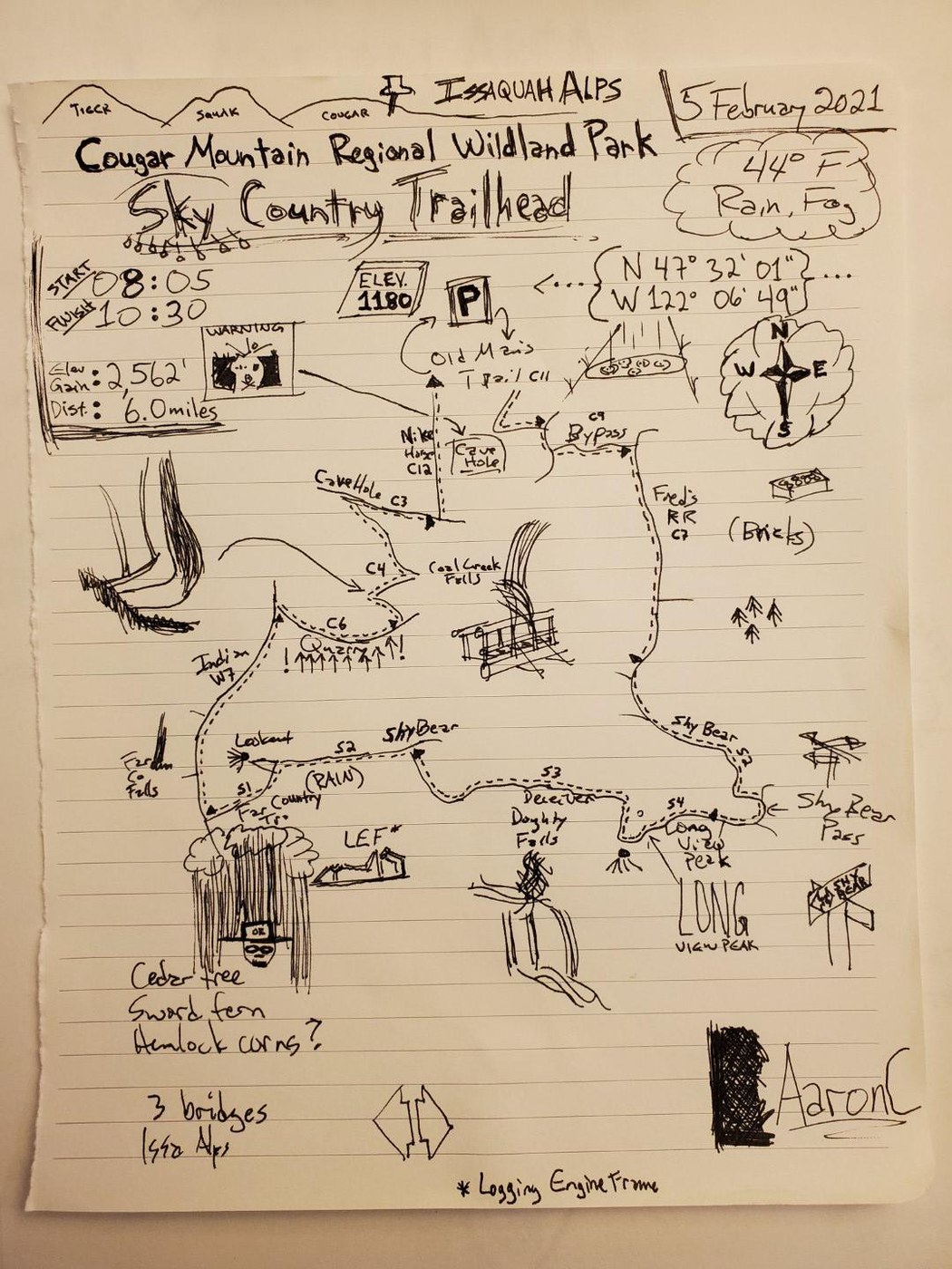
The rain was on and off (very on at one point!) but kept most folks off the trail this wet Friday morning. A six-mile loop from Sky Country trailhead: Old Man/Miner's Trail, Bypass, Fred's RR, Shy Bear, Long View Peak, Deceiver (& Doughty Falls), Shy Bear, Far Country, Indian, Quarry, Coal Creek Falls, Cave Hole, Nike Horse.
Only "obstacle" on the trail was mud and puddles in various places.
I've started doing sketches of my hikes as a way to note interesting aspects and the pertinent details. This is my very first attempt, so still a skill at which I need more practice. (I think the elevation gain noted in the sketch is way off...the Garmin GPS has an "elevation correction" feature, which reduces the gain to 1200 ft).


Comments
Alpine Jackalope on Old Man's Trail, Fred's Railroad, Shy Bear, Long View Peak, Deceiver, Far Country, Indian Trail, Quarry, Coal Creek Falls, Cave Hole, Nike Horse Trail
Love the sketch idea and the little details, like the pin in the mountains at the top. Your cave-in danger sign is great too.
Might need a Where's Waldo style Bigfoot in there, just to see if people are paying attention.
Posted by:
I ❤️ Trees on Feb 09, 2021 10:43 AM
FMerkel on Old Man's Trail, Fred's Railroad, Shy Bear, Long View Peak, Deceiver, Far Country, Indian Trail, Quarry, Coal Creek Falls, Cave Hole, Nike Horse Trail
I like your map. I think that kind of personal perspective adds value and character to the hike.
Posted by:
FMerkel on Feb 10, 2021 03:00 PM