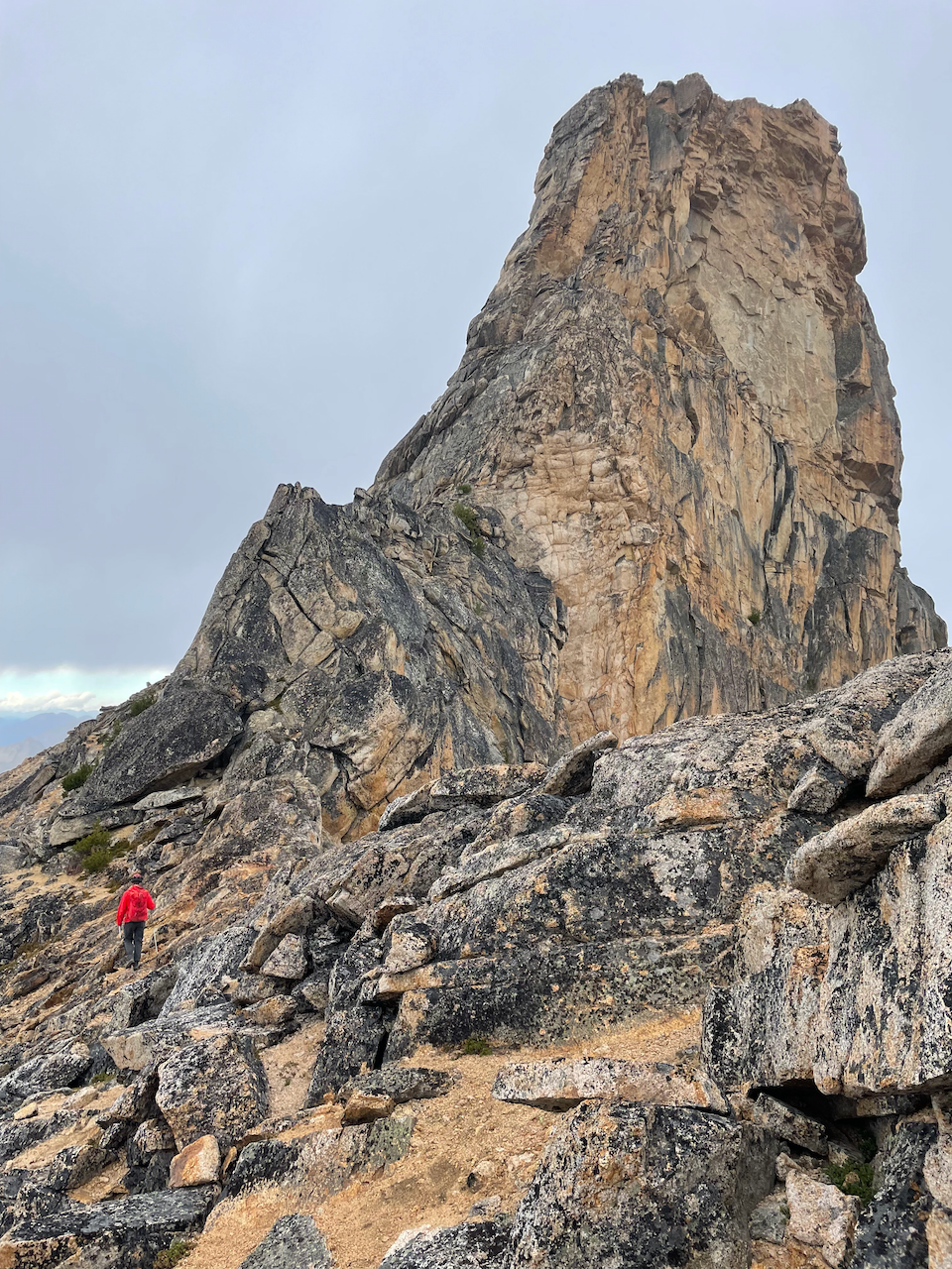
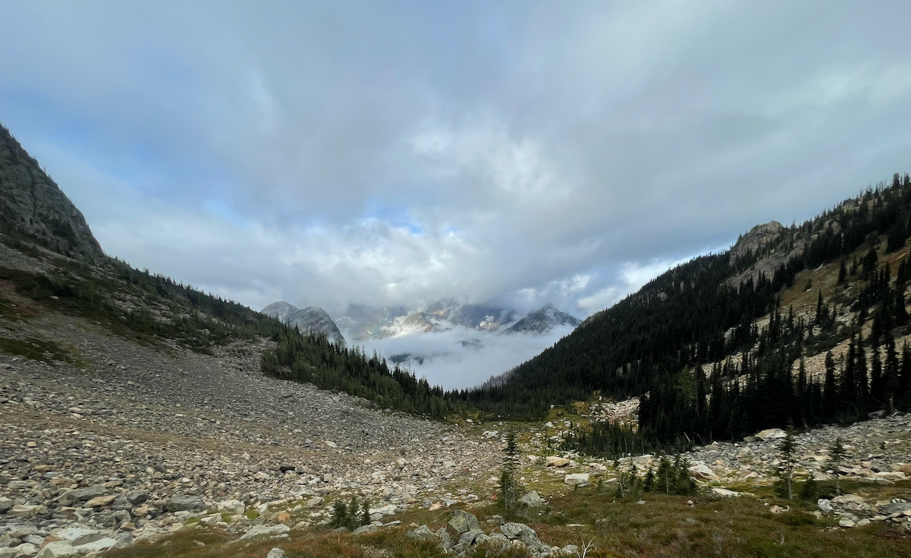
Did a multi-day backpack with a guide from Mountain Madness starting at Rainy Pass, heading up the PCT to Snowy Lakes 2 nights. We backtracked and stayed by the PCT near the Rainy Pass trailhead 1 night. We visited Tower Mountain and Golden Horn Friday and attempted Cutthroat Peak Sunday, but bailed due to weather.
All objectives listed are technical scrambles (Tower and Golden Horn) or technical climbs (Cutthroat Peak). While there’s a ton of information out there for Tower Mountain, the guide and I found it misleading, and conversely, found Golden Horn to be more difficult than advertised. Cutthroat Peak was difficult to gauge since beta on the mountain was a bit sparse.
Day 1 - Hike to Snowy Lakes
We hiked to Snowy Lakes from Rainy Pass south passing through Cutthroat Pass and Granite Pass. The trail here is very well trodden, and also quite dry past Porcupine Creek: there are some other water sources before Cutthroat Pass and right before the Snowy Lakes junction, but they’re trickles in comparison. The trail down to the Snowy Lakes junction is extremely good—just a bit gnarly descent wise from Cutthroat to Granite Pass, because of the grade and loose scree.
The hike up from the PCT proper to Snowy Lakes is easy to miss if not looking, but the outlet is near another dispersed site on the opposite side of the PCT with an excellent view of Mount Hardy.
The trail to Snowy Lakes is a climber’s trail at first, then turns into a proper trail near the top (someone’s doing trail maintenance!). It’s being rebenched so it’s not super pretty yet, but it’ll look and be easier to maintain soon.
We setup camp near Lower Snowy Lake, then went to sleep for the night.
Day 2 - Tower Mountain and Golden Horn
We started the day heading to Tower Mountain, then went to Golden Horn.
Tower Mountain
Rockfall is really bad in the main gully. Single party ascents advised. Routefinding experience advised to avoid class 4/5 terrain over loose/unprotectable rock.
The path we took to Tower Mountain involved going cross-country laterally from our site to the talus field, aiming for the large red boulder in the middle of the talus. From there we aimed for the ramp to the left of the cave, walked across the ramp to the bottom of the main gully, then went up the right side of the main gully, crossing over to a smaller right gully following cairns, zig zagging over the right and main gullies, then walked up the SW ridge. We did a minor class 4 move over a fin using a cheval move, then walked up to the summit. On the way down we short roped, I went out in front since the guide I was with was leading, and did the reverse of our ascent.
We used direct communication while short-roped and planned out a descent path verbally before committing. That being said, I accidentally kicked down a few smaller rocks, which bounced around the gully a few hundred feet. I was also klutzy and slipped a couple times on the loose scree over bedrock, but I recovered before sliding too far 😅.
On the way down we found a slightly more beaten bootpath back through/traversing the talus field, we dropped down a bit further, then walked up 50’ or so to our campsite via the trail.
Golden Horn
We hiked up to Golden Horn via Upper Snowy Lake.
The guide I was with proposed we walk the SE ridge from tree cluster to tree cluster. I agreed with his wise suggestion. This prevented us from walking straight up over some of the pumice-like kitty litter scree.
The walk up along the ridge was very similar to heading up the Mebee Pass to the lookout (not surprising I guess since they’re fairly adjacent areas).
We crossed under the SE horn/gendarmes along the ridge, pivoting to the S ridge. We then walked up to the final summit block from the left (W) side, pivoting to the NW side.
The lichen-covered rock was very wet, which definitely pushed me outside my comfort zone. Even though Beckey claims the last 70' was class 3, we thought it was actually mostly class 2-3, with the last 15' being class 4 with a set of low class 5 moves to achieve the true summit on the N side. The S side was mid to upper class 5, I think, with some degree of crack climbing, edging, and smearing involved. The guide I was with and I switched to approach shoes, climbed up the N side of the summit block (fully-engaged), we mantled to get to the summit block, then anchored off the rappel ring at the summit. We used cordalette as backup (we left the rope at camp thinking this was the easier of the two climbs 😔).
Downclimbing was going to be impossible without protection, so he recommended lowering/rappelling, but I chickened out and downclimbed on the cordalette, sacrificing some skin on my fingertips to the mountain and slipping once, almost falling off the rock when downclimbing. He rappelled down easily with an ATC and cordalette since he had experience and comfort doing similar.
On the way down we took a slightly more direct route to Upper Snowy Lake which had cairns along part of the way.
Day 3 - Moving Camp
This day was standard, breaking down of camp and moving from Lower Snowy Lake to a site near Porcupine Creek.
Not much to report other than we ran into a number of folks attempting Tower and heading up the PCT. We heard rockfall at camp from the folks climbing Tower 😬.
Day 4 - Cutthroat Peak attempt
We got up early, tore down camp, and went to the junction hoping to get up the N ridge of Cutthroat Peak.
It was a bushwhack with minimal information on the route--just generalizations on staying left of the creek drainage and avoiding the talus on the right side.
The ascent to the start of the route involved some blowdown hopping and wet vegetation under the trees and in the low meadows. We ran into lichen/moss-covered rocks, loose scree, loose talus, and swampy terrain, and wet vegetation once we got out of the trees. It wasn't great going up and it was worse going down since it rained while we were at the base—much more difficult than many climber's approaches I've done. It was Grade III -- the most difficult I've attempted so far.
The rain and the cold (it was in the upper 30s/mid 40s) stymied us as far as starting the climb was concerned. I was also extremely gassed from the last few days and likely wouldn't have fared well on the climb 😕.
We peeked over at the E approach (from Washington Pass). He said it looked horrible because the rock was loose ("fried"), and I tended to agree given the general state of rock in the area (Golden Horn, Tower).
We knocked some large boulders loose in the gully between the lower and upper meadows which seemed solid. Good communication and movement out of harm’s way prevented rockfall from injuring each other, but care is definitely require in the gully section.
I’d like to come back and attempt the North Ridge when snow is present up the first pitch using the WA pass approach maybe or the Rainy Pass approach.


Comments
daleroy on Pacific Crest Trail (PCT) Section L - Rainy Pass to Manning Park, Golden Horn - Snowy Lakes, Tower Mountain, Cutthroat Peak, Cutthroat Pass via the Pacific Crest Trail
Is Snowy Lake the only water source?
Posted by:
daleroy on Sep 12, 2021 11:48 PM
ngie on Pacific Crest Trail (PCT) Section L - Rainy Pass to Manning Park, Golden Horn - Snowy Lakes, Tower Mountain, Cutthroat Peak, Cutthroat Pass via the Pacific Crest Trail
From what I saw, it was the only reliable water source 2 miles from Cutthroat Pass to the Snowy Lakes junction. There were trickles by Snowy Lakes, but they didn't seem reliable.
Posted by:
ngie on Sep 13, 2021 02:38 AM