

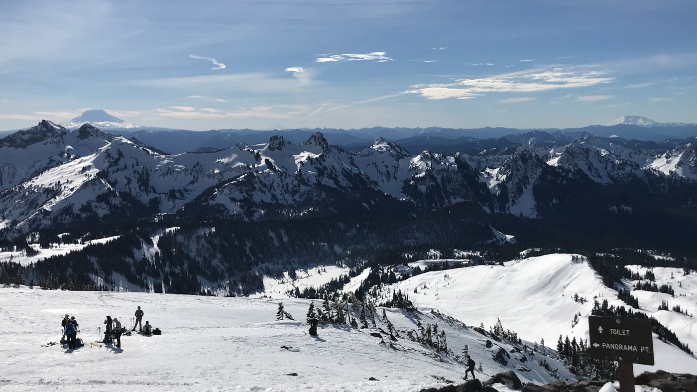
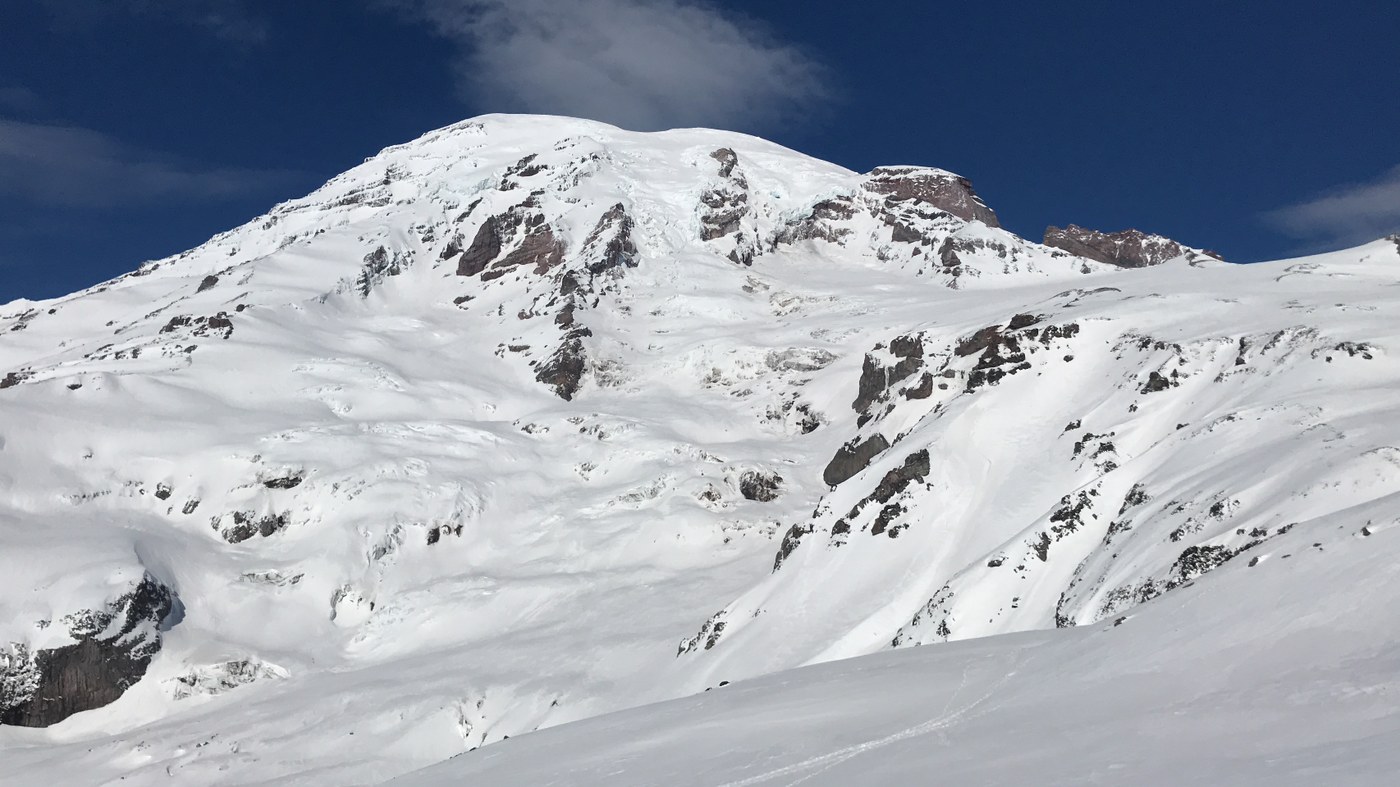
I ran out of adjectives trying to describe how incredible, amazing, epic the views of Mt. Rainier and the Tatoosh Range were.
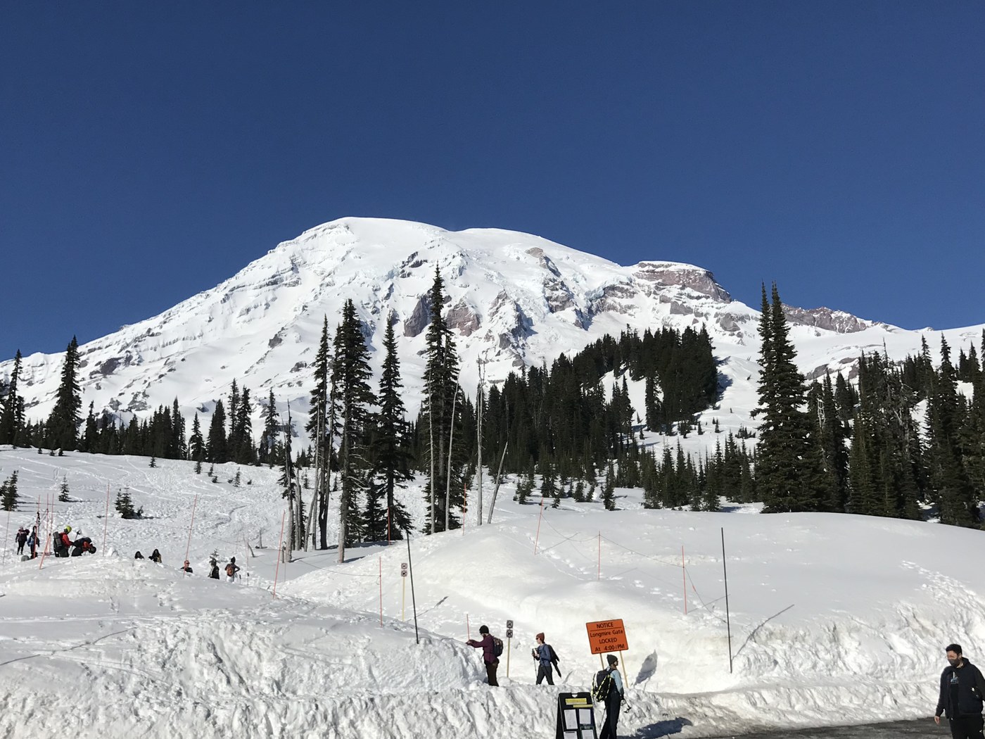
I had forgotten that the gate between Longmire and Paradise is closed every night. It opens at around 9am depending on how much snow or snowslides fell on the road. It opened early today, so we got to the Paradise parking lot right at 9am.
There are quite a few trails intersecting near the parking lot and Visitor Center. With several feet of snow on the ground, you cannot see the trail markers, and there are not colored sticks marking the trail here like in some parts of the park. Fortunately there had been little snow in the past few days, so a foot path approximating the Skyline trail near the Visitor Center was well-marked by many many earlier boots (going clockwise around the Skyline Loop). However, the main reason I am putting in this trip report was because it was at times very difficult to find the trail and we ended up doing some trail blazing. The Skyline Trail route on the National Park Service print maps, Google Maps, and GPS maps like Trails, AllTrails, and Hiking Project show the *summer* trail. The winter trail is different! I followed the summer trail until ~6500 ft (before Panorama Point) where the trail became super steep for a short section. I would call it more mountain climbing than hiking, and I would not attempt it unless you have experience, an ice axe, and crampons (not microspikes, but macrospikes). I was wondering why so many people split from the Skyline Trail at ~6000 ft and headed cross country directly for Panorama Point down a slope and then up a wide and also steep hill, but not as steep as the way I avoided. So I backtracked and followed the crowd, and it turned out to be a good way to get to Panorama Point. From Panorama Point we followed the summer trail fine until the high point of the loop at 7100 ft. But the way down was unclear. Though there were tons of people on the trail, almost all were carrying skis and continuing up higher and planning to make their own way down. We could not find previous tracks or a trail down. Based on the GPS map, the best we could make out was quite a steep slope. We went for it carefully and I ne of our party fell, and after sliding on her butt for 100 yards and screaming the whole way, she yelled "That was so fun! I want to climb back up and do it again!" So we all slid down on our butts and that was definitely the best way go; much faster, safer, and more fun. When we reached the Golden Gate Trail, we took that way back to the Visitors Center. It seemed that no one had traveled this way today. There was also a steep downhill at this intersection where we had to put our newfound sliding skills to good use. As we got closer to the Visitors center, the Golden Gate trail became more well-traveled and was easy to follow.
Despite the pathfinding difficulties, we had a great day! There were sunny skies, and the views were awesome from the parking lot and with every hundred feet of elevation gain got better and better. The Tatoosh Range was spectacular and as you climbed up ~1000 feet, you could see Mt. Adams and Mt. Saint Helens like I've never seen them before. Come ready to do some trailblazing, come ready to slide on your butt, come ready for adventure, come ready to take pictures, and bring your endurance.
Comments