Bottom Line:
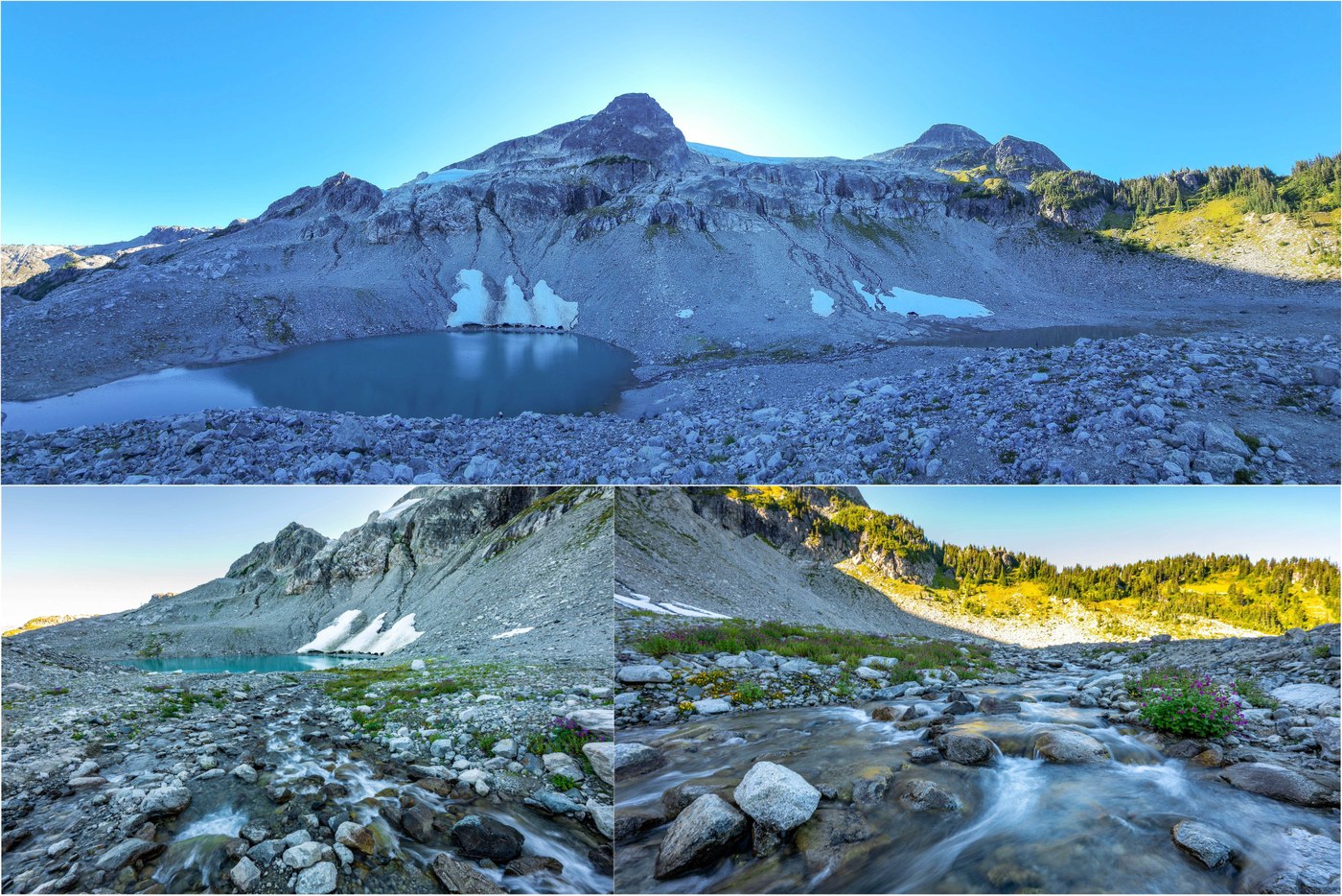
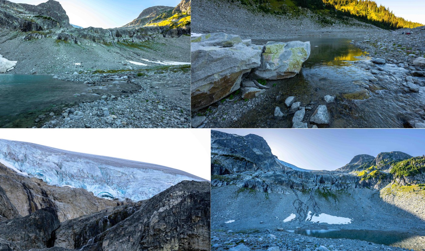
After hiking Mt Baker, this was a 2-hour drive north of the border (with no traffic) in Whistler, BC. Stunning trail of waterfalls, old-growth forest, alpine meadows, a lake basin with a turquoise lake, dramatic waterfall-clad headwall and a hanging glacier. This is a popular spot for a cold plunge in the summer. The lake name comes from calving of the snowfield at the bottom of a cliff below a glacier. The old-growth forest ascent on the Upper 19-Mile Creek Trail has mile after mile of BEAUTIFUL waterfalls - see video. The trail starts in rocky and thin soil forest that reminded me of hiking on the San Juan Islands, transitions to Rain Forest, and then ends in the high alpine. Note to be confused with last summer's "Iceberg Lake" at Mt Adams. CAUTION: Grizzly spotted at the lake (much smaller than nearby Cirque Lake grizzly) - carry bear spray.
Stats:
- Distance: 14-3/4 miles
- Vertical: 3375 ft
- Duration: 8-1/4 hours
- Road/Parking: Trail access is via neighborhood roads on the west side of Hwy 99 in Whistler, BC right across from Green Lake. You can park at the east end of Mountain View Dr (upper) or Valley Rd (lower). There is a connector trail between the two. We used Valley Rd and this added some distance/vertical. There were about 10 parking spots on the side of the road here, with "no parking" areas clearly designated. No toilet at the bottom, but there is an outhouse in the alpine.
- Weather: Sunny and warm, no wind, 70-80Fs
- Flora/Fauna: There was a juvenile grizzly at the lake today grazing on the rocky slopes across the lake. This is bear (black, grizzly) and cougar country - carry spray. Flowers were mostly done at lower elevation with some pearly everlasting and fireweed. At the meadows and lake, there were still plenty of flowers, adding in monkeyflower, aster, flowering corn lily and others. Fall color is starting to show in the meadows and above - see video. Bugs were only an issue at the lake once the sun set behind Rainbow Mountain casting the basin into shade - bring bug spray.
- Water: There is filterable water pretty much the entire length of the trail, although it is glacial runoff that may clog your filter over time. Might carry a little water for the first couple miles of the trail as the water sources are more of the "trickle" variety.
- Trail: The trail is in excellent condition, with just a bit of mud from recent rains just before reaching the meadows, and one section of road-to-trail conversion that is steep and straight uphill. The road-to-trail conversions are less than a mile total, and mainly used to connect some different trail segments. The trail is steepest at the beginning, and the final rocky climb above the meadows to the lake basin. The trail has three distinct flavors, making it wildly entertaining! The first is the initial climb through a granite and thin-soil forest that reminds me of hiking on the San Juans, or the top of Little Si. This transitions into Upper 19-Mile Creek trail in an old-growth rain forest with a rich understory that felt tropical at times. This segment of trail passes mile after mile of BEAUTIFUL waterfalls (all faint blue from glacial till). Finally, you reach tree line and enter the meadows with a dramatic headwall and hanging glacier straight ahead. About a third of the way up that headwall sits a hidden Iceberg Lake. The final ascent to the lake is rocky, but straightforward. The views on all directions, including across the valley to Wedgemount, are amazing. There is an outhouse in the meadows. The trail is not in a park and is maintained by the Alpine Club of Canada. CAUTION: This trail is well-known for cougars. Also, we saw a grizzly at the lake. Carry bear spray. Dogs are not permitted as they have the potential to provoke grizzly attacks. NOTE: The trail is well-signed throughout. The Lower 19-Mile Creek trail has a number of junctions with Iceberg Lake specifically called, and then it is a straight shot on the Upper trail to the meadows. Would still suggest GPS. There was a moment in our "Hey, bear!" descent where the valley closed in, the trees grew into old-growth monsters, and the acoustics all of a sudden became fantastic - maybe the moment of the summer!
- Takeaway: A stunning trail with three distinct personalities! Next time, I would start earlier, as the basin gets shady in the late afternoon, and seeing the lake in direct sunshine would be a different experience. Also served as a reminder of the importance of bear spray! There is an alternate descent that could be used to create a loop. Panorama Ridge in Garibaldi Provincial Park is probably still the highlight of this region, but that hike was crowded (even while requiring permits), whereas this is a much quieter area ;)
The attached 4K video captures the hike end-to-end, and given the diversity of this hike, is probably better than these (highly compressed) pics to see what makes this hike so great!


Comments