Bottom Line:
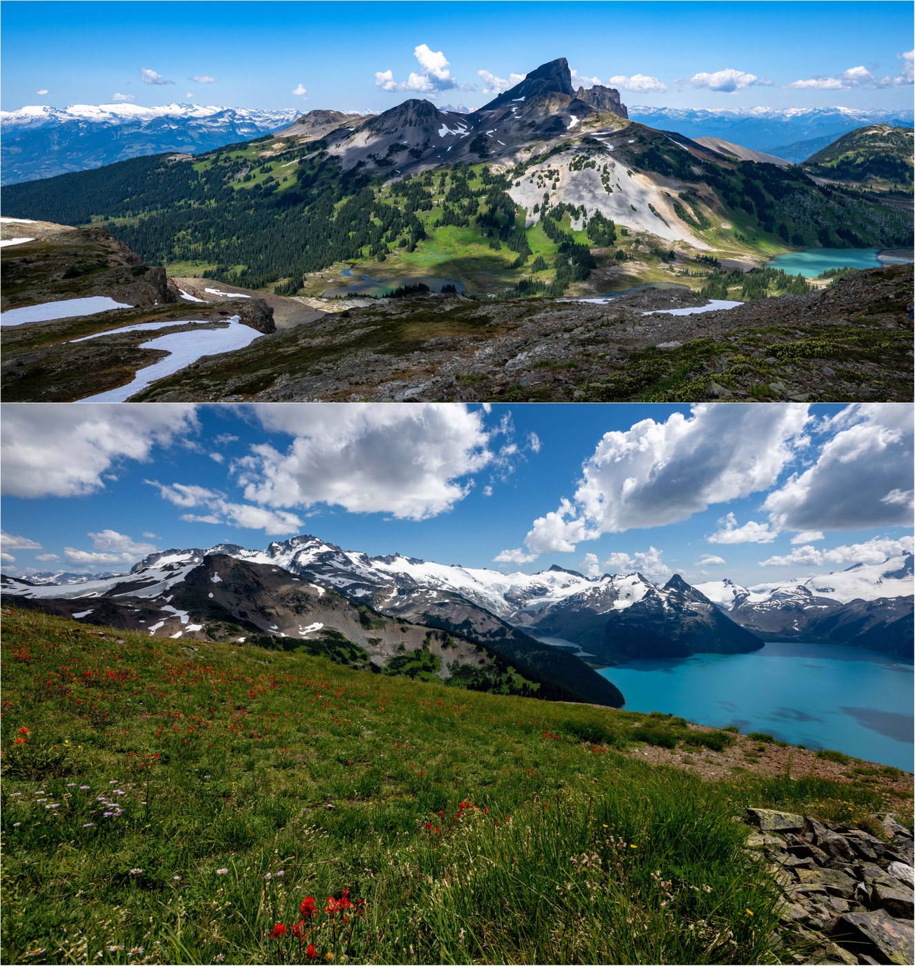
Surely one of the most incredible day hikes on the West Coast that elicits audible gasps when hikers reach the summit of Panorama Ridge overlooking turquoise Garibaldi Lake and glaciers as far as the eye can see! This hike is located between Squamish and Whistler, BC in Garibaldi Provincial Park, a land of volcanos, glaciers and emerald lakes. Very early morning with no Metro Vancouver traffic, one can reach the trailhead in ~2 hours from the border. But this is a long day requiring an early start! Day users need a permit available at 7am 2-days prior. SIMPLY AMAZING and in our backyard. What a difference from a snowy visit to Garibaldi Lake in May!
Stats:
- Distance: 23-1/2 miles (looping down to the lake for exploration - see video)
- Duration: ~12-1/2 hours (extended time on the ridge, and at the lake)
- Vertical: 5350 ft
- Road/Parking: The trailhead is a short spur off Hwy 99 north of Squamish. Parking is free, but a day-use permit is required to hike out of the trailhead. Toilets available, and overflow parking available on the road. The dirt road is in good condition and can be handled by any vehicle.
- Weather: Sunshine with puffy clouds, light breeze on the ridge, 40s to 80s, some smoke haze. Bugs were out - the mosquitos were kept at bay with spray, but the horse flies hurt if they get you, even though clothes (luckily, they are really slow and can be easily killed!)
- Water: The switchbacks up to Taylor Meadows are mostly dry, so carry water. From Taylor Meadows to the rocky ascent up Panorama Ridge, there are plenty of streams for filtering (see video). The ascent however is dry and there were folks running out of water and cramping. Glacial till will clog your filter! :)
- Flowers: The flowers start at Taylor Meadows, and were pretty amazing. The (prolific) heather is mostly done at lower elevations but starts again as one ascends Panorama Ridge. Otherwise, flowers included: lupine, monkeyflower, paintbrush, aster, columbine, arnica, dwarf fireweed, thistle, corn lilies (blooming!), phlox, penstemon, western anemone (seeded!) and fleabane.
- Fauna: Marmots, pika and chipmunks. While this is bear country (both black and grizzly), grizzly bears tend to be found on the WEST side of Hwy 99. The Garibaldi front-country is also well-visited, with a huge trailless backcountry, so I was not concerned and did not bother carrying bear spray given the distance.
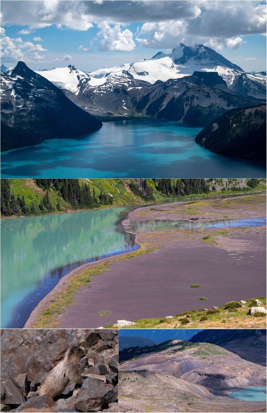
- Trail: We used the Rubble Creek trailhead. The trail was busy, with an international crowd, including some Seattle folks. The ascent to Taylor Meadows via switchbacks is not that exciting, although the old-growth forest is lovely and the trail is in fine condition (mellow and well-maintained). From Taylor Meadows (with its wood boardwalks above flowers and creeks) until you descend into the trees again maybe 10 hours later is so amazingly beautiful that the miles and vertical just melt away. The trail crosses the meadows to the south of Black Tusk (an eroded volcanic plug), past many small lakes, before beginning the rocky ascent up Panorama Ridge. The trail is moderate (the vertical notwithstanding) until this final 1800 ft up the ridge, which is rocky and steep at times. The ridge itself is huge, and there is space to spread out, and hike to a quiet and remote spot on the ridge to contemplate how such a beautiful place can exist. On the descent, we took a trail down to Garibaldi Lake at a Taylor Meadows junction, and enjoyed the shoreline of this milky, turquoise wonder. This formed a CLOCKWISE loop for the mid-section of the trail - see map. NOTE: The lake has very high water right now due to glacier melt, so traversing from the bridge over Rubble Creek to the Battleship Islands on the shoreline (see video) took some gymnastics and rock hopping. CAUTION: Given the proximity to Whistler tourists, the number of unprepared hikers was notable - this is a long, tough day, and many folks did not have sufficient water, an ability to filter or electrolyte tablets. There were SAR helicopters buzzing late in the day...
- Takeaway: Like Cirque Lake the other day, it would have been nice to have my packraft. From the first picture above, you can see an ideal packraft route - hike to Garibaldi Lake (~11 miles/3200 ft RT), packraft the left shore of this emerald beauty to that basin and climb past those terraced, emerald pocket-lakes up to the toe of the glacier and its ice caves. Next time!! CAUTION: Lake can be very cold, although there were folks swimming yesterday. Getting stuck on the trailless opposite end of the lake would likely require a helicopter rescue. Black Tusk is also climbable and has spectacular views if you are comfortable with the "chimney" (a crack in the volcanic plug) - have done it twice but honestly not eager to try again :)
The attached 4K video will take some time to upload and convert to high definition. There is so much more to see on this hike than I can fit into a handful of pics - see video :)
"Backcountry Brewing" in Squamish is a good post-hike place for an IPA, wings and a pizza ;)


Comments
vikr on Panorama Ridge, BC
Thanks for the detailed TR. We did this trail as backpacking trip in 2019 fall and it was also amazing. We will be visiting BC with our 2 year old and looking for some options for easy hikes in Vancouver BC area. Let me know if you have any suggestions.
Posted by:
vikr on Aug 08, 2024 03:54 AM
Alpine Wanderer on Panorama Ridge, BC
In Metro Vancouver, the ~6-mile Stanley Park seawall is a great urban park option. Also, Lynn Canyon over the bridge in North Vancouver. Seymour Provincial Park and the close-by demonstration forest also offer scenic hiking. There are also trails out of Cypress Provincial Park. You can drive to the alpine for both Seymour and Cypress, but Northshore hiking does tend to be kind of steep (thus its reputation for downhill mountain hiking). For an easy ocean hike, Lighthouse Park in West Vancouver is very nice. There are also some interesting hikes over on Bowen Island, just a 15-minute ferry from Horseshoe Bay. Of course, the Grouse Grind is famous, heading up to Grouse Mountain where you can take the tram back down. Heading up Squamish way, there are lots of hikes off the Sea-to-Sky highway (most notably Stawamus Chief), but these tend to be steep. Up in Whistler, the High Note Trail up Whistler Mountain (pay for the gondola) is moderate and spectacular, and there are easy hikes to Nairn Falls, in Lost Lake Park, etc. Moderate hike to Iceberg Lake is beautiful! Have fun!!
Posted by:
Alpine Wanderer on Aug 08, 2024 08:52 AM