

My trip report won't add a ton of value, as the description on Pilot Ridge Loop main page and last trip report are detailed and accurate.
I caught Mountain Loop Hwy out of Darrington. FR 49 has some potholes, but road was manageable, especially for my Outback. I arrived at trailhead late Thursday (4th of July) afternoon. All of the parking spots next to trailhead was full, but I was able to park between 2 trees by the campsites.
Public service announcement: Learn to park and don't park in the middle of the road so other cars can get by!!!
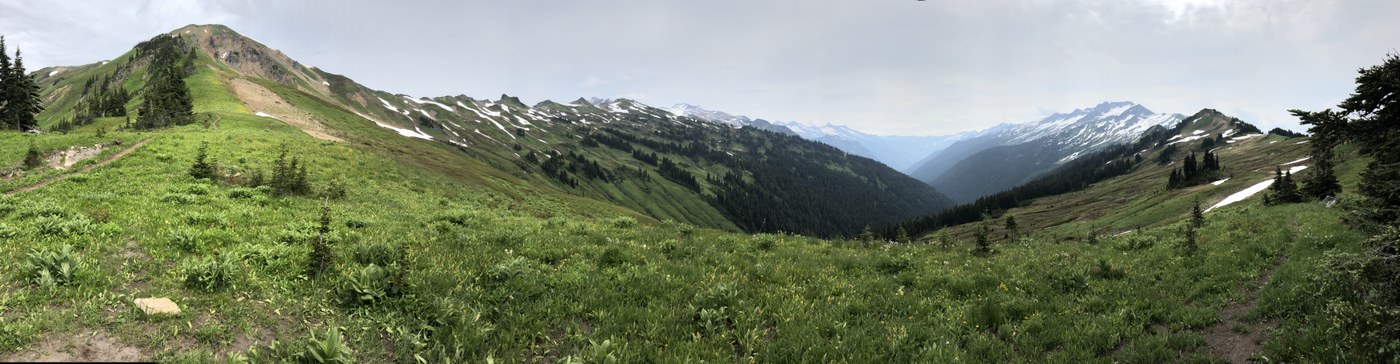
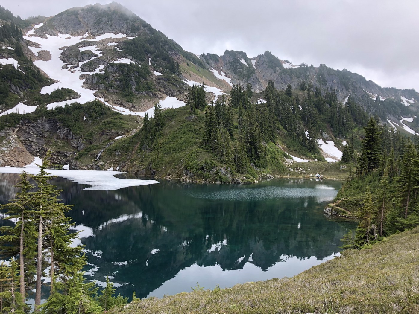
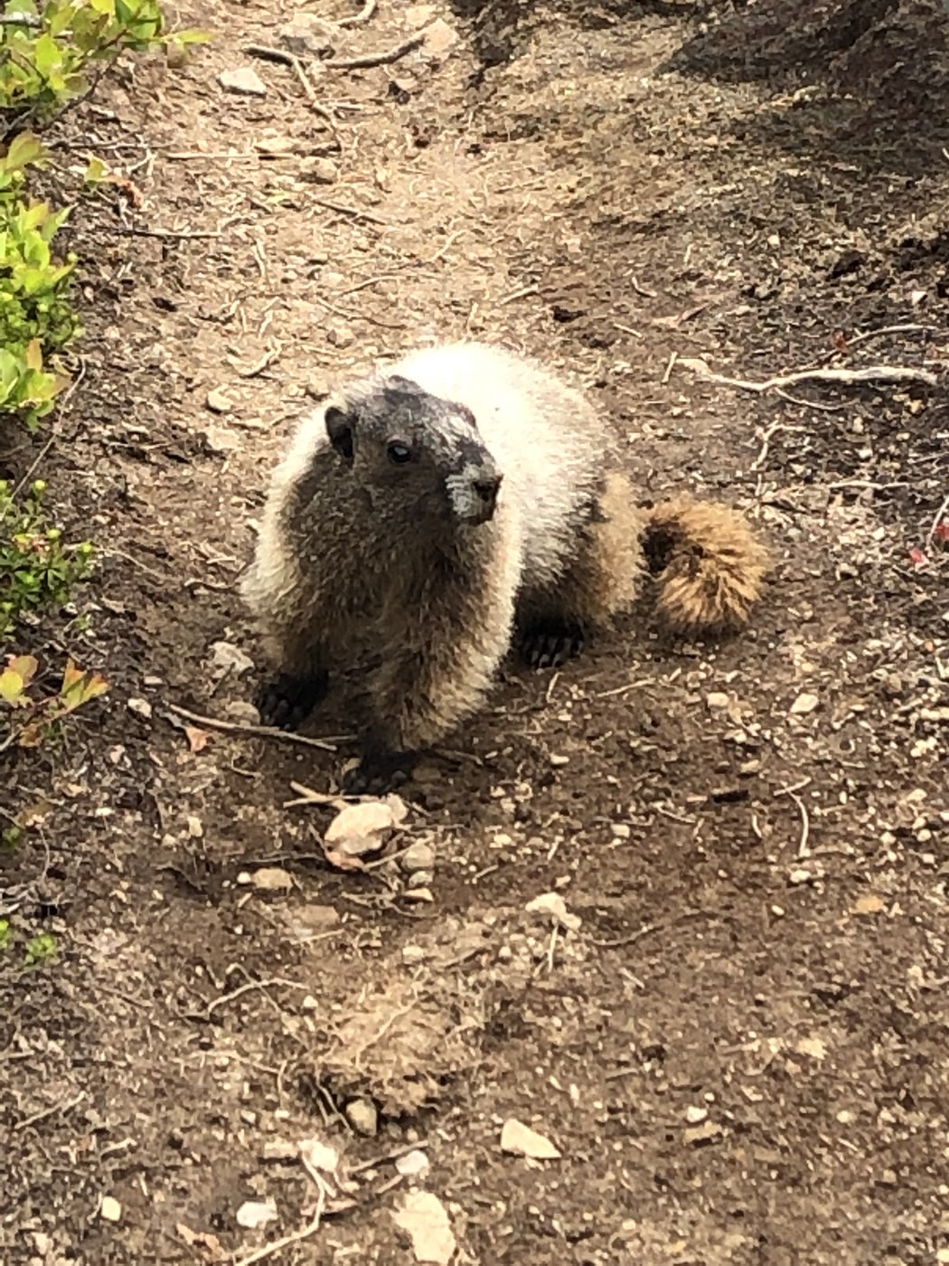
I began hiking on North Fork Sauk River Trail ~4:30 pm. Passed the junction to Pilot Ridge Trail (campsite here). 2 campsites with water access (on left and other on right) ~2,799'. Since I got a late start, I setup at one of the many camps (Mackinaw Shelter?) ~2,957' - bathroom and river access. The next day, start switchbacks and the elevation gain. Amazing views and lots of flowers plus a couple marmots :) Next water source/small stream (~5,481') and another just before junction with PCT. Another small stream just after PCT junction. Cross over first snow patch across trail. Turned right (south) on PCT. Ideally, I would have stayed at White Pass. The view on a clear day would be awesome. Unfortunately the weather wasn't clear, so I didn't get the full benefit of the views. After White Pass there aren't as many flowers and number of snow patches that are easy to cross increase. ~5,538 pond with campsite. Another pond ~5,378'. @~5,321' there's stream. ~4,973' there is a cap by the meadow. The pond in meadow is dirty, so fill up water at stream beforehand. By Meander Meadows trail junction (~5,408) there is a camp with view. There is camp by junction of Bald Eagle Trail & PCT. Turn right on Bald Eagle trail. Pass multiple water sources (streams). At next junction, took Blue Lake High Route - more and more and more climbing! The trail is easy to follow and no snow, but the trail is very narrow and rocky with some steep drop offs. After finally reaching the top, awesome views with first glimpse of Blue Lake. Begin steep descent; continue to watch your footing. Cross some more snow just before lake. I walked around Blue Lake trying to find a campsite, but all appeared to be taken and I didn't want to be rude and setup camp right next to another party. I caught trail to right of outlet and headed ~.5 mile down to Little Blue Lake. There was no one else camped there. The camps are not on the lake. The mosquitoes were swarming all around me. I thought about heading back toward Blue Lake, but I didn't have it in me (I was so exhausted and hungry!) and didn't know where I would camp by junction of . The next morning, I did short walk down to the stream. As I was filtering water, I watched a couple marmots. Fill up with water as you won't have another water source until you begin heading down toward river (~4,729'). I headed back toward Blue Lake, but headed left on Pilot Ridge trail up hillside. Tons of flowers! At times I questioned if I was on the trail, as it was slightly overgrown. At end of very long switchback, reach the ridge. Shortly thereafter reach junction Johnson Mountain trail. Stay left on Pilot Ridge trail. No campsites as trail is cut in hillside. There was one patch of snow that I tried to go around and fell on my front side and slid a bit down the hill. Trail went up and down and up and down. ~5,404' there is a flat area where a tent could be setup (view of mountains). Begin the downward knee jarring descent. Finally come to NF Sauk river. Campsite available. I ate some blueberries after 2 of the bushes which bloomed. I evaluated the situation trying to figure out the best the way cross the river. Just down river of where trail approaches river is a single log that was fairly easy to cross, even for wussies like me who don't like walking on logs over water. Back to trailhead. Most of the campsites were occupied.
Comments
Great, detailed report! By any chance did you find a pair of sunglasses? I hiked the loop on July 1st and Coming down from Pilot Ridge I left them at the creek crossing at ~ 3680.
And, yeah, that parking situation looks severely annoying...
Posted by:
Sir-Hikes-A-Lot on Jul 15, 2019 09:36 PM
Hi Sir-Hikes-A-Lot,
Sorry, I didn't see your sunglasses.
Posted by:
Sarah on Jul 17, 2019 12:10 AM
Ok, thanks for getting back to me. : )
Posted by:
Sir-Hikes-A-Lot on Jul 17, 2019 07:07 PM