Hike a Rail Trail
Built in the corridors where trains once chugged along, rail trails can be found in almost any part of Washington. Due to this history, most are relatively flat and wide and are either covered in asphalt or gravel. Many are long distance, with multiple access points, allowing you to jump on and hike for as long as you like. So grab your boots and go hit some (t)rail!
If you can’t get out right now but still want to give these trails a try, create a My Backpack account to save them for later. When you do go check them out, be sure to write a trip report about your adventure.
Eastern Washington
FERRY COUNTY RAIL TRAIL
Location: Eastern Washington -- Okanogan Highlands/Kettle River Range
Length: 25.0 miles, one-way
Elevation Gain: minimal

Ferry County Rail Trail. Photo by trip reporter Smooth Operator.
A relatively new feature to northeast Washington’s extensive recreational repertoire, this family-friendly trail highlights the area’s cultural heritage and natural beauty, offering a fun and safe community connector as well as a first-rate recreational experience. Hike, walk, run or bike with the whole family and choose from a multitude of environments.
> Plan your visit to Ferry County Rail Trail using WTA's Hiking Guide
COlumbia Plateau Trail - Fish Lake
Location: Eastern Washington -- Spokane Area/Coeur d'Alene
Length: 7.5 miles, roundtrip
Elevation Gain: 200 feet

Discover history, geology and biology on the Columbia Plateau Trail – Fish Lake. Photo by trip reporter KristinSF.
Explore the 130 miles of the former Spokane, Portland and Seattle rail line at the Columbia Plateau Trail State Park. The 7.5 mile, roundtrip Fish Lake section starts at the Fish Lake Regional Park and will take you past ponderosa pines and basalt columns. See shallow “pothole” wetlands, agricultural land, migratory birds and even the Turnbull National Wildlife Refuge on this fantastic trail.
> Plan your visit to Columbia Plateau Trail - Fish Lake using WTA's Hiking Guide
Palouse to Cascades Trail - Tekoa Trailhead
Location: Eastern Washington -- Palouse and Blue Mountains
Length: 3.4 miles, roundtrip
Elevation Gain: 470 feet

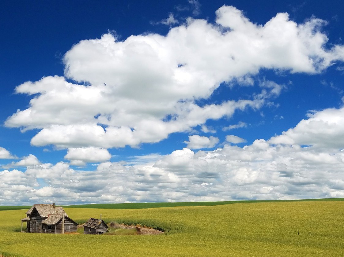
Fields off of the Palouse to Cascades Trail. Photo by trip reporter Maddy.
The Palouse to Cascades Trail goes for miles across Washington, but this short section makes for a relaxing day hike with panoramic rolling hills and seasonal flowers. From the Tekoa Trailhead, hikers can head east or west, but we recommend heading east for a more maintained stretch of trail.
> Plan your visit to Palouse to Cascades Trail - Tekoa Trailhead using WTA's Hiking Guide
North Cascades
Old Robe Canyon
Location: North Cascades -- Mountain Loop Highway
Length: 2.4 miles, roundtrip
Elevation Gain: 350 feet
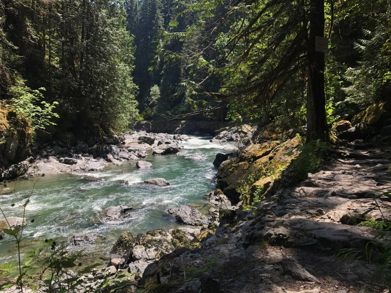
 Old Robe Canyon view. Photo by theptaryndactyl.
Historically significant and naturally beautiful, the trail through Robe Canyon is a worthy hiking destination any time of year. The well-maintained trail quickly leaves the Mountain Loop Highway behind as it descends 300 feet down a steep bluff toward the Stillaguamish River. A series of gentle switchbacks makes the trip down (and back up) easy on the knees. The river bottom is wide and lush with maples and cottonwoods, making this an ideal place to soak your feet while soaking up the sun.
> Plan your visit to Old Robe Canyon using WTA's Hiking Guide
Bay to Baker Trail
Location: North Cascades -- Mount Baker Area
Length: 3.0 miles, roundtrip
Elevation Gain: minimal
Public Transit: Yes

Experience the forest and the beach without having to stray far from the city on the Bay to Baker Trail. Photo by wafflesnfalafel.
This former rail road has been transformed into a wonderful way to discover nature within the city of Bellingham. There are three segments of trail currently open with eventual plans to connect Bellingham Bay to the Mount Baker Ski Area. The 1.5-mile segment from Squalicum Park to Squalicum Beach will allow you to experience both beach and forested trail all in one journey.
> Plan your visit to Bay to Baker Trail using WTA's Hiking Guide
Puget Sound and Islands
Lake Whatcom Park-Hertz Trail
Location: Puget Sound and Islands--Bellingham Area
Length: 6.2 miles, roundtrip
Elevation Gain: 100 feet

Covered bridge on the Hertz Trail. Photo by trip reporter Alistair.
Walk along the shore of Lake Whatcom on this welcoming trail. Along the way, you will come across interesting stream crossings and even a waterfall. This trail is accessible all year, but especially nice in the autumn when the changing colors of the leaves are reflected on the surface of the lake.
> Plan your visit to Lake Whatcom Park-Hertz Trail using WTA's Hiking Guide
Cascade Trail
Location: Puget Sound and Islands -- Bellingham Area
Length: 22.5 miles, one-way
Elevation Gain: 60 feet
Public Transit: Yes
 Bike or hike on the Cascade Trail. Photo by Surviving Urban.
This 22.5-mile rail trail follows the abandoned Burlington Northern grade connecting the towns of Sedro Woolley and Concrete, and can be accessed from three trailheads off of the North Cascades Highway.
> Plan your visit to Cascade Trail using WTA's Hiking Guide
Redmond Central Connector Trail
Location: Puget Sound and Islands -- Seattle-Tacoma Area
Length: 4.6 miles, roundtrip
Elevation Gain: 13 feet
Public Transit: Yes

The paved Redmond Central Connector Trail is a wonderful way to enjoy the Sammamish valley and downtown Redmond. Photo by trip reporter wafflesnfalafel.
The Redmond Central Connector Trail is an urban rail trail that is fun for the whole family. Take in the sights and sounds of the river as you pass the Sammamish Slough, and see quirky urban railroad-inspired art as you pass through downtown Redmond. For those who would like their journey to last a little longer, both the East Lake Sammamish Trail and the Sammamish River Trail can be accessed from the Redmond Central Connector Trail.
> Plan your visit to Redmond Central Connector Trail using WTA's Hiking Guide
Snoqualmie Region
Palouse to Cascades Trail - Rattlesnake Lake
Location: Snoqualmie Region -- North Bend Area
Length: 11.0 miles, roundtrip
Elevation Gain: 300 feet

The Palouse to Cascades Trail, formerly known as the John Wayne Trail, combines history and natural beauty. Photo by Maddy.
When the Chicago, Milwaukee, St. Paul, and Pacific Railroad went bankrupt in 1980, the Department of Natural Resources acquired the land to create the Iron Horse State Park. The 100-foot-wide state park traverses the state from east to west and includes the scenic Palouse to Cascades Trail - Rattlesnake Lake section. See mountains, waterfalls, wildlife and more on this historic (and flat!) trail. It also makes a pretty good snowshoe, when snow is present.
> Plan your visit to Palouse to Cascades Trail-Rattlesnake Lake using WTA's Hiking Guide
Palouse to Cascades Trail-Lake Keechelus
Location: Snoqualmie Region -- Snoqualmie Pass
Length: 4.0 miles, roundtrip
Elevation Gain: 200 feet

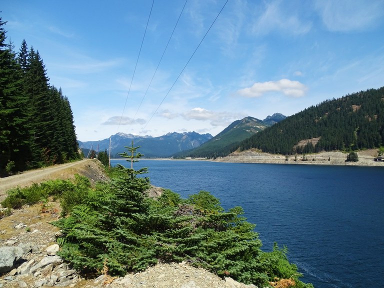
Follow the path of the old Milwaukee Railroad to see fabulous views of the mountains and lake along the trail. Photo by ToddlerTrekking.
The Lake Keechelus trail follows the path of the former Milwaukee Railroad. The gentle route will take you along the lakeshore and through the forest, providing stunning mountain views. This unique rail trail is also great place to give cross-country skiing or snowshoeing a try during the winter.
> Plan your visit to Palouse to Cascades Trail-Lake Keechelus using WTA's Hiking Guide
Rainier Trail
Location: Issaquah Alps
Length: 2.5 miles, one way
Elevation Gain: 100 feet
Public Transit: Yes

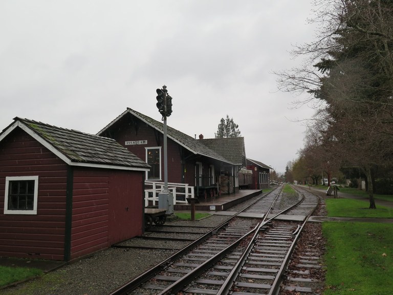
Issaquah Depot Museum along the Rainier Trail. Photo by wafflesnfalafel.
The Rainier Trail is a great option right in the heart of Issaquah. You will feel connected to the vibrancy of this town without having to contend with traffic. The trail is about half paved and half gravel and takes walkers along a historical route, going past the Issaquah Depot Museum and a statue of the trail advocate Harvey Manning.
> Plan your visit to Rainier Trail using WTA's Hiking Guide
Olympic Peninsula
Dosewallips State Park - Steam donkey Trail
Location: Olympic Peninsula -- Northern Coast
Length: 3.5 miles, one way
Elevation Gain: 400 feet

Steam Donkey Trail. Photo by trip reporter JoeHendricks.
Ok, this isn't technically a rail trail, but it's similar. The Steam Donkey Trail is on the site of a former logging operation which involved the use of a "steam donkey" — a piece of logging equipment used to pull logs through the forest once they'd been downed. There is a strong chance that you will see wildlife in winter and spring, since an elk herd resides in the area, and with the estuary so close, the area is rife with bird-life.
> Plan your visit to Steam Donkey Trail using WTA's Hiking Guide
Central Washington
Washtucna Coulee - Kahlotus Railroad Grade
Location: Central Washington -- Tri-Cities
Length: 8.0 miles, roundtrip
Elevation Gain: 30 feet
 The Washtucna Coulee - Kahlotus Railroad Grade has wildflowers, wildlife and a fascinating geological history. Photo by trip reporter greymstreet.
Take in the breathtaking views of the Washtucna Coulee, a deep and wide ravine carved out by the Great Missoula Floods, as you hike along the Washtucna Coulee - Kahlotus Railroad Grade. This trail will take you through a dark and eerie former railroad tunnel in Devils Canyon and past the ancient dried lake bed of Lake Kahlotus. Along the way, spot some splendid plants and wildflowers, like sage violets, buttercups, desert parsley and more.
> Plan your visit to Washtucna Coulee - Kahlotus Railroad Grade using WTA's Hiking Guide
Cowiche Canyon
Location: Central Washington -- Yakima
Length: 5.8 miles, roundtrip
Elevation Gain: 100 feet
 Spring wildflowers in Cowiche Canyon. Photo by Bob and Barb.
The Cowiche Canyon Trail may be short, but it sure is sweet. From the trailhead just off Weikel Road, you’ll wind beneath steep sagebrush slopes and cliffs of basalt and andesite splotched with colorful lichens, crossing Cowiche Creek numerous times along the way. The creek is always close at hand, and the lush riparian vegetation and sagebrush hillsides are home to numerous species of songbirds, while raptors and vultures circle above the cliffs. If you’re lucky, you’ll hear a canyon wren or spot a yellow-bellied marmot or a lucia azure butterfly. In the spring, a wide array of wildflowers dot the hillsides.
> Plan your visit to Cowiche Canyon using WTA's Hiking Guide
Southwest Washington
Chelatchie Prairie Rail Trail
Location: Southwest Washington -- Vancouver Area
Length: 2.0 miles, roundtrip
Elevation Gain: 50 feet

The short and sweet Chelatchie Prairie Railroad trail is ADA-accessible and allows leashed dogs. Photo by Susan Saul.
The one-mile, paved Chelatchie Prairie Rail Trail is only the beginning of what is planned to be 33 miles of multiuse trail. Starting in at the Battle Ground Lake state park, this ADA-accessible trail follows the Chelatchie Prairie Railroad owned by Clark County Parks. For your safety and others, please stay off the railroad tracks and stay on the family-friendly trail.
> Plan your visit to Chelatchie Prairie Rail Trail using WTA's Hiking Guide
Willapa Hills Trail
Location: Southwest Washington -- Lewis River Region
Length: 56.6 miles, one way
Elevation Gain: minimal

The Willapa Hills Trail connects the towns of Chehalis and South Bend and has many options for both shorter and longer hikes. Photo by abbymrex.
This lengthy rail trail connects the towns of Chehalis and South Bend. Hikers, bikers, joggers and more can enjoy the outdoors on the paved, graveled or dirt sections of trail. With 56 miles of trail to explore, the length and intensity of your hike is up to you.
> Plan your visit to Willapa Hills Trail using WTA's Hiking Guide
Klickitat Rail Trail
Location: Southwest Washington -- Columbia Gorge - WA
Length: 31.0 miles, one way
Elevation Gain: minimal
 The Klickitat Rail Trail. Photo by E. Jarvinen.
Hop aboard for an early-season wildflower bloom amid remote terrain and open air. At a healthy clip or a slow meander, this rail trail is fun at any speed! The Klickitat Trail runs 31 miles, with multiple access points placed in unique areas, from grass plains and the rugged Swale Canyon along the Wild and Scenic Klickitat River, to oak-filled valleys dropping down to Lyle and the Klickitat’s mouth at the Columbia River. Bring your sense of adventure, as you’ll cross old railroad trestles, encounter some very large cows, and stumble across a strange mixture of artifacts, from discarded equipment and railroad spikes to bleached white animal skulls.
*Note*: if you do come across any artifacts, please leave them for the next person who visits.
> Plan your visit to Klickitat Rail Trail using WTA's Hiking Guide

