
This short loop just off of Interstate 90 offers an easy escape to nature. With plenty to keep little ones occupied, and just enough mileage to give your legs a little workout, this is a delightful detour for anyone venturing west or east over Snoqualmie Pass.
Asahel Curtis was a photographer from Minnesota who moved to Washington in 1888. Shortly after beginning work in his family’s photography studio, he became one of Seattle’s preeminent photographers. His pictures of Washington’s history, landscape, and native people are vital–-the Washington State History Museum has more than sixty thousand of his images in their archives!
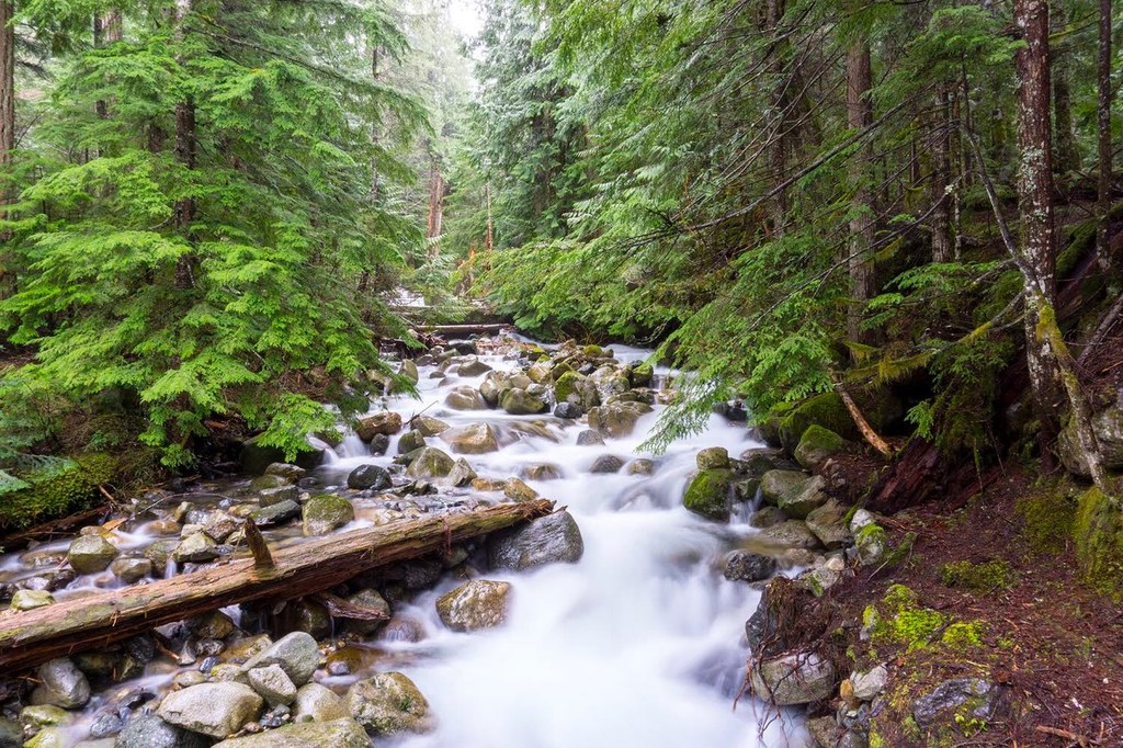
Step out of the large gravel parking lot and into an old forest wonderland fit for Curtis’s camera. The forest is replete with ferns and undergrowth, as well as a burbling creek flowing over rocks, which you cross right away via a large footbridge. WTA volunteer crews worked all summer of 2014 to install the approach to this bridge, an effort that involved moving more than 200,000 pounds of rock, gravel, and dirt, as well as 300 volunteer days on trail.
Once past the footbridge, meander along a rolling pathway, through the forest, which gains a moderate amount of elevation as it passes various numbered posts. These are planted in front of notable flora specimens, and a guide at the beginning of the trail contains information that corresponds with each post. Grab one before your hike to get the most out of your visit.
Asahel Curtis Nature Trail

-
 Length
- 0.5 miles, roundtrip
-
 Elevation Gain
- 180 feet
-
 Highest Point
- 2,000 feet
This short loop just off of Interstate 90 offers an easy escape to nature. With plenty to keep little ones occupied, and just enough mileage to give your legs a little workout, this is a delightful detour for anyone venturing west or east over Snoqualmie Pass.
Continue reading
Hiking Asahel Curtis Nature Trail

WTA worked here in 2019, 2015, 2014, 2012 and 2011!
Map & Directions
 Trailhead
Before You Go
Parking Pass/Entry Fee
Northwest Forest PassWTA Pro Tip: Save a copy of our directions before you leave! App-based driving directions aren't always accurate and data connections may be unreliable as you drive to the trailhead.
Getting There
From Seattle head east on I-90 to exit 47, signed for Asahel Curtis and Denny Creek. Take a right from the the off-ramp and proceed one-quarter mile to a "T" intersection. Then, turn left onto Forest Road 5590. You'll find the parking area to your right in less than half a mile.


