

The furthest northwest tip of the contiguous United State, Cape Flattery provides a dramatic backdrop to a surprisingly accessible hike. It's managed by the Makah Tribe, who provide permits for parking here at many locations in Neah Bay. As you drive through on the way to the trailhead, be sure to purchase yours — they're good for the year, and you can also use it for Shi Shi Beach.
From the trailhead, depart down a wide, graveled trail into open forest. Heading gently downhill, the trail narrows down to boardwalk, keeping hikers out of the worst of the mud before transitioning to rooty tread. Signs along the way encourage you to stay on the trail; please honor these. This area sees enough traffic that a spur trail can quickly impact the area in a bad way. Preserve your future visits here by remaining on trail during this visit.
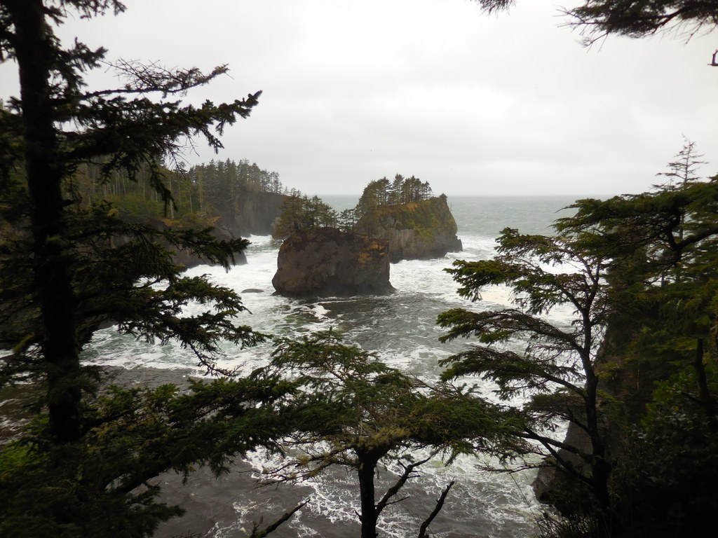
Eventually, the trail returns to boardwalk, carrying you over boggy sections as the wind intensifies. You're approaching the point. Three turnoffs exist that allow you to see views from all sides of the point. The first branches off to the left, to a viewing platform that allows you to peer down the sheer south side of the point. The second, a few hundred feet further down the trail, is a two-layered affair, where you can enjoy an expansive view north from the upper deck, and a more intimate view of the sea caves below from the lower layer.
The third and last is, appropriately, the piece-de-resistance: a viewing platform. Straight ahead is Tatoosh Island. A lonely lighthouse sits on the island, which is constantly buffeted by waves and wind. To the north, it's the rocks of Cape Flattery reef, while to the south it's Kessiso Rocks. Birds wing in the breeze, and the seas around here teem with life.
The constant pounding surf and the meeting of water with land here provides an ideal place for animals of all sorts to feed. As you gaze out on the Pacific, look for seagulls, cormorants, shorebirds of many other sorts, and marine animals like whales or otters playing in the surf.
When you've had your fill, return the way you came.
 Trailhead


