

Franklin Falls has avalanche danger in the winter. Please check our Franklin Falls - Winter entry for information on how to enjoy the falls when there is snow and ice present.
Hiking with kids, new to hiking, or just looking for an easy day hike with a spectacular endpoint? Look no further than Franklin Falls! At just 2 miles roundtrip with 400 feet in elevation gain it is the perfect destination for any hiker looking for something easy and beautiful.
WTA has done trail work here for the last ten years, building walls and rocks steps and constructing bridges to make this trail as safe as possible for even the smallest of hikers. There are a few spots where bits of the trail have been washed out, or handrails haven’t been installed, but overall you can feel confident in bringing your youngsters here for a safe and fun day on the trail. The trail includes a number of stairs with a very gentle incline that is easily hiked. As you hike, you'll be enshrouded in a thick canopy of coniferous trees which makes it a great trail to do on a hot day.
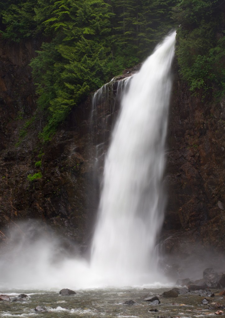
At 0.7 miles in, the trail draws parallel to National Forest Road 58 for a short time. Just 0.3 miles further along, you reach picturesque Franklin Falls. The falls are situated between two tall viaducts that allow traffic along I-90 to pass year-round without interference from avalanches in winter. The falls are actually comprised of three separate tiers, giving them a total drop of 135 feet. However, only the last and largest drop can be seen from the trail. At 70 feet, Franklin Falls is a spectacular sight to see, with its best flows between April and July.
There is a viewpoint before reaching the falls but hikers can get closer by following a narrow trail gouged into the side of the rock. Use caution and keep children close as the rocks are often wet and potentially slippery. The falls, when running at peak, give off a pretty heavy spray so rain gear is a good idea if you want to get close. During lower flow periods there is more room to roam by the base of the falls. In the wintertime this also makes an excellent destination for an easy snowshoe, though hikers are well-advised to not venture to the splash pool in icy conditions. The falls run year round and the incredible icicle formations along the rock face around the falls are spectacular — well worth the trip.
There are no garbage receptacles at the trailhead so be sure to pack it out!

 Trailhead


