Trails for everyone, forever

Home Go Hiking Hiking Guide Glacier Lake

Glacier Lake

South Cascades > Goat Rocks
46.5457, -121.6222 Map & Directions
Length
5.0 miles, roundtrip
Elevation Gain
1,634 feet
Highest Point
2,905 feet
Calculated Difficulty About Calculated Difficulty
Moderate
Crystal clear water on Glacier Lake. Photo by JamesHaitch. Full-size image
  • Dogs allowed on leash
  • Lakes
  • Rivers
Saved to My Backpack

A short and steep hike, somewhat challenging hike to a quiet mountain lake. Continue reading

Rating
2.93 out of 5

(15 votes) Log in to rate

Hiking Glacier Lake

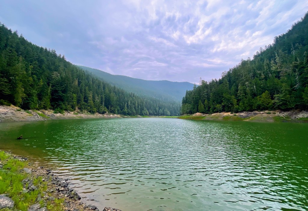
Glacier Lake is a peaceful lake surrounded by steep hills that rise steeply from its shores. The trail, while relatively short, is steep in sections. For families with kids who are up for the challenge of uphill hiking, it’s a good introduction to backpacking.

From the trailhead, the trail soon dips down before reaching a very lovely seasonal creek, which makes an excellent spot to stop for a snack.

The trail then continues to climb up — steeply at times — and the trail is sometimes rough or crumbly. The mossy forest is beautiful, however, and you can hear the sounds of Glacier Creek for much of the hike.

When the landscape begins to change from forest to boulders, you are getting close to the lake. Head left for a few campsites and access to the lake. There is a rough trail that leads off around the edge of the lake, but it peters out quickly.

Hike Description Written by
Jessi Loerch, WTA Staff

Glacier Lake

Map & Directions

Trailhead
Co-ordinates: 46.5457, -121.6222 Open in Google Maps

Before You Go

See weather forecast

WTA Pro Tip: Save a copy of our directions before you leave! App-based driving directions aren't always accurate and data connections may be unreliable as you drive to the trailhead.

Getting There

From Packwood, head south on U.S. 12 for 2.7 miles. Turn left (east) on FR 21. At the first fork, keep right to stay on FR 21. After about 5 miles, take a left on FR 2110. Veer right and the trailhead will be on the right side of FR 2110. Parking for 6 cars.

More Hike Details

Trailhead

South Cascades > Goat Rocks

Glacier Lake trail (#89)

Gifford Pinchot National Forest, Cowlitz Valley Ranger District

Guidebooks & Maps

Day Hiking: South Cascades (Nelson - Mountaineers Books)

Day Hiking: Mount Adams and Goat Rocks (Asars - Mountaineers Books)

Buy the Green Trails Packwood No. 302 map

You can improve or add to this guidebook entry!

Glacier Lake

66 Trip Reports

Hiked here recently?

Submit a trip report!
 
Trip Reports