

From the peak of Mount Baldy, you'll have views of the central Cascades and the Snoqualmie Region, but you'll work for those views — it gets extremely steep on your way to the top.
From the parking area, take the path behind the signs for Easton Ridge (trail #1212) and Kachess Ridge (trail #1315). Soon after setting off, you'll reach a junction. Turn right onto the Easton Ridge Trail and cross over a wood bridge. Climb moderately steep switchbacks for about 1.5 miles to another junction. Keep left onto the Domerie Divide Trail, (#1308.2).
This begins a relatively flat section, lasting about a half-mile. There is a good view of the Silver Creek drainage along this stretch; take advantage of the flat trail to take in the views before the real climbing begins. Once it starts, you'll gain about 1500 feet in one mile (yes it's that steep), topping out at Para Point and yet another junction.
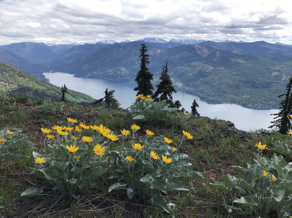
Turn right onto the unsigned Domerie Peak Trail (#1308). This trail drops around 200 feet in a mile-long ridge traverse, then gains it all back, with one final short and steep section leading to the summit of Mount Baldy. Wildflowers abound along the ridge.
From Baldy it seems all the peaks of the Alpine Lakes Wilderness are in view. Pick out Mounts Stuart, Daniel and Hinman, as well as the Dutch Miller peaks, the Teanaways, and as a bonus Mount Rainier to the south.
Cle Elum Lake sprawls below. The last couple of miles of the hike are out of sight and sound of I-90, shielded by nearby Easton Ridge. Though Mount Baldy is well outside the Alpine Lakes Wilderness boundary, it certainly seems wild and lonely. If you're still feeling spry, it's possible to continue east along the ridge on a faint trail toward Domerie Peak and farther.
 Trailhead


