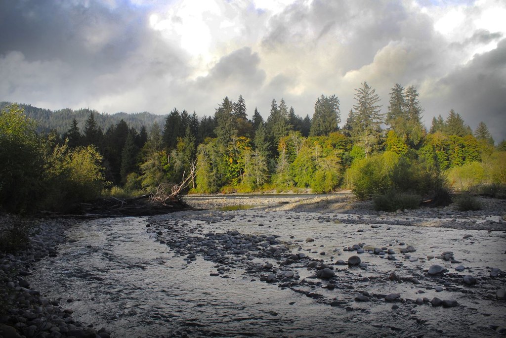

The Queets River Trail is legendary for both its wild rainforest scenery and for the challenges it presents to the hiker. To begin, the trail can only be accessed after fording the glacier-born Queets River itself. Across the river, the trail is primitive and remote. Most hikers skip this trail either because of the ford or because it dead ends at 11 miles. But anglers and Olympiphiles hold a special place for this valley in their hearts.
From the steep bank by the parking lot, follow the Sams River Trail for 100 yards until a worn path leads to the left. Head down the sandy path among young alders to the gravel bars where the Sams and Queets Rivers meet. The Queets River Trail begins on the north side of the river, which is only possible to ford when the flow is low enough to be safe. Olympic National Park advises no more than 800 cf/s for a safe ford.
The trail continues on the north side of the Queets River, opposite the mouth of the Sams River. It may be best to ford the Sams River first before fording the Queets, since its volume is added to the Queets downstream. Use sturdy poles and aim for the marker, if present, that hangs on a trunk on the north bank. If no marker is present, simply aim due north. An official sign marks the start of the Queets River Trail above the bank.
The hiker is immediately greeted by towering spruce and bigleaf maples draped in heavy curtains of moss. A charming but narrow dirt path ambles among a legion of oversized sword ferns where elk sometimes browse. On summer days the wind-freed leaves of red alder sparkle as they fall to the forest floor. Dapple sunshine dances across the grass to an ancient rhythm. Chances are there is no one else around.
At 1.8 miles the trail enters Andrews Field, a former homestead that highlights rapid entropy in a rainforest setting. Even the barn, which stood next to the trail until the 1980’s, is gone forever, decayed beneath a bramble thicket. Blackberries, thistle, and a few pioneering alder make up the field now. Imagine the hard working pioneers who toiled in the here, sweating under the summer sun, or shivering in a midwinter rain.
At 2.4 miles the trail crosses Coal Creek on an old, sun bleached log. Just before the creek lies the abandoned trail to the world’s largest Douglas fir. The trail was once maintained, but winter storms have toppled so many trees along the route that it is nearly impossible now to find or follow it. Fierce brush and little hemlocks completely obscure the path in places, while matchstick piles of fallen trees pose the risk of injury.
Fortunately there are large trees all along the Queets River Trail. Sitka spruce and western hemlock dominate, but exemplary specimens of cottonwood, maple, and even shrubs abound. The ground is covered in a soft, luxuriant carpet beneath spruce colonnades so grand that they resemble a soaring cathedral. The trail fades slightly in places, and is sometimes overgrown with salmonberry and nettles.
At 3.5 miles the trail hits the river at a crumbling bank. A rough path works its way along the bank, and can be slightly hard to follow. Stay relatively close to the river and the path becomes obvious again as it comes to a junction at 4.0 miles. To the right are campsites both in the forest and along a pleasant gravel bar that is popular among anglers. This way trail once continued across the river, but has been abandoned.
The main trail continues left at the junction, and penetrates what seems to be deeper woods. The path is noticeably less maintained now, with overgrown huckleberries concealing tree litter that lies on the path. The path climbs a gentle slope to a terrace of older age that is inhabited almost entirely by hemlock. But the trail soon dips down again toward the river, following a rocky track before arriving at Spruce Bottom.
At 5.0 miles is the pleasant camp site in the bottomland of spruce that inspires its name. The camp site is marked by a fire pit beneath three large and tightly spaced trunks. The site is primitive, with no privy available and no evidence of the shelter which once stood here. It is a special place, however, where the sound of the rushing river creates a comforting backdrop that is only broken by the occasional hooting owl.
Beyond Spruce Bottom the trail is even less maintained, and presents a few tricky spots where it is easy to lose the way. First, the trail skirts above a washout on a rough reroute. Then it drops down to a creek in a long alder flat. Cross the creek and head left. The faint path passes through a photogenic hallway of white alder trunks. Soon the river is heard, and the path emerges directly across from Smith Place, another homestead.
It is here that the Queets River Trail really showcases its best qualities. This is a realm of spruce and hemlock that has never been exploited; ancient, virgin rainforest. The narrow and rambling track follows the land intimately. The path is covered in hemlock cones and needles, the hiker’s boots crunching along between borders of oxalis and little ferns that dance on a breeze. The walking is simply superb.
At 7.5 miles the trail crosses Bear Creek and enters Harlow Bottom. This stretch of 3 miles or so is full of enormous spruce trees and frequent little gurgling creeks underfoot. As usual, the way fades here and there, but is generally easy to follow, marked by metal tags, cut logs, and sometimes ribbon. The bottomland ends and the trail crosses Bob Creek just before the campsite of the same name at 11.0 miles.
Here the Queets River Trail officially ends. The Paradise Fire took the last 4 miles in 2015 along with an unknown number of wonderful trees. Even before the fire it was hard to follow the last few miles to Pelton Creek Shelter. The upper valley beyond is only for the hardiest of cross country travelers, and the burn zone should be avoided entirely.
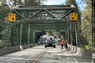
 Trailhead