
Venturing to the Twisp Pass trailhead can be a bit of a drive, but don’t despair, there are many campgrounds along the Twisp River Road and several day hikes to be done from this one trailhead.
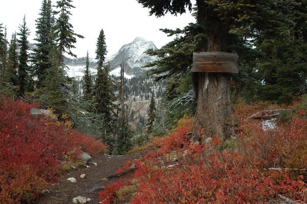
On this old mining road turned trail, the first two miles have few obstacles. Open meadowy areas feature aspens turning brilliant yellow in the fall and offering needed shade during the summer. A few small creeks pose no crossing difficulty. Dramatic views of Lincoln Butte, a lesser peak at the head of the valley, may titillate your climbing ambitions.
After these delightful two miles, the trail turns abruptly left, crossing the North Fork of the Twisp River. Perhaps a little hard to follow is the right-hand fork here. This is Trail 426, which continues on to Copper Pass. Once somewhat hair-raising, the log bridge crossing is safer now with a handrail installed, but always be careful crossing the water.
The trail now winds south and then west around the base of Lincoln Butte. After a brief mile and a half, encounter several fabulous domed rock campsites over looking the South Fork of the Twisp River. While they are great sites, they are dry, so be sure to fill up at the river crossing.
As this trail climbs towards the pass, note the extensive rock cribwork performed. Imagine that 100 years ago this was a proposed route for the North Cascades Highway through to Cascade Pass! Twisting and turning, this glorious trail winds through stunted hemlocks, granite outcrops, and flowery meadows fed by gurgling brooks.
WTA Pro Tip: Twisp Pass is expansive with many little spots to camp or spread out for an afternoon nap. It is also a beautiful gateway to the North Cascades National Park. Please be observant that guns and dogs are not allowed past the pass. For those with more energy to burn there are several cross-country rambles which depart from this location.
Twisp Pass

-
 Length
- 9.0 miles, roundtrip
-
 Elevation Gain
- 2,460 feet
-
 Highest Point
- 6,064 feet
Twisp Pass is a stunner in summer and autumn. Though it is a bit of a drive to get there from almost anywhere in the state, it's well worth it!
Continue reading
Hiking Twisp Pass

WTA worked here in 2025, 2024, 2023, 2022 and 2021!
Map & Directions
 Trailhead
Before You Go
Parking Pass/Entry Fee
Northwest Forest PassWTA Pro Tip: Save a copy of our directions before you leave! App-based driving directions aren't always accurate and data connections may be unreliable as you drive to the trailhead.
Getting There
Drive east on Highway 20 (closed from the west side in winter) through the North Cascades to the small town of Twisp.
Alternatively, take I-90 over Snoqualmie or Highway 2 through Stevens Pass. On either route, transfer to Highway 97 North to Highway 153 towards Winthrop.
From Twisp, take the Twisp River Road (west on 2nd Ave) for 6.8 miles where it then becomes USFS Road 44. Follow USFS Road 44 (USFS Road 4440) for 17.7 miles, where the trailhead is up the access road on the right. Note: USFS Road 4440 is gated shortly after the trailhead access road and the Road's End Campground is permanently closed.
Trailhead amenities include: parking for about 15 cars, vault toilet, picnic table, hitching rail, trail information sign with fee envelopes, and pay post.


