Trails for everyone, forever

Home Go Hiking Hiking Guide Verne Samuelson Trail

Alert: On Oct. 1 the federal government began a partial shutdown that will impact National Parks, National Wildlife Refuges and U.S. Forest Service lands in Washington. Here's the latest information we have for hikers and campers


Verne Samuelson Trail

Olympic Peninsula > Northern Coast
48.0946, -123.4556 Map & Directions
Length
2.0 miles, roundtrip
Elevation Gain
419 feet
Highest Point
503 feet
Calculated Difficulty About Calculated Difficulty
Easy
Trillium
  • Dogs allowed on leash
  • Good for kids
  • Mountain views
  • Wildlife
Saved to My Backpack

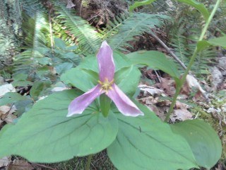
A nice forested stroll, with views of a small creek, and the valley below. Continue reading

Rating
3.00 out of 5

(5 votes) Log in to rate

Hiking Verne Samuelson Trail

A 1-mile (one way) long trail that runs along Valley Creek. The entrance of the trail is located on Department of Natural Resources property off Wellman Road, and the exit of the trail is opposite the Highway 101 and South Pine Street intersection. Due to its small neighborhood size, the trail, which is forested, is minimally used by local citizens.

Verne Samuelson Trail

Map & Directions

Trailhead
Co-ordinates: 48.0946, -123.4556 Open in Google Maps

Before You Go

See weather forecast

WTA Pro Tip: Save a copy of our directions before you leave! App-based driving directions aren't always accurate and data connections may be unreliable as you drive to the trailhead.

Getting There

Within Port Angeles, head west on Hwy 101, then take a right on Pine St. At stop sign turn left on Black Diamond Rd. Follow for 1 mile, then turn left on Wellman Rd. Trailhead parking is at the end of Wellman Rd., .2miles.

More Hike Details

Trailhead

Olympic Peninsula > Northern Coast

Washington State Department of Natural Resources

You can improve or add to this guidebook entry!

Verne Samuelson Trail

5 Trip Reports

Hiked here recently?

Submit a trip report!
 
Trip Reports