
Don't let the very steep start of this trail deter you. Though it's hidden behind a 6.5-mile road walk or bike, the West Fork Dosewallips River trail offers tunnels of rhododendrons, a jubilant river, and solitude.
Less than ten miles west off Highway 101, begin hiking on the Dosewallips River Trail. This beginning is what's left of the road that previously went 6.5 miles further to the Dosewallips Campgrounds.
The beginning of the trail goes up and over an improvised bypass to the road washout, passing some wonderful old growth trees along the way. At the top of the short climb, take a short detour off the left side of the trail to look out over the river. Continuing past the washout, drop back down to the abandoned forest service road and hike in the surreal world Mother Nature has taken over in the last 10 years of human absence.
One mile in, a left hand turn takes you to a bridge to nowhere, where you can watch the water flow by. A further 0.2 miles up the road, a left turn takes you to the abandoned Elkhorn Campground, replete with abandoned privy toilets and picnic benches. Despite its apparent remoteness, this is still a popular campground, so be sure to pack it out.
Pressing further uproad, wander through second and old-growth forest as the river's noise keeps you company. 3.9 miles from the trailhead, encounter the park boundary. Pets are not allowed into Olympic National Park, so if you're traveling with a canine companion, this is where you'll need to turn around.
Past the boundary, cross two bridges, the second of which is for Constance Creek -- the creek followed by the Constance Trail to Constance Lake and the summit of Mount Constance.
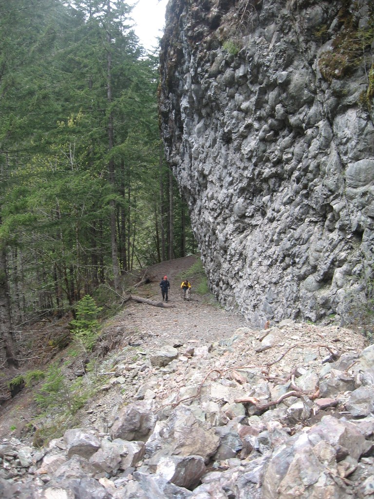
At 4.5 miles, encounter a shoulder of Constance that comes almost straight down to the river except for a notch carved out. This notch allows you to walk to an overlook of the cascading Dosewallips Waterfall.
Heading further, you hike up a short, steep hill to the head of the waterfall. Traffic signs abound, but can be ignored. Another half mile and you'll arrive at the abandoned 40 site campground, equipped with a pit toilet and bear lockers for food storage. The many fallen trees along the western-most campsites provide a delightful shelter from the chilly breeze the river provides.
Stop at the campground for fine riverside dining, or continue on. Continuing takes you past the boarded up facilities of the park service.
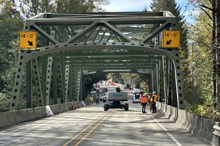
Less than a mile later, encounter the West Dosewallips Span, high above the crashing waters below. Just on the other side is a great site to sit for a good feed. Over the next several miles you'll find extensive meadows, wide open mossy valleys and tree lined solitude. About 8 miles from the span you'll find yourself at Honeymoon Meadows and the end of the West Fork Trail. Fear not! Lacrosse and Anderson passes beckon just a short, several thousand foot, jaunt beyond.

 Trailhead